
Sivaganga is the City and headquarters of the Sivaganga district in the Indian state of Tamil Nadu. It is known for the 16th-century Sivagangai Fort, located in City Centre. Inside the fort, the Rajarajeshwari Amman Temple features many ornate sculptures. Nearby, the Government Museum has prehistoric relics and natural history displays. There are many famous places like historical monuments, Historical temples and lands donated by King Muthuvaduganatha Thevar and other many temples been built and maintained by King Maruthpandiyar brothers, Princess Velunachiyar which are still available and maintained in good condition by public and authorities. The City is located at a distance of 48 km (30 mi) from Madurai and 449 km (279 mi) from the state capital Chennai.
Tiruvallur district, also spelled as Thiruvallur district, is one of the 38 districts in the Indian state of Tamil Nadu. The fast developing city of Tiruvallur is the district headquarters. The district has a mixture of urban and rural characteristics. The eastern part of Tiruvallur district is dominated by urban characteristics while the Northern part of the district has influence of Andhra culture due to its position. In 2011, the district had a population of 3,728,104 with a sex-ratio of 987 females for every 1,000 males.

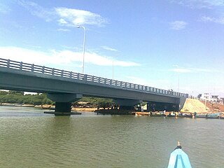
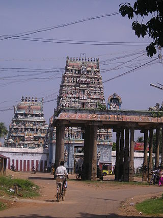
Tiruvallur is a Grade I municipality in the Indian state of Tamil Nadu. It is located on the banks of Coovum river about 45 km (28 mi) from downtown Chennai (Madras) in the western part of the Chennai Metropolitan Area (CMA). It is a satellite town of Chennai and is the administrative headquarters of Tiruvallur District. The town is known for the Veeraraghava Swamy Temple, one of the 108 sacred shrines of Vaishnavites. The tank festival is held at a pond near this temple. A Shiva temple near this shrine which is popular among the locals. There is also a 40-foot (12 m) tall Viswaroopa Panchamukha Hanuman temple, where the murti is made of a single green granite stone.

Poonamallee is a western suburb of Chennai, India under the Chennai Metropolitan Area. It was historically called Pushpagirimangalam, later renamed in Tamil as Poovirundhavalli, and now colloquially called as Poondhamalli. It is the headquarters of the Poonamallee taluk of the Tiruvallur district in the Indian state of Tamil Nadu. The nearest Railway station is at Avadi. It acts as the gateway to the city from its western side. It is a town with rich cultural heritage and also a fast-growing areas in the city. As of 2011, the town had a population of 60,607. There are plans to merge the areas under Poonamallee Municipality with Avadi Municipal Corporation.

Gummidipoondi is an industrial town in Chennai Metropolitan Region of Thiruvallur district in the Indian state of Tamil Nadu. Notably, it is the northernmost assembly constituency and settlement in the state of Tamil Nadu.
Ponneri is a town located in Chennai Metropolitan Area, Thiruvallur district in the Indian state of Tamil Nadu. It is located in Ponneri taluk. Ponneri is major destination for Andhra Pradesh people to buy goods. It is a part of the area Chennai Metropolitan Development Authority (CMDA) and a vital locality in Chennai Metropolitan Area.
Podaturpet is a Town under Pallipattu (Pallipet) Taluk in Thiruvallur district in the Indian state of Tamil Nadu.
Tiruvottriyur is a neighbourhood in North Chennai, administered by the Greater Chennai Corporation. It is part of the Tondiarpet division, located to the north of Chennai. It is one of the fifteen administrative zones in the Greater Chennai Corporation. The zone is called Zone 1 (Tiruvottriyur).

Ariyalur is a town and district headquarters of Ariyalur district in the South Indian state of Tamil Nadu and is rich in limestone, surrounded with seven cement factories and two sugar factories. The town is located at a distance of 310 km (190 mi) from the state capital Chennai.

The Chennai Metropolitan Development Authority (CMDA), formerly known as the Madras Metropolitan Development Authority (MMDA), is the nodal planning agency of Chennai in the Indian state of Tamil Nadu. The CMDA administers the Chennai Metropolitan Region, spread over an area of 5,904 km2 (2,280 sq mi) and covers the districts of Chennai, Thiruvallur, Chengalpattu, Ranipet and Kancheepuram. It was set up for the purposes of planning, co-ordination, supervising, promoting and securing the planned development of the Chennai Metropolitan Area. It coordinates the development activities of the municipal corporations, municipalities and other local authorities.
Thirumullaivoyal is a western neighbourhood of Chennai the capital of the India state of Tamil Nadu, under Avadi City Municipal Corporation Limits. It is located in the Chennai Metropolitan Area in Thiruvallur district, 3 km (1.9 mi) from Avadi and 3 km (1.9 mi) from Ambattur O.T Bus depot. The neighbourhood is served by Thirumullaivoyal railway station and Annanur Railway Station. The region was historically part of Thondaimandalam, a region in Chola Empire during 9th century CE.
Gummidipoondi is a state assembly constituency in Tiruvallur district in Tamil Nadu. Its State Assembly Constituency number is 1. It consists of the Gummidipundi and Uthukkottai taluks. It falls under Thiruvallur Lok Sabha constituency. It is one of the 234 State Legislative Assembly Constituencies in Tamil Nadu.
Manellore is a village in the Tiruvallur district of Tamil Nadu, India. It is located in the Gummidipoondi taluk.

Thuvarankurichi is a town in Tiruchirappalli district in the Chola Nadu region of the Indian state of Tamil Nadu. It is situated 65 kilometers away from both Tiruchirappalli and Madurai. The town is located within the drainage basin of the Vellar River Raja college of Allied Health Science and Hotel Management College located at Thuvarankurichi.
Elavur is a village in the Tiruvallur district of Tamil Nadu, India. It is located in the Gummidipoondi taluk border between Tamil Nadu and Andhra pradesh. NH16 Chennai-Kolkata Highway. India's First modern Integrated Check post opened by Tamil Nadu chief minister and also located frontline medical village. ELR is and railway station code for Elavur.Farming land can be found in this place.
Kadambathur, also spelt Kadambattur, is a town located in Tiruvallur district in the Indian state of Tamil Nadu. It is a census town in Tiruvallur taluk. According to the 2011 census, the town has a population of 11,235.

Tirupathur or Tirupattur is the headquarters of Tirupathur district in the state of Tamil Nadu in India and is one of the oldest inhabited places in the state, with a history of over 1,600 years. The town is known for an abundance of sandalwood in the surrounding hills. It is located about 89 km (55 mi) from Vellore, 85 km (53 mi) from Hosur, 60 km (37 mi) from Dharmapuri, 50 km (31 mi) from Krishnagiri, 50 km (31 mi) from Thiruvannamalai, 279 km (173 mi) from coimbatore, 210 km (130 mi) from Chennai, and 125 km (78 mi) from Bangalore.
T. J. Govindrajan is an Indian politician from Tamil Nadu. He represents Gummidipoondi Assembly constituency in Thiruvallur district. He became a member of the Tamil Nadu Legislative Assembly representing Dravida Munnetra Kazhagam. He won the 2021 Tamil Nadu Legislative Assembly election.
Arakkambakkam is a village located in the Ambattur block of Thiruvallur district, Tamil Nadu, India.
