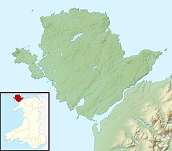
The Menai Strait fish weirs are historically important fishing traps used in the fast-flowing tidal waters of the Menai Strait, which separates Anglesey from the rest of North Wales. The strait was particularly well suited to utilising fish weirs. The tidal waters pull huge volumes of water past the coastline with every tide, and the weirs and traps enabled fish to be concentrated into small holding areas from which they can be readily caught. Such methods are thought to have been used from earliest times, but the submerged and standing remains along both the Anglesey and Gwynedd coasts are from medieval and post-medieval periods, and in some cases were still in use into the 20th century.
Evidence of fishing with nets in the Menai Strait was documented in the 11th century. [1] However the development of various types of permanent structures have been found in the mud and sand of the Menai Strait. Of the various designs used around Britain, three in particular have been noted on the strait: Crescent, V-shaped and Rectilinear. In addition, there are also traps that use natural features, such as a gap between two islands. [2] Crescent Traps may represent the earliest form, and take the form of a crescent of rocks or other material to create a pond at low tide, into which fish can be driven and then contained and caught. V-shaped structures develop this by allowing a sluice at the narrow end. This funnelled the water through a gap around 1.5 metres (4.9 ft) wide, over which a large net bag could be placed to catch the fish as the water drained out. Two v-shaped traps are sometimes located side by side, to create a w-shape. [2] A more developed structure is the Rectilinear trap, which is particularly well represented along the Strait. A dry stone wall runs 200 metres (660 ft) or so directly out from the shore between the high to low water marks. A second wall forms a rectangle to the shoreline, by running a similar distance parallel to the shore. A third, shorter wall runs back at an acute angle on the shorewood side, in a 'hook' shape, to form in effect, a v-shaped funnel within the rectangle, from which the water can be released through a net bag.
Map showing the fish weirs at the northern end of Anglesey's Menai Strait shoreline. |
The northern (Anglesey) shore of the Menai Strait has visible evidence of at least 11 fish weir sites. Five of these are northeast of Beaumaris, in Llangoed Community and are thought to have all been associated with Llanfaes Friary. All five are of the rectilinear design. [3] Two were still in use in the 19th century, one of which was still operating in 1960, whilst others were unknown until identified by aerial photographs. [4]
Map showing the fish weirs of the Swellies, in Anglesey's Menai Strait. |
The Swellies (or Wellies) are a series of submerged rocks and small islands in the most constricted section of the Strait, between the two bridges. The tides run fastest past these constrictions, which have been used to create a series of fish weirs on the shore and in mid stream. Three are scheduled monuments, all in Llanfair Pwllgwyngyll Community.
Two further fish weirs are north of Menai Bridge, near the River Cadnant at Ynys Castell and Ynys y Big. Neither are scheduled monuments, [25]
Towards the southern end of the Strait are various intertidal features which are probable fish weirs. Three of the more distinct are:
Only one of the fish weirs on the Gwynedd side of the Strait is a scheduled monument. Five others are also recorded in the coflein database.
Moelfre is a village, a community and until 2012 an electoral ward on the north-east coast of the Isle of Anglesey in Wales. The community area covers the village and harbour, and several smaller, dispersed settlements. It includes six scheduled Iron Age hut groups and many other sites of archaeological interest. The harbour was formerly a local fishing port; a lifeboat station has been based here since 1854. Among many shipwrecks off the coast was that of the Royal Charter in 1859. Near the modernised lifeboat station is the RNLI Seawatch Centre. The coastline includes a rocky headland north of the village and a large sandy beach at Lligwy Bay, both traversed by the Anglesey Coastal Path. The 2011 census measured the village population as 710.
Llangoed is a small village, community and electoral ward just north of Beaumaris, on the Isle of Anglesey or Ynys Môn, at grid reference SH609793. The Royal Mail postcode begins LL58. Llangoed ward has a population of 1,275 (2001), falling at the 2011 census to 1,229.
Ynys Gored Goch, sometimes Ynys Gorad Goch, is a small island in the Menai Strait between Gwynedd and Anglesey in north Wales. It is situated in the stretch of the strait called the Swellies between Thomas Telford's Menai Suspension Bridge and Robert Stephenson's Britannia Bridge.
Puffin Island is an uninhabited island off the eastern tip of Anglesey, Wales. It was formerly known as Priestholm in English and Ynys Lannog in Welsh. A hermitage was established here around the 6th century and there are remains of a 12th-century monastery on the island. The island is also a Special Protection Area for wildlife.
Tref Alaw is a community in Anglesey, north Wales. The community takes in the area west and south west of the Llyn Alaw, a man made reservoir which is also the largest body of water on the island. The community consists of a wide network of dispersed farms, and five settlements. Two small villages, close to each other in the centre of the community area are Llanddeusant and Elim. Llantrisant is a hamlet a mile or so to the south-west of Elim. In the north west is the small village of Llanbabo, and in the far south is the tiny hamlet of Llechgynfarwy, of which the principal building is St Cynfarwy's Church. At the 2001 census the community had a population of 606 inhabitants, reducing to 581 at the 2011 census.
Llanddona fish weir is a post medieval fish trap sited in Llanddona, on the Isle of Anglesey. The fish weir is a scheduled monument.