Menlo, County Galway

Last updated

Menlo
Mionlach
Menlough
Townland
Menlo castle galway ireland.jpg
Menlo Castle (or Menlough Castle) on the banks of the River Corrib
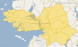
Ireland adm location map.svg
Red pog.svg
Menlo
Location in Ireland
Coordinates: 53°18′07″N9°04′24″W / 53.30194°N 9.07333°W / 53.30194; -9.07333
Country Ireland
Province Connacht
County County Galway

Menlo or Menlough (Irish : Mionlach (or) Mionloch, meaning 'small lake') [1] is a village and townland in one of the Gaeltacht areas of County Galway, Ireland. Menlo falls within the boundaries of the city of Galway, though it is outside the urbanised parts of the city and retains the feel of a small village.

Contents

Name

Plaque on Menlo pier noting the connection with Menlo Park, California Commemorative Plaque (geograph 6543406).jpg
Plaque on Menlo pier noting the connection with Menlo Park, California

Menlo is both a village and townland name and is in the parish of Castlegar, County Galway. Known as Mionloch in Irish, and later anglicised as "Menlo", some older maps also spell it as "Menlough". English writer Thomas Campbell Foster spells it "Menlow". [2]

Menlo gave its name to the town of Menlo Park in California, which was named by Denis J. Oliver and D.C. McGlynn after their native village. [3]

History

Menlo Castle Menlo Castle.jpg
Menlo Castle

Menlo is situated on the east side of the River Corrib and south of Lough Corrib. The remains of Menlo Castle (sometimes given as Menlough Castle) [4] overlook the river. This castle was the former home of Sir Valentine Blake, 1st Baronet. It was owned by the Blake family until it was destroyed by an accidental fire in 1910. [5]

The village retains some of the characteristics of the clachan form which is more evident in Ordnance Survey of Ireland maps of the 19th century. [6] In his Letters on the Condition of the People of Ireland, Thomas Campbell Foster writes of a visit to Menlo in mid-October 1845 (shortly before the Great Famine) and describes it as an example of an Irish rundale village: "It contains about two thousand inhabitants, and their chief subsistence is derived from supplying Galway [City] with milk. The inhabitants keep great numbers of cows, which they feed principally on grains bought in Galway". [2] Foster continues: "The way through the village is the most crooked, as well as the most narrow and dirty lane that can be conceived. There is no row of houses, or anything approaching to a row, but each cottage is stuck independently by itself, and always at an acute, obtuse, or right angle to the next cottage" (293). He continues: "As this is the largest village I ever say, so it is the poorest, the worst built, the most strangely irregular, and the most completely without head or centre, or market or church, or school, of any village I ever was in. It is an overgrown democracy. No man is better or richer than his neighbour in it. It is, in fact, an Irish rundale village". [2]

The first primary level school opened in the village in 1862. The seanchaí and folklorist Tomás Laighléis details the events surrounding this in his book Seanchas Thomáis Laighléis. [7] In the late 1930s a new building for the national school was built housing two classrooms. In the late 1970s two more classrooms were added to the existing school building of Scoil Bhríde. In 2001 the community got permission to build a sporting complex adjoining the school called Áras Pobail, Mionloch. A new modern two storey school building was built on the site of the older school and opened for the start of the school year in September 2014. [8]

Sport

Menlo is home to the Emmetts Rowing Club which won the Blue Riband of Irish Senior Eights Rowing in 1929 and again in 1931. [9] Although the rowing club was disbanded some years later, a hurling club bearing the same Menlo Emmetts name was formed in 1981. Menlo Emmetts GAA club won the Galway County Junior B title in 1983 and in 2006, going on to win the 2006–07 All-Ireland Junior B Club Hurling Championship. [10]

Notable people

See also

Related Research Articles

<span class="mw-page-title-main">Galway</span> City in Connacht, Ireland

Galway is a city in the West of Ireland, in the province of Connacht, which is the county town of County Galway. It lies on the River Corrib between Lough Corrib and Galway Bay. It is the most populous settlement in the province of Connacht, the sixth most populous city on the island of Ireland and the fourth most populous in the Republic of Ireland, with a population at the 2022 census of 85,910.

<span class="mw-page-title-main">Oranmore</span> Town in County Galway, Ireland

Oranmore is a town near the city of Galway in County Galway, Ireland. It is also the name of the civil parish and Roman Catholic parish in which the town lies.

<span class="mw-page-title-main">River Corrib</span> River in Galway, Ireland

The River Corrib in the west of Ireland flows from Lough Corrib through Galway to Galway Bay. The river is among the shortest in Europe, with only a length of six kilometres from the lough to the Atlantic. It is popular with local whitewater kayakers as well as several rowing clubs and pleasure craft. The depth of this river reaches up to 94 feet.

<span class="mw-page-title-main">Oughterard</span> Town in Connemara, Ireland

Oughterard is a small town on the banks of the Owenriff River close to the western shore of Lough Corrib in Connemara, County Galway, Ireland. The population of the town in 2022 was 1,846. It is located about 26 km (16 mi) northwest of Galway on the N59 road. Oughterard is the chief angling centre on Lough Corrib.

<span class="mw-page-title-main">Headford</span> Town in County Galway, Ireland

Headford is a small town in County Galway, located 26 km north of Galway city in the west of Ireland. It is an angling centre for the eastern shore of Lough Corrib, and Greenfields, approximately 6.5 km west of the town, is its boating harbour. The town is situated next to the Black River which is the county boundary with Mayo. Located on the N84 national secondary road from Galway to Castlebar and the R333, and R334 regional roads, the town is a commuter town to Galway City.

<span class="mw-page-title-main">Cappamore</span> Town in County Limerick, Ireland

Cappamore is a small town in northeast County Limerick in the midwest of Ireland. It is also a parish in the Roman Catholic Archdiocese of Cashel and Emly.

<span class="mw-page-title-main">Ardrahan</span> Village in County Galway, Ireland

Ardrahan is a village in County Galway, Ireland.

<span class="mw-page-title-main">Moycullen</span> Gaeltacht village near Galway city, Ireland

Moycullen is a Gaeltacht village in County Galway, Ireland, about 10 km (7 mi) northwest of Galway city. It is near Lough Corrib, on the N59 road to Oughterard and Clifden, in Connemara. Moycullen is now a satellite town of Galway with some residents commuting to the city for work, school, and business. Although Moycullen and its hinterland are classified as a ‘Gaeltacht’ area, the language has not been the local vernacular for many years. Moycullen falls under a Category C Gaeltacht Area due to its low percentage of daily Irish speakers.

<span class="mw-page-title-main">Skehana</span> Townland in Connacht, Ireland

Skehana or Skehanagh is a small village and townland in County Galway, Ireland. The name Skehana derives from the Irish Sceith eánach meaning "place of the whitethorn".

<span class="mw-page-title-main">Gneeveguilla</span> Village in County Kerry, Ireland

Gneeveguilla,, officially Gneevgullia, is a small village in the Sliabh Luachra region of East County Kerry, Ireland. It lies about 19 km (12 mi) east of Killarney, close to the County Kerry/County Cork border.

<span class="mw-page-title-main">Castlefin</span> Town in County Donegal, Ireland

Castlefin, sometimes spelt Castlefinn, is a market town and townland in the Finn Valley of County Donegal in Ulster, the northern province in Ireland. It is located between Ballybofey and Lifford in East Donegal and, as of 2016, the population was 705. The River Finn flows by the town. The town is located in along the main N15 national primary road, which runs from Bundoran to Lifford. The town lies 6 miles from Lifford and 8 miles from the twin towns of Ballybofey and Stranorlar. It has close links to Letterkenny, to the twin towns of Ballybofey and Stranorlar, and to West Tyrone in Northern Ireland, especially with the towns of Strabane and Castlederg.

Menlough is a village in the civil parish of Killoscobe in northeast County Galway, Ireland. It is located 35 km from Galway, 27 km from Tuam, 30 km from Ballinasloe, and 20 km from Athenry. Together with nearby Skehana, Menlough is a half-parish within the diocesan parish of Killascobe in the Roman Catholic Archdiocese of Tuam.

<span class="mw-page-title-main">Castlegar, County Galway</span> Village in County Galway, Ireland

Castlegar is a village and electoral division in County Galway, just outside the city of Galway, in Ireland. Castlegar is also an ecclesiastical parish in the Roman Catholic Diocese of Galway, Kilmacduagh and Kilfenora. It extends from Lough Corrib across to Merlin Park by the old Galway-Dublin road.

<span class="mw-page-title-main">Renmore</span>

Renmore is a suburb of Galway City, Ireland, situated approximately 2 km to the east of the city. Renmore runs east along the coast and south of Dublin Road, from the shore of Lough Atalia on its west side to Lurgan Park on its east. The area houses approximately 5,000 people and includes Ballyloughane beach, which also has camping facilities.

<span class="mw-page-title-main">Paulstown</span> Village in Leinster, Ireland

Paulstown is a small village in County Kilkenny in Ireland.

<span class="mw-page-title-main">Croghan, County Offaly</span> Village in Leinster, Ireland

Croghan is a village in County Offaly in Ireland. It is situated near Croghan Hill, on an "island" of high ground surrounded by an expanse of raised bog which forms part of the Bog of Allen.

Annaghdown is a civil parish in County Galway, Ireland. It takes its name from Eanach Dhúin, Irish for "the marsh of the fort". It lies around Annaghdown Bay, an inlet of Lough Corrib. Villages in the civil parish include Corrandulla and Currandrum. Annaghdown is also an ecclesiastical parish in the Roman Catholic Archdiocese of Tuam and the Church of Ireland Diocese of Tuam, Killala and Achonry.

<span class="mw-page-title-main">Brawny (barony)</span> Barony in Leinster, Ireland

Brawny is a barony in south–west County Westmeath, Ireland. It was formed by 1672. It is bordered by County Roscommon to the west. It also borders two other Westmeath baronies: Kilkenny West and Clonlonan. The largest centre of population in the barony is the town of Athlone.

<span class="mw-page-title-main">Menlo Castle</span> 16th-century castle in County Galway, Ireland

Menlo Castle or Menlough Castle, also called Blake's Castle, is a 16th century castle situated on the bank of the River Corrib near Menlo village in County Galway, Ireland.

Leitrim is a barony in Ireland that lies partly in County Galway and partly in County Clare. It is located in the south-eastern corner of County Galway and the north-eastern corner of County Clare. Prior to 1898, the entire barony was contained in County Galway. The Local Government (Ireland) Act 1898 split the barony: part of the barony was transferred to County Clare. Leitrim is bounded, clockwise from the southwest, by the Clare baronies of Tulla Upper and Tulla Lower; the Galway baronies of Loughrea to the west, Kilconnell to the north, and Longford to the east; and by Lough Derg to the south and southeast. It measures 20 miles (32 km) from north to south and 9.5 miles (15.3 km) from east to west.

References

  1. "Mionlach / Menlough". logainm.ie. Placenames Database of Ireland. Retrieved 6 January 2021.
  2. 1 2 3 Foster, Thomas Campbell (1846). Letters on the Condition of the People of Ireland. Chapman and Hall. pp. 292–293.
  3. "Menlo Park history". menlopark.org. City of Menlo Park. Retrieved 6 January 2021. The men named their new home after their old, in Menlough on Lough Corib, County Galway, Ireland
  4. "Caisleán Mhionlaigh / Menlough Castle". logainm.ie. Placenames Database of Ireland. Retrieved 6 January 2021.
  5. 1 2 "Menlo/Menlough Castle". Landed Estates Database. Retrieved 6 January 2021.
  6. "Shop.osi.ie Mapviewer". Archived from the original on 29 August 2012. Retrieved 15 February 2015.
  7. Laighléis, Tomás (1977). Seachas Thomás Laighléis. An Clóchomhar. p. 38.
  8. "Fáilte go suíomh idirlín Scoil Bhríde!". scoilbhride1862.ie. Retrieved 7 January 2021. We are a growing school situated just on the edge of Galway city. Our school is in a new two storey building with an adjacent full size sports hall and grass pitch [..] opened in 2014
  9. "The mighty men of Menlo". advertiser.ie. Galway Advertiser. 2 July 2009. Retrieved 7 January 2021.
  10. "All-Ireland dream dies as Menlo capture Junior 'B' hurling crown Rocks pipped in final replay". Enniscorthy Guardian. Independent News & Media. 29 March 2007. Retrieved 24 June 2020.
  11. "Laighléis, Tomás (1895–1984)". ainm.ie (in Irish). Retrieved 7 January 2021.
  12. "Macken's deep sense of Galway". irishtimes.com. Irish Times. 28 April 2001. Retrieved 7 January 2021.