Related Research Articles

Menlo Park is a city located at the eastern edge of San Mateo County within the San Francisco Bay Area of California in the United States. It is bordered by San Francisco Bay on the north and east; East Palo Alto, Palo Alto, and Stanford to the south; Atherton, North Fair Oaks, and Redwood City to the west. Menlo Park is one of the most educated cities in the state of California and the United States; nearly 70% of residents over the age of 25 have earned a bachelor's degree or higher. Menlo Park had 32,026 inhabitants according to the 2010 United States Census, which had grown to an estimated 34,698 inhabitants by 2019. The city is home to the corporate headquarters of Facebook and where Google and Round Table Pizza were founded.

North Fair Oaks is a census-designated place and an unincorporated area located in San Mateo County, California adjacent to Redwood City, Atherton, and Menlo Park. As of the 2010 census the area had a total population of 14,687. Because of the large number of residents from one Mexican state the area is also known as Little Michoacán. The larger area including North Fair Oaks and adjacent parts of Redwood City has a large Latino population and is known locally as Little Mexico. It is one of the most distinctive cities on the entire Peninsula, as it is one out of only three cities that have a majority Hispanic population.

South San Francisco is a city in San Mateo County, California, United States, located on the San Francisco Peninsula in the San Francisco Bay Area. The city is colloquially known as “South City”. The population was 63,632 at the 2010 census.

Area code 650 is a telephone area code in the North American Numbering Plan (NANP) for the San Francisco Bay Area in the U.S. state of California. It was split from area code 415 on August 2, 1997, and includes most of San Mateo County, part of San Francisco, and the northwestern portion of Santa Clara County including Palo Alto, Mountain View, and Los Altos.

Hayes Valley is a neighborhood in the Western Addition district of San Francisco, California. It is located between the historical districts of Alamo Square and the Civic Center. Victorian, Queen Anne, and Edwardian townhouses are mixed with high-end boutiques, restaurants, and public housing complexes. The neighborhood gets its name from Hayes Street, which was named for Thomas Hayes, San Francisco's county clerk from 1853 to 1856 who also started the first Market Street Railway franchise.

The Piedmont Avenue neighborhood is a residential and commercial district in the North Oakland region of Oakland, California. It is named for Piedmont Avenue, a commercial street known for dining and retail. The neighborhood is roughly bounded by Temescal and Broadway on the west, Oakland Avenue and the City of Piedmont on the east, the Mountain View Cemetery on the north, and the MacArthur Freeway section of Interstate 580 on the south.

Pacific Heights is a neighborhood of San Francisco, California, which is known for the notable people who reside in the area. It has panoramic views of the Golden Gate Bridge, San Francisco Bay, the Palace of Fine Arts, Alcatraz, and the Presidio.
The Menlo Park City School District is a public school district in the San Francisco Bay Area, primarily serving the communities of Menlo Park and Atherton. Through the Tinsley Voluntary Transfer Program the district allows students from East Palo Alto and eastern Menlo Park to attend MPCSD schools.

Seminary is a neighborhood in the East Oakland section of Oakland, California. It is located just north of the Elmhurst neighborhood. Seminary's ZIP code is 94621. It is best known for its close proximity to Mills College.

Menlo College is a private college specializing in business and located in Atherton, California.

Temescal is one of the oldest neighborhoods in Oakland, California, located in North Oakland, and centered on Telegraph Avenue. The neighborhood derives its name from Temescal Creek, a significant watercourse in the city.
Oxford Circle is a neighborhood in the lower Northeast section of Philadelphia, Pennsylvania, United States. Its namesake is the much used traffic circle at Roosevelt Boulevard and Oxford Avenue. The Oxford Circle neighborhood has traditionally included the areas up to Rhawnhurst and Mayfair but does not really have a fixed boundary other than in publications about Philadelphia which are of a public relations or informational nature.
College Terrace is a neighborhood in the city of Palo Alto, California, adjacent to Stanford University.
The Parkside is a neighborhood in the western part of San Francisco, California, usually considered to be part of the Sunset District. It is located in the southern part of the Avenues south of Quintara and north of Sloat Boulevard.

Longfellow is a neighborhood of North Oakland, California. It is bounded by Temescal Creek to the north, State Route 24 to the east, Interstate 580 to the south, and Adeline Street to the west.
Banbury Oaks is a neighborhood in Pasadena, California. It is bordered by Washington Boulevard to the north, Mountain Street to the south, Fair Oaks Avenue to the East, and Forest Avenue to the west. The neighborhood is bisected by I-210. The main roads through the neighborhood are Hammond Street and Lincoln Avenue.
Laurel Heights is a neighborhood of San Francisco, California.
Thousand Oaks is a neighborhood of Berkeley in Alameda County, California. Located at the base of the Berkeley Hills, it lies at an elevation of 239 feet.
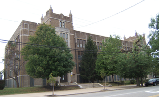
Mid-Peninsula High School (Mid-Pen) is an independent non-profit and non-sectarian coeducational college preparatory high school located in Menlo Park, California. The school offers a flexible and personalized academic program, small class sizes and accommodations for learning differences. The school has a reputation for inclusiveness, according to a San Francisco Chronicle article about helping young people cope with cliques. Mid-Pen's colors are maroon and gray and its school nickname is the dragons.
The Peninsula Library System (PLS) is a consortium of public and community college libraries in San Mateo County, California, United States, which serves the part of the San Francisco Bay Area known as "The Peninsula". The system has dozens of branches in local communities and at various area community colleges, a bookmobile, and automated book kiosks called Library-a-Go-Go.
References
http://www.paloaltoonline.com/news/2010/02/02/menlo-park-neighborhoods Menlo Park neighborhoods
http://www.paloaltoonline.com/media/reports/1234292593.pdf Neighborhood map
http://www.paloaltoonline.com/news/2010/02/01/menlo-oaks Menlo Oaks description
Coordinates: 37°28′09″N122°09′59″W / 37.46917°N 122.1665°W
| This San Mateo County, California-related article is a stub. You can help Wikipedia by expanding it. |