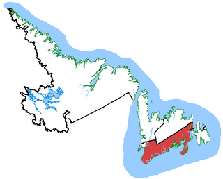
Random—Burin—St. George's was a federal electoral district in Newfoundland and Labrador, Canada, that was represented in the House of Commons of Canada from 2004 to 2015.
Placentia Bay is a body of water on the southeast coast of Newfoundland, Canada. It is formed by Burin Peninsula on the west and Avalon Peninsula on the east. Fishing grounds in the bay were used by native people long before the first European fishermen arrived in the 16th century. For a time, the French controlled the bay. They built their capital at Placentia on the east coast. The British gained Placentia during the Treaty of Utrecht in 1713. The town and nearby Castle Hill are national historic sites. English settlement followed in the bay and today the main communities are Burin, Marystown, and Placentia.

Bellevue is a former provincial electoral district for the House of Assembly of Newfoundland and Labrador, Canada. As of 2003 it had 7310 eligible voters. The district was abolished in 2015 and replaced by Placentia West-Bellevue.
Broad Cove is on King's Island, Placentia Bay, Newfoundland, Canada. It was one of five communities on King's Island; the others were: Tack's Beach, Best Harbour, Baker's Cove, Cooper's Cove and Yaulis Cove. All the communities had the same postal address, which was "Tacks Beach, Placentia Bay, Newfoundland".
Tack's Beach was a small community located on King Island in Placentia Bay. The population was 252 in 1921. The population had declined to 140 by 1966 due to a decline in fish stocks and the community was depopulated in 1967.
Garden Cove is a local service district and designated place in the Canadian province of Newfoundland and Labrador. It is southeast of Swift Current. The residents of Sound Island moved without government assistance during a period around 1953. They moved to the mainland into Garden Cove and surrounding communities. Today Garden Cove has an active close community. There is a tour boat, Merasheen which is part of the Woody Island Resort hotel which gives people a Newfoundland outport experience. Garden Cove has hiking trails passing by Big Rock Hill and Placentiamans Point. There is an inshore fishery operating there. Some species caught are lobster, cod, mackerel, herring, crab, scallops, mussels, flounder and trout. Late in summer Tuna chase bill fish just off shore.
Red Island is a former village about 12 miles northwest of Placentia, Newfoundland and Labrador, Canada in Placentia Bay, on an island of the same name. It had five families in 1864, and had a population of approximately 350 in the 1945 census.1 The village of 283 was depopulated in October 1968, during the provincial government's Resettlement Program. In modern times, many people have cabins there and use it as a summer retreat. It recorded a 1986 population of 1, during an attempt to repopulate the island. This failed, however, when no teacher could be found for the proposed re-opened school.
Merasheen Island is an island in Newfoundland and Labrador, Canada. With a length of approximately 35 km and a width at its widest point of 9 km, it is situated about 6 km from Presque. It is the largest island in the Placentia Bay.
Western Cove is located on Bar Haven Island in Placentia Bay. It is formed between Newfoundland, Labrador, and Bar Haven.
Darby's Harbour is a locality and former settlement located southwest of Swift Current in Paradise Sound, Placentia Bay, Newfoundland, Canada. It had a post office in 1940. The 1935 population was 21, but by 1990 it was uninhabited.
Dunville is a neighborhood located in the Town of Placentia, in Canada. it was earlier called Northeast or North East Placentia. The name was formed from "Dunphy's Village" a part of Northeast Placentia. It is a community that makes up the north-eastern section of the Town of Placentia. It stretches approximately 8 km along the northern shore of the North-East Arm of Placentia Bay.
Oderin Island is an island in the Canadian province of Newfoundland and Labrador in western Placentia Bay, located about 30 km northeast of Marystown. Initially recorded as a fishing post of the French and later an outpost of the English, the island came to be inhabited at some time before 1704. The island no longer has any permanent residents due to a resettlement program in 1966.
Harbour Buffett was established in 1836. It was a small place with ten families in the St. Mary's area by 1864. The Way Station became a Post Office in 1891.
Kingwell was the former name of Mussel Harbor, a village located on Long Island in Placentia Bay. It had a population of 243 in 1940 and 198 in 1956.
Woody Island is an island and former settlement in Placentia Bay, Newfoundland and Labrador.
Port Elizabeth is a resettled community in Newfoundland and Labrador. It's located on Davis Island in the Flat Islands archipelago in Placentia Bay.
Great Brule is a settlement on the northern tip of Merasheen Island in Placentia Bay in Newfoundland and Labrador. The first permanent residents in the community were recorded in 1813. The cod fishery was the primary source of employment in Great Brule. Between 1951 and 1956 the community was abandoned and most of the residents relocated to larger centers in Placentia Bay.
Flat Islands is an archipelago and resettled community in Placentia Bay in Newfoundland and Labrador.
Division No. 1, Subdivision B is an unorganized subdivision on the Avalon Peninsula in Newfoundland and Labrador, Canada. It is in Division 1 and contains the unorganized communities of Iona, Little Barasway, Placentia Junction, Point Verde and Ship Harbour.
Division No. 1, Subdivision C is an unorganized subdivision on the Avalon Peninsula in Newfoundland and Labrador, Canada. It is in Division 1 and contains the unincorporated communities of Cape St. Mary's, Cuslett, Gooseberry Cove, Great Barasway, Lears Cove, Patrick's Cove-Angels Cove, Ship Cove and Stoney House.