Meridian Woods Park

Last updated
Meridian Woods Park
Location map Indianapolis.png
Red pog.svg
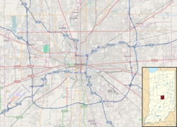
Meridian Woods Park
Location in Indiana
USA Indiana location map.svg
Red pog.svg
Meridian Woods Park
Meridian Woods Park (Indiana)
Coordinates: 39°40′03″N86°10′17″W / 39.66756°N 86.171363°W / 39.66756; -86.171363 Coordinates: 39°40′03″N86°10′17″W / 39.66756°N 86.171363°W / 39.66756; -86.171363
Country United States
State Indiana
County Marion
City Indianapolis
Time zone UTC-5 (EST)
  Summer (DST) UTC-4 (EDT)
ZIP Code
46217

Meridian Woods Park is a neighborhood located on the south side of Indianapolis, Indiana, United States. It is home to the Meridian Woods Marlins swim team. Children in the neighborhood attend the schools of the Metropolitan School District of Perry Township.

Related Research Articles

<span class="mw-page-title-main">Meridian, Mississippi</span> City in Mississippi, United States

Meridian is the seventh largest city in the U.S. state of Mississippi, with a population of 41,148 at the 2010 census and an estimated population in 2018 of 36,347. It is the county seat of Lauderdale County and the principal city of the Meridian, Mississippi Micropolitan Statistical Area. Along major highways, the city is 93 mi (150 km) east of Jackson, Mississippi; 154 mi (248 km) southwest of Birmingham, Alabama; 202 mi (325 km) northeast of New Orleans, Louisiana; and 231 mi (372 km) southeast of Memphis, Tennessee.

<span class="mw-page-title-main">East Boston</span> Neighborhood of Boston in Suffolk, Massachusetts, United States

East Boston, nicknamed Eastie, is a neighborhood of Boston, Massachusetts with over 45,000 residents. Annexed by the city of Boston in 1637, it is bordered by the cities of Winthrop, Revere, and Chelsea to the east, north, and northwest. It is separated from the Boston neighborhood of Charlestown and downtown Boston by Boston Harbor to the west and south. The footprint of the East Boston neighborhood as it is known today was created in the 1940s by connecting five of the inner harbor islands using land fill.

Adams Morgan Neighborhood of Washington, D.C.

Adams Morgan is a neighborhood in Northwest Washington, D.C., centered at the intersection of 18th Street NW and Columbia Road, about 1.5 miles (2.54 km) north of the White House. Notable establishments in the neighborhood include the Washington Hilton and Madam's Organ Blues Bar. Notable residential buildings include Euclid Apartments, Fuller House, Park Tower, Meridian Mansions, and the Pink Palace. Embassies in the neighborhood include the Embassy of Lithuania, the Embassy of Poland, the Embassy of the Central African Republic, the Embassy of Gabon and the Embassy of Cuba. Notable public artwork in Adams Morgan includes Carry the Rainbow on Your Shoulders, The Servant Christ, and The Mama Ayesha's Restaurant Presidential Mural.

Wallingford, Seattle Neighborhood of Seattle, Washington

Wallingford is a neighborhood in north central Seattle, lying on a hill above the north shore of Lake Union about four miles from the downtown core. The neighborhood developed quickly during the early 20th century after the establishment of the University of Washington to the east. With trolley tracks laid through the neighborhood as early as 1907, Wallingford is a classic streetcar suburb, typified by its many 1920s era box houses and bungalows. Commercial development is primarily concentrated along North 45th Street where a number of iconic structures stand including the neon "WALLINGFORD" sign, the Wallingford Center, and the original Dick's Drive-In. With its central location, numerous public amenities, including the world-renowned Gas Works Park, and views of both the Olympic and Cascade mountains, Wallingford has long been home to many middle and upper-class families. While Wallingford is mostly residential in nature, the neighborhood's southern edge, along Lake Union, has historically been an industrial and commercial business strip. In recent years, numerous office buildings have been developed as an extension of the burgeoning business center in neighboring Fremont. In 2014 Brooks Sports moved its headquarters from Bothell to a new six-story office building at the southwestern edge of Wallingford.

Meridian, Seattle

Meridian or Tangletown is the part of Seattle's Wallingford neighborhood that lies north of N 50th Street, near Green Lake. Of note are its "K streets": Kensington, Kenwood, Keystone, and Kirkwood Places N.

Columbia Heights (Washington, D.C.) Neighborhood of Washington, D.C.

Columbia Heights is a neighborhood in Northwest Washington, D.C., United States. It has diverse demographics, the DC USA shopping mall and many restaurants, BloomBars, Meridian Hill/Malcolm X Park, Howard University, Banneker Recreation Center, and All Souls Church.

<span class="mw-page-title-main">Meridian Hill/Malcolm X Park</span> United States historic place

Meridian Hill Park, also known as Malcolm X Park, is a structured urban park located in the Washington, D.C., neighborhood of Columbia Heights; it also abuts the nearby neighborhood of Adams Morgan. The park was designed and built between 1912 and 1940. This 12-acre (49,000 m2), formally landscaped site is officially part of the National Capital Parks Unit of the National Park System, and is administered by the superintendent of nearby Rock Creek Park. Meridian Hill Park is bordered by 15th, 16th, W, and Euclid streets NW, and sits on a prominent hill 1.5 miles (2.4 km) directly north of the White House. Since 1969, the name "Malcolm X Park" has been used by many in honor of minister and activist Malcolm X.

Central Square, East Boston Neighborhood in Massachusetts, US

Central Square is a section of the neighborhood of East Boston in Boston, Massachusetts, United States. The square begins at the intersection of Bennington Street and Meridian Street, continues up Meridian to its intersection with White Street, and includes all the area to the left. The square’s intersecting streets also include Border, Saratoga, and Eutaw Street. It is within close proximity of the entrance to the Sumner Tunnel, which motorists take to downtown Boston.

Historic Meridian Park Neighborhood is situated north of downtown Indianapolis, and located within the larger Mapleton Fall Creek Neighborhood. While the neighborhood is fairly small, it was listed on the National Register of Historic Places in 2009.

St. Mary of the Woods Catholic Church is a parish in the Archdiocese of Chicago located at 7033 North Moselle Avenue in the Edgebrook neighborhood of Chicago, Illinois.

First Presbyterian Church of Meridian Historic church in Mississippi, United States

First Presbyterian Church of Meridian is a historic church in Meridian, Mississippi, which is listed on the National Register of Historic Places. The church was founded in 1856 by eight members including John T. Ball and Lewis A. Ragsdale, founders of the city of Meridian. The reverend at the time was William Curtis Emerson.

Eagle Hill Historic District Historic district in Massachusetts, United States

The Eagle Hill Historic District is a residential historic district roughly bounded by Meridian, Princeton, and White Streets meeting in Prescott Square in the East Boston neighborhood of Boston, Massachusetts. This part of East Boston was developed roughly between 1834 and 1900, and includes a remarkable concentration of original housing stock. The neighborhood is dense, with a mix of single-family and multiple-family wood frame housing. The preponderance of these buildings are Italianate, Second Empire or Renaissance Revival in style, with earlier Greek Revival and later Colonial Revival and Queen Anne styling present in smaller numbers. Some of the most prominent properties in the district are: the Donald McKay House, Trinity Neighborhood House, the Paul Curtis Mansion, and the William Waters Jr. House. Another noteworthy property in the district is the East Boston High School located at the top of the hill, built on a site formerly used as a reservoir.

Chapman, also known as Chapman Woods is a neighborhood in Pasadena, California. It is bordered by Del Mar Boulevard to the north, Huntington Drive to the south, the Eaton Wash to the west, and Highway 19 to the east. Chapman is an anomaly in that part of the neighborhood is in incorporated Pasadena while part is in unincorporated Los Angeles County. The region is named after Alfred Chapman who purchased the surrounding land and built his home on the corner of present-day California Boulevard and Ivydale Court.

Modena Park is a neighborhood in Northeast Philadelphia. It is located east of Northeast Philadelphia Airport at Morrell Avenue.

Meridian Street (Indianapolis) Primary north-south street in Indianapolis, Indiana, United States

Meridian Street is the primary north–south street in Indianapolis, Indiana, United States.

<span class="mw-page-title-main">Central Court Historic District</span> Historic district of Indianapolis, Indiana

The Central Court Historic District is a historic district and neighborhood of the city of Indianapolis in northern Center Township, Marion County, Indiana, United States. Built around Central Court near the intersection of 36th Street and Central Avenue, the neighborhood consists of seventy-five buildings over an area of 7.6 acres (3.1 ha).

<span class="mw-page-title-main">Oliver Johnson's Woods Historic District</span> Historic district in Indiana, United States

Oliver Johnson's Woods is a historic district and neighborhood on the northern side of Indianapolis, Indiana, United States. Located in southern Washington Township, the district occupies the site of what was once the family farm of Oliver Johnson. Born on the present site of the Indiana State Fairgrounds, Johnson grew up in a pioneer family that lived on the edge of the state capital city. Upon attaining adulthood, he bought property a short distance to the west, to which he moved in 1846. Here, he built a larger farmhouse in 1862, and he tilled the soil for most of the rest of his life. As Indianapolis grew northward, it reached the Johnson farm in the early twentieth century; the aged farmer and his sons saw the city's growth as an opportunity for financial gain, and in 1905 they announced the platting of 0.25 square miles (0.65 km2) of their property into individual lots. They chose an advantageous time to sell their property; as the new residents began to build their homes, an interurban railway was built along College Avenue on the district's western side that connected downtown with Broad Ripple. Many prosperous businessmen were attracted by the development's large lots and wooded streets; the city annexed Oliver Johnson's Woods in 1912, and by the outbreak of World War II, the streets were filled with large houses built in a wide variety of architectural styles. These early residents came from many different ethnicities: European immigrants were becoming more prosperous and leaving their ethnic enclaves, and new neighborhoods such as Oliver Johnson's Woods appealed to them. Among the neighborhood's leading residents was a colony of Jews of German descent.

<span class="mw-page-title-main">Bryker Woods, Austin, Texas</span>

Bryker Woods is an older Austin, Texas, central city neighborhood developed in the 1930s, the center of which is approximately located at 30°18′17″N97°45′06″W. It is predominantly a mix of young and old families and zoned as a single-family neighborhood composed of mostly small homes in good condition, most of which are over 50 years old. The Bryker Woods neighborhood is also part of the Old West Austin Historic District. Bryker Woods has its own elementary school, Bryker Woods Elementary, and is convenient to retail and recreational facilities.

Longfellow Historic District Historic district in Iowa, United States

The Longfellow Historic District is a nationally recognized historic district located in Iowa City, Iowa, United States. It was listed on the National Register of Historic Places in 2002. At the time of its nomination, it consisted of 355 resources, which included 250 contributing buildings, 103 non-contributing buildings, and two non-contributing structures. As the University of Iowa expanded in the early 20th-century new sections were being added to the city. The Longfellow neighborhood, named after the local elementary school completed in 1919, was part of this expansion. The northern part of the neighborhood along East Court Street developed in the 19th century because the street connected the city center to the Muscatine road. The rest of the neighborhood was platted on farm land in 1908 and 1914. A trolley line was completed to the area in 1910, leading to the creation of suburban development.

References