
Oxfordshire is a ceremonial county in South East England. The county is bordered by Northamptonshire and Warwickshire to the north, Buckinghamshire to the east, Berkshire to the south, and Wiltshire and Gloucestershire to the west. The city of Oxford is the largest settlement and county town.

The River Wharfe is a river in Yorkshire, England originating within the Yorkshire Dales National Park. For much of its middle course it is the county boundary between West Yorkshire and North Yorkshire. Its valley is known as Wharfedale.
Burnley Wood is a district and former electoral ward of Burnley, Lancashire. In broad terms the area lies between Parliament Street in the north and Hufling Lane in the south, and from the railway in the west to Todmorden Road in the east. Based on historic definitions of the ward boundary, Burnley Wood could also be defined as including the more affluent areas around the Woodgrove Road area to the east of Todmorden Road, Brooklands Road to the south and the area north of Parliament Street as far as the River Calder. Historically the district was located in the parish and township of Habergham Eaves, separated from the adjacent Burnley township, later Borough by the Calder before being incorporated into the County Borough of Burnley in 1894.

The Oxford University Parks, commonly referred to locally as the University Parks, or just The Parks, is a large parkland area slightly northeast of the city centre in Oxford, England. The park is bounded to the east by the River Cherwell, though a small plot of land called Mesopotamia sits between the upper and lower levels of the river. To the north of the parks are Norham Gardens and Lady Margaret Hall, to the west the Parks Road, and the Science Area on South Parks Road to the south. The park is open to the public during the day, and has gardens, large sports fields, and exotic plants. It includes a cricket ground used by Oxford University Cricket Club.

The Greenway is a 7-kilometre (4.3 mi) long footpath and cycleway in London, mostly in the London Borough of Newham, on the embankment containing the Joseph Bazalgette Northern Outfall Sewer.

The Lower Lea Valley is the southern end of the Lea Valley which surrounds the River Lea in eastern Greater London. It is part of the Thames Gateway redevelopment area and was the location of the 2012 Summer Olympics.

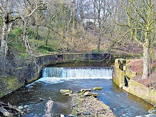
Hambleden Lock is a lock with a long weir situated on the River Thames in England, about 2 miles downstream of Henley Bridge. The lock is on the Berkshire bank between Aston and Remenham. Built by the Thames Navigation Commission in 1773, the lock is named after the village of Hambleden, a mile (1.5 km) to the north.

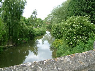
Marston Road is a road in the east of Oxford, England. It links London Place, the junction of St Clements, the foot of Headington Hill, and Morrell Avenue by South Park to the south with the suburb of New Marston to the north. A mini-roundabout has been replaced by traffic lights and connects with Cherwell Drive and Headley Way at the northern end. To the north is the suburb of Northway. The road is designated the B4150 but this is not shown on signs.
Dame's Delight was a place for women to bathe on the bank of the River Cherwell in the meadows near the Oxford University Parks opposite Mesopotamia Walk in Oxford, England.
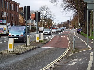
Botley Road is the main road into the centre of Oxford, England from the west. It stretches between Botley, on the Oxford Ring Road (A34) to the west of the city, and Frideswide Square at the junction with Oxford railway station, close to central Oxford.
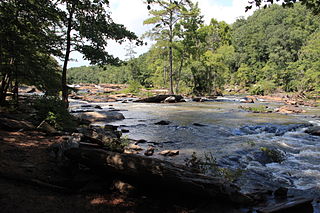
Sweetwater Creek State Park is a 2,549 acres (10.32 km2) Georgia state park in east Douglas County, 15 miles (24 km) from downtown Atlanta. The park is named after Sweetwater Creek which runs through it. Cherokee people were forcibly removed from the area and it eventually became home to the New Manchester Manufacturing Company and mill town of New Manchester. During the American Civil War the textile mill and general store were burned down by the Union Army and the women and children taken away and eventually sent to Louisville, Kentucky and Indiana as refugees.
The River Brun is a river in eastern Lancashire. It is approximately 4.5 miles (7.2 km) long and has a catchment area of 9.32 square miles (24.134 km2).

The River Beane is a short river in the county of Hertfordshire, England. A tributary of the River Lea, it rises to the south-west of Sandon in the hills northeast of Stevenage and joins the Lea at Hartham Common in Hertford.
The A3036 is an A road in London, England, running from Waterloo to Wandsworth.
One of the characteristics of the Isle of Man Railway is the numerous level crossings and farm crossings along the various routes; many smaller crossing places are marked only by gates that criss-cross farm land and provide access to private roads connecting the farms to the main roads. Being largely rural in nature the railway has many of these scattered along the existing South Line, and there were many more on the closed sections of the railway. These can be summarised as follows, along with other points of interest along the line not covered in the Isle of Man Railway stations section:-

The River Bourne rises in the parish of Ightham, Kent and flows in a generally south easterly direction through the parishes of Borough Green, Platt, Plaxtol, West Peckham, Hadlow, and East Peckham where it joins the River Medway. In the 18th century the river was known as the Busty or Buster, the Shode or Sheet, but is not known by these names nowadays. A bourne is a type of stream, while shode means a branch of a river.
The River Beult is a tributary of the River Medway in South East England.

Wantage Road railway station was a railway station on the Great Western Main Line in the Vale of White Horse district in Oxfordshire. The station was actually at the village of Grove, Oxfordshire, more than two miles north of Wantage. The station closed in December 1964 as part of the Beeching cuts.

Shire Brook is a small stream in the south eastern part of the City of Sheffield in South Yorkshire, England. It rises in the suburb of Gleadless Townend and flows in a general easterly direction for 4 miles (6.5 km) to its confluence with the River Rother between Beighton and Woodhouse Mill. In the past the brook has been both the border of Yorkshire and Derbyshire and between the sees of Canterbury and York. The course of the stream has been influenced by human intervention in the 20th century with the brook being diverted underground and flowing through culverts on three occasions as it traverses locations which were formerly landfill sites and extensive railway sidings.

The Dollis Valley Greenwalk is a footpath route in the London Borough of Barnet in London, England, between Moat Mount Nature Reserve in Mill Hill and Hampstead Heath. The route is designed to act as a link between the Capital Ring and the London Loop, and between the many green spaces and wildlife corridors along the way. It is approximately 10 miles (16 km) long. It mainly follows the Dollis Brook and is one of the many parks and open spaces in Barnet.

