
Kangerlussuaq is a settlement in western Greenland in the Qeqqata municipality located at the head of the fjord of the same name. It was Greenland's main air transport hub and the site of Greenland's largest commercial airport until the new airport opened at Nuuk on 28th November 2024. The airport dates from American settlement during and after World War II, when the site was known as Bluie West-8 and then Sondrestrom Air Base.
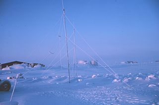
Station Nord is a military and scientific station in northeastern Greenland 1700 km north of the Arctic Circle.

Jameson Land is a peninsula in eastern Greenland.
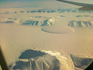
Northeast Greenland National Park is the world's largest national park and the 10th largest protected area. Established in 1974, the Northeast Greenland national park expanded to its present size in 1988. It protects 972,000 km2 (375,000 sq mi) of the interior and northeastern coast of Greenland and is larger than the area of Tanzania, but smaller than that of Egypt. This means that the national park is bigger than 166 of the world's 195 countries. It was the first national park to be created in the Kingdom of Denmark and remains Greenland's only national park. It is the northernmost national park in the world and the second-largest by area of any second-level subdivision of any country in the world, trailing only the Qikiqtaaluk Region in Nunavut, Canada.
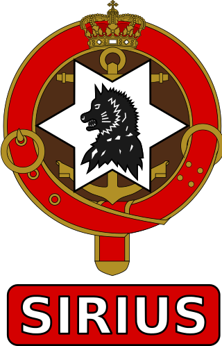
The Sirius Dog Sled Patrol, known informally as Siriuspatruljen and formerly known as North-East Greenland Sledge Patrol and Resolute Dog Sled Patrol, is an elite Danish naval unit. It conducts long-range reconnaissance patrolling, and enforces Danish sovereignty in the Arctic wilderness of northern and eastern Greenland, an area that includes the Northeast Greenland National Park, which is the largest national park in the world. Patrolling is usually done in pairs and using dog sleds with about a dozen dogs, sometimes for four months and often without additional human contact.

Nerlerit Inaat Airport, also referred to as Constable Point Airport is an airport in the Sermersooq municipality in eastern Greenland. It is located on Jameson Land and serves the town of Ittoqqortoormiit, approximately 40 km (25 mi) to the south-east. The airport can serve STOL aircraft. An AS 350 helicopter of Air Greenland is permanently housed at the airport, linking it with Ittoqqortoormiit Heliport. The helicopter also provides search and rescue capabilities within the surrounding area, and can be chartered for transport.

Mont Forel is a mountain in King Christian IX Land, Sermersooq Municipality, Greenland. It is part of the Schweizerland range, also known as 'Schweizerland Alps'.

Crown Prince Christian Land is a large peninsula in northern Greenland. It is a part of King Frederick VIII Land and administratively it belongs to the Northeast Greenland National Park.

King Christian X Land is an area of northeastern Greenland.

The Joint Arctic Command is a direct Level II authority in the Danish Defence. Joint Arctic Command's primary mission in peacetime is to ensure Danish sovereignty by monitoring the area around the Faroe Islands and Greenland. The command also handles tasks such as fisheries inspection, search and rescue (SAR), patient transport and other tasks that support the civil society. In short, the Joint Arctic Command handles military tasks, coast guard duties and disaster response - all in one organisation.

King Frederik VIII Land is a major geographic division of northeastern Greenland. It extends above the Arctic Circle from 76°N to 81°N in a North-South direction along the coast of the Greenland Sea.

Romer Lake is a land-locked freshwater fjord at the northern end of King Frederick VIII Land, near Greenland's northeastern coast. The Danish military base/weather station Nord —the only inhabited place in the area— lies 50 km (31 mi) to the northeast. The lake and its surroundings are part of the Northeast Greenland National Park zone.

The Stauning Alps are a large system of mountain ranges in Scoresby Land, King Christian X Land, northeastern Greenland. Administratively the Stauning Alps are part of the Northeast Greenland National Park zone.

The Princess Caroline-Mathilde Alps are a mountain range system in the Holm Land Peninsula, King Frederick VIII Land, northeastern Greenland. Administratively this range is part of the Northeast Greenland National Park zone.
The Princess Elizabeth Alps is a mountain range in King Frederick VIII Land, northeastern Greenland. Administratively this range is part of the Northeast Greenland National Park zone.
Scoresby Land is an area of Eastern Greenland, which lies partly in Sermersooq and partly in the Northeast Greenland National Park zone. The area is uninhabited, except for Mestersvig, a military outpost.

Centrum Lake, is a lake in King Frederick VIII Land, near Greenland's northeastern coast. The lake and its surroundings are part of the Northeast Greenland National Park zone.

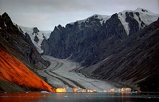
Nordvestfjord, meaning 'Northwest Fjord', is a fjord in King Christian X Land, eastern Greenland.
Nathorst Land is an area in King Christian X Land, Eastern Greenland. It lies in the Northeast Greenland National Park zone. The area is remote and uninhabited.

