Related Research Articles

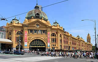
Flinders Street railway station is located on the corner of Flinders and Swanston streets in the central business district (CBD) of Melbourne, Victoria, Australia. Opened in 1854, the historic station serves the entire metropolitan rail network, as well as some country services to eastern Victoria. Backing onto the Yarra River in the heart of the city, the complex includes platforms and structures that stretch over more than two whole city blocks, from east of Swanston Street nearly to Market Street.

The City Loop is a mostly-underground and partly surface-level subway and rail system in the central business district (CBD) of Melbourne, Victoria, Australia.

This is a timeline of major events in the history of the city of Melbourne, Australia.

Camberwell railway station is located on the Lilydale, Belgrave and Alamein lines in Victoria, Australia. It serves the eastern Melbourne suburb of Camberwell, opening on 3 April 1882.

Proposals for expansion of the Melbourne rail network are commonly presented by political parties, government agencies, industry organisations and public transport advocacy groups. The extensions proposed take a variety of forms: electrification of existing routes to incorporate them into the suburban rail system; reconstruction of former passenger rail lines along pre-existing easements; entirely new routes intended to serve new areas with heavy rail or provide alternative routes in congested areas; or track amplification along existing routes to provide segregation of services. Other proposals are for the construction of new or relocated stations on existing lines, to provide improved access to public transport services.

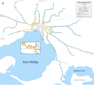
The Melbourne rail network is a passenger and freight train system in the city of Melbourne, Australia. It is the core of the larger Victorian railway network, with links to both intrastate and interstate systems. A large suburban passenger network centred on the CBD also operates, with a limited degree of segregation from longer-distance passenger and freight trains.

Kensington is an inner suburb of Melbourne, Australia, 4 km north-west of Melbourne's central business district. Its local government area is the City of Melbourne.

Kalkallo is a town in Victoria, Australia, 33 km north of the Melbourne city centre. It is local government area is the City of Hume. At the 2016 Census, Kalkallo had a population of 105.

Transport in Melbourne, the state capital of Victoria, Australia, consists of several interlinking modes. Melbourne is a hub for intercity, intracity and regional travel. Road-based transport accounts for most trips across many parts of the city, facilitated by Australia's largest freeway network. Public transport, including the world's largest tram network, trains and buses, also forms a key part of the transport system. Other dominant modes include walking, cycling and commercial-passenger vehicle services such as taxis. Melbourne is a busy regional transport hub for the statewide passenger rail network, coaches and interstate rail services to New South Wales and South Australia. Freight transport also makes up a significant proportion of trips made on the network from the Port of Melbourne, Melbourne Airport and industrial areas across the city.
Melbourne tram route 48 is operated by Yarra Trams on the Melbourne tram network. It operates from Balwyn North to Victoria Harbour Docklands. The 13.5 kilometre route is operated by A and C class trams from Kew depot.
The Melbourne and Metropolitan Board of Works (MMBW) was a public utility board in Melbourne, Australia, set up in 1891 to provide water supply, sewerage and sewage treatment functions for the city. In 1992, the MMBW was merged with a number of smaller urban water authorities to form Melbourne Water. MMBW was abolished in 1992.

Melbourne city centre is the central built up area of the city of Melbourne, Victoria, Australia, centred on the Hoddle Grid, the oldest part of the city laid out in 1837, and includes its fringes. It is not to be confused with the larger local government area of the City of Melbourne which includes this area and the inner suburbs around it.

The Doncaster railway line was a long-proposed suburban railway in the eastern suburbs of Melbourne, Victoria, Australia, that was anticipated to be built before December 2027, as a branch, along with the Hurstbridge line, of the planned future Clifton Hill Loop Line, as part of the 2013 PTV Network Development Plan.

The 1969 Melbourne Transportation Plan was a road and rail transport plan for Melbourne, the state capital of Victoria, Australia, instituted by Henry Bolte's state government. Most prominently, the plan recommended the provision of an extensive freeway network, much of which has since been built.
The Ashworth Improvement Plan was a report that recommended a number of improvements to be made to the electrified suburban railways of inner city Melbourne, Australia. It was produced in 1940 by a committee headed by John Marmaduke Ashworth, the Victorian Railways Chief Engineer for Way and Works. In order to meet projected future needs, the report recommended duplication of lines, terminal improvements and underground railway connections.

Jolimont Yard was an array of railway lines and carriage sidings on the edge of the central business district of Melbourne, Australia. Located between Flinders Street station, Richmond Junction, the Yarra River and Flinders Street they were often criticised for cutting off the city from the river, being the site of many redevelopment proposals. The Princes Gate Towers were built over part of the yard in the 1960s, which themselves were replaced by Federation Square in the 1990s. The rail sidings themselves were progressively removed from the 1980s to the 1990s with only running lines today, but the area continues to be referred to as the 'Jolimont railyards' by Melburnians.
Saxil Tuxen (1885–1975) was an influential surveyor and town planner in Melbourne, Australia, during the interwar periods. Tuxen was born in Kew, Victoria, on 11 December 1885.

The Metro Tunnel is a metropolitan rail infrastructure project currently under construction in Melbourne, Australia. It includes the construction of twin 9-kilometre rail tunnels between South Kensington station and South Yarra with five new underground stations. The southern portal for the tunnel is to be located to the south of South Yarra station. As a result, the tunnel will connect the Pakenham and Cranbourne lines with the Sunbury line, and allow these lines to bypass Flinders Street station and the City Loop while still stopping in the Melbourne central business district.

The architecture of Melbourne, the capital of the state of Victoria and second most populous city in Australia, is characterised by a wide variety of styles dating from the early years of European settlement to the present day. The city is particularly noted for its mix of Victorian architecture and modern buildings, with 52 skyscrapers in the city centre, the most of any city in the Southern Hemisphere.

The Sydney Region Outline Plan (SROP) was a land use and infrastructure scheme for metropolitan New South Wales released by the State Planning Authority in March 1968. The SROP superseded the 1948 County of Cumberland planning scheme. Whereas the Cumberland scheme echoed contemporary plans for London, the SROP adopted a Scandinavian model of town centres arranged along existing railway corridors.
References
- ↑ McLoughlin, J. Brian, Shaping Melbourne's Future?: Town Planning, the State and Civil Society CUP Archive, 1992 p.32
- 1 2 Andrew Brown-May (October 2001). "Federation Square … a place in history…" (PDF). www.federationsquare.com.au. Archived from the original (PDF) on 19 July 2008. Retrieved 15 August 2008.
- ↑ eMelbourne Encyclopedia Metropolitan Town Planning Commission
- ↑ Nichols, D, 2009, Lecture Four: ‘Early Planning Innovator's, The University of Melbourne 23 March 2009, retrieved 13 May 2009, <http://app.lms.unimelb.edu.au/webapps/portal/frameset.jsp?tab=course&u%2Fbn%2Fcommon%2Fcourse.pl%3Fcourse_id%3D_108727_1>.
- ↑ Nichols, D, 2004, ‘Merely the Man in the Street: Community Consultation in the Planning of 1920's Melbourne’, Australian Planner, vol. 41, no. 3, p. 53
- ↑ C L Fouvy. "The Melbourne Region's Opportunity and need for Rapid Transit" (PDF). Railway Technical Society of Australasia. Archived from the original (PDF) on 21 July 2008. Retrieved 20 July 2008.
- ↑ Stephen Cauchi (February 1998). "Whatever Happened to the Proposed Railway to Doncaster East". Newsrail . Vol. 26 no. 2. Australian Railway Historical Society (Victorian Division). p. 40.
- ↑ Melbourne Metropolitan Planning Scheme 1954 – Report and its associated Survey and Analysis volume being produced and gradually implemented under the aegis of the Melbourne & Metropolitan Board of Works, Department of Transport and local councils.