Related Research Articles

Sofala is a province of Mozambique. It has a population of 2,259,248. Beira is the capital of the province, named for the ruined port of Sofala which is 35 kilometres (22 mi) to the south.

Blantyre is Malawi's centre of finance and commerce, and its second largest city, with a population of 800,264 as of 2018. It is sometimes referred to as the commercial and industrial capital of Malawi as opposed to the political capital, Lilongwe. It is the capital of the country's Southern Region as well as the Blantyre District.

The Shire Highlands are a plateau in southern Malawi, located east of the Shire River. It is a major agricultural area and the most densely populated part of the country.

Sequoia National Forest is located in the southern Sierra Nevada mountains of California. The U.S. National Forest is named for the majestic Giant Sequoia trees which populate 38 distinct groves within the boundaries of the forest.

The Zomba Plateau, also called the Zomba Massif, is a mountain of the Shire Highlands in southern Malawi. Its total area is about 130 square kilometres (50 sq mi), with a highest point of 2,087 metres (6,847 ft).

Mbeya is a city located in south west Tanzania, Africa, with an urban population of 649,000 in 2023. Mbeya is the capital of the surrounding rural Mbeya region.
Dedza is a district in the Central Region of Malawi. It covers an area of 3,754 km.² to the south of the Malawi capital, Lilongwe, between Mozambique and Lake Malawi and has a population of 830,512. The capital is Dedza.

Ntcheu is a district in the Central Region of Malawi. It borders with the country of Mozambique. The district headquarters is Ntcheu, known as BOMA in the local language, but is most commonly called Mphate. It is run by Yeneya, the village headman. The district covers an area of 3,424 km.² and has a population of 659,608 people according to the 2018 Malawi Population and Housing Census. The Ntcheu district lies around halfway between Malawi's majors cities of Blantyre and Lilongwe - the capital city.
Salima is a district in the Central Region of Malawi. The city of Salima is the district's capital. The district covers an area of 2,196 km.² and has a population of 478,346. The beach at Senga Bay is the weekend retreat of many from the capital, Lilongwe, and has hosted the annual Lake of Stars festival since 2008, when it was moved from Chintheche in order to be less remote. There is a range of accommodation options in the area, though most are a few kilometers off the main road.
Ntchisi is a town located in the Central Region of Malawi. It is the administrative capital of Ntchisi District.
Mount Soche is a mountain near Blantyre, Malawi.

Mulanje Mountain Forest Reserve is a nature reserve founded in 1927 in Malawi. The reserve covers 56,317 hectares. It is operated by the Mulanje Mountain Conservation Trust. The reserve was designated a biosphere reserve by UNESCO in 2000.

Dondo District is a district of Sofala Province in Mozambique. The principal town is Dondo. The district is located in the center of the province, and borders with Muanza District in the north, the city of Beira and Buzi District in the south, and with Nhamatanda District in the west. In the east, the district is limited by the Indian Ocean. The area of the district is 2,306 square kilometres (890 sq mi). It has a population of 142,387 as of 2007.

Balsam Mountain is one of the High Peaks of the Catskill Mountains in the U.S. state of New York. Its exact height has not been determined, so the highest contour line, 3,600 feet (1,100 m), is usually given as its elevation. It is located in western Ulster County, on the divide between the Hudson and Delaware watersheds. The summit and western slopes of the peak are within the Town of Hardenburgh and its eastern slopes are in Shandaken. The small community of Oliverea is near its base on that side. Most of the mountain is publicly owned, managed by the New York State Department of Environmental Conservation as part of the state Forest Preserve, part of the Big Indian-Beaverkill Range Wilderness Area in the Catskill Park. The summit is on a small corner of private land.

Balsam Lake Mountain is one of the Catskill Mountains, located in the Town of Hardenburgh, New York, United States. It is the westernmost of the range's 35 High Peaks. Its exact height has not been determined, but the highest contour line on topographic maps, 3,720 feet (1,130 m), is usually given as its elevation.

Chiradzulu Mountain is located in the Shire Highlands of Malawi, approximately 20 km to the north-east of Blantyre, Malawi's main commercial centre. The administrative district of Chiradzulu in southern Malawi was named after this mountain. Chiradzulu Mountain rises to a peak of 1,773m above sea level and is the third highest mountain peak in southern Malawi, after Mulanje Mountain, whose famous Sapitwa peak rises to 3,002m above sea level, and Zomba Mountain, which rises to 2,085m above sea level at its peak.
The Poroto Mountains are a mountain range in the Mbeya Region of Tanzania. They are located east of the city of Mbeya. The Poroto Mountains are a northwestward extension of the Kipengere Range, and part of the Southern Highlands. The Poroto mountains are volcanic in origin, part of the geological Rungwe Volcanic Province.

The Matundwe Range is a range of mountains in southernmost Malawi and adjacent Tete Province of Mozambique. The range is located between the Zambezi and Shire rivers just north of their confluence, and the Malawi-Mozambique border runs along the divide between the two rivers' watersheds.
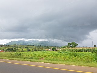
Dedza Mountain is a mountain in central Malawi. It is located in Dedza District, just north of the town of Dedza.
References
- ↑ Mauambeta, Daulos (2010). Status of Forests and Tree Management in Malawi: A Position Paper Prepared for the Coordination Union for Rehabilitation of the Environment (CURE). CURE Technical Report. September 2010 DOI: 10.13140/2.1.3497.7926
| | This Malawi location article is a stub. You can help Wikipedia by expanding it. |
| | This Africa mountain, mountain range, or peak related article is a stub. You can help Wikipedia by expanding it. |