Chapada do Apodi | |
|---|---|
 | |
| Country | Brazil |
| State | Rio Grande do Norte |
| Mesoregion | Oeste Potiguar |
Chapada do Apodi is a microregion in the Brazilian state of Rio Grande do Norte.
Chapada do Apodi | |
|---|---|
 | |
| Country | Brazil |
| State | Rio Grande do Norte |
| Mesoregion | Oeste Potiguar |
Chapada do Apodi is a microregion in the Brazilian state of Rio Grande do Norte.
The microregion consists of the following municipalities: [1]

Vale do Rio dos Bois Microregion is a statistical region in central Goiás state, Brazil. It lies west of the state capital, Goiânia. It takes its name from the Rio dos Bois, a river that flows through the microregion.

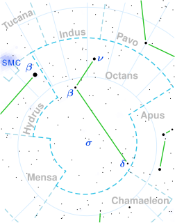
δ Octantis, Latinised as Delta Octantis, has the distinction of being Saturn's southern pole star. An orange giant of class K2III, it has 1.2 times the mass of the Sun and about 25 times the Sun's radius. This star is about 4.3 billion years old, which is similar to the age of the Sun.

The Litoral Lagunar Microregion is a microregion in the southern part of the state of Rio Grande do Sul, Brazil. Its total area is of 9,379.518 km².

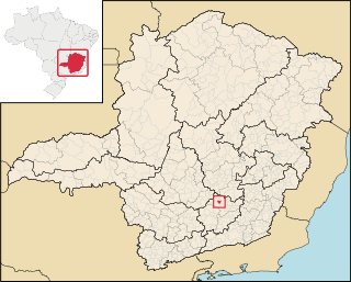
São Brás do Suaçuí is a Brazilian municipality located in the state of Minas Gerais. The city belongs to the mesoregion Metropolitana de Belo Horizonte and to the microregion of Conselheiro Lafaiete. As of 2020, the estimated population was 3,754.
Z Apodis (Z Aps) is a variable star in the constellation of Apus. It has an apparent visual magnitude which varies between 10.7 and 12.7, over a period of 39.37 days. Although described in the General Catalogue of Variable Stars as a cataclysmic variable star, it appears that it is a pulsating variable star, and has been classed as an RV Tauri variable star, type A.

Ibiracatu is a Brazilian municipality located in the north of the state of Minas Gerais. In 2020 the population was 5,369 in a total area of 359 km². It became a municipality in 1995.

Dionísio is a municipality in the state of Minas Gerais, Brazil. The city belongs to the mesoregion Metropolitana de Belo Horizonte and to the microregion of Itabira. As of 2020, the estimated population was 7,609.
João Dourado is a municipality in the state of Bahia in the North-East region of Brazil.

Barbalha is a municipality in the state of Ceará in the Northeast region of Brazil. Barbalha covers 569.5 km2 (219.9 sq mi), and has a population of 61,228 with a population density of 100 inhabitants per square kilometer. It is located at the south of the state, 575 km (357 mi) from the state capital of Fortaleza. The eastern part of the Araripe-Apodi National Forest, established in 1946, is located in Barbalha. The city sits at the foot of the Chapada do Araripe, a large plateau on the border of Ceará and Pernambuco.
Agricolândia is a municipality in the state of Piauí in the Northeast region of Brazil.
Santa Rosa do Piauí is a municipality in the state of Piauí in the Northeast region of Brazil.

Apodi is a municipality in the state of Rio Grande do Norte in the Northeast region of Brazil.
Penlan is an unincorporated community in Buckingham County, in the U.S. state of Virginia.

Umarizal is a microregion in the Brazilian state of Rio Grande do Norte.

Mossoró is a microregion in the Brazilian state of Rio Grande do Norte.

Médio Oeste is a microregion in the Brazilian state of Rio Grande do Norte.

Oeste Potiguar is a mesoregion in the Brazilian state of Rio Grande do Norte.
Reece is an unincorporated community in Greenwood County, Kansas, United States.

The Microregion of Frederico Westphalen was one of the Microregions of the Rio Grande do Sul state, in Brazil. It belonged to the mesoregion of the Noroeste Rio-Grandense. Its population was estimated by the IBGE to be of 175,391 in 2005, divided in 27 municipalities. Its total area is of 5,182.529 km². The IBGE has since discontinued the microregion system for population tracking, replacing it with the term "immediate geographic region".

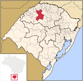
The Microregion of Ijuí was one of the Microregions of the Rio Grande do Sul state, in Brazil. It belonged to the mesoregion of the Noroeste Rio-Grandense. Its population was estimated by the IBGE to be of 183.142 inhabitants in 2005, and it was divided in 15 Municipalities. Its total area was of 5.100,402 km². The IBGE has since discontinued the microregion system for population tracking, replacing it with the term "immediate geographic region".
Coordinates: 5°39′50″S37°47′56″W / 5.66389°S 37.79889°W