Microregion of Pelotas

Last updated
Pelotas
Micro-region
RioGrandedoSul Micro Pelotas.svg
Country Brazil
State Rio Grande do Sul
Mesoregion Sudeste Rio-Grandense
Municipalities10
Area
  Total 10,307 km2 (3,980 sq mi)

The Pelotas Microregion (Portuguese: Microrregião de Pelotas) is a microregion in the southeastern part of the state of Rio Grande do Sul, Brazil. The area is 10,306.601 km².

Rio Grande do Sul State of Brazil

Rio Grande do Sul is a state located in the southern region of Brazil. It is the fifth most populous state and the ninth largest by area. Located in the southernmost part of the country, Rio Grande do Sul is bordered clockwise by Santa Catarina to the north and northeast, the Atlantic Ocean to the east, the Uruguayan departments of Rocha, Treinta y Tres, Cerro Largo, Rivera and Artigas to the south and southwest, and the Argentine provinces of Corrientes and Misiones to the west and northwest. The capital and largest city is Porto Alegre. The state has the highest life expectancy in Brazil, and the crime rate is considered to be low.

Brazil Federal republic in South America

Brazil, officially the Federative Republic of Brazil, is the largest country in both South America and Latin America. At 8.5 million square kilometers and with over 208 million people, Brazil is the world's fifth-largest country by area and the fifth most populous. Its capital is Brasília, and its most populated city is São Paulo. The federation is composed of the union of the 26 states, the Federal District, and the 5,570 municipalities. It is the largest country to have Portuguese as an official language and the only one in the Americas; it is also one of the most multicultural and ethnically diverse nations, due to over a century of mass immigration from around the world.

Municipalities

The microregion consists of the following municipalities: [1]

Arroio do Padre Place in South, Brazil

Arroio do Padre is a Brazilian municipality in the southeastern part of the state of Rio Grande do Sul. Its 2009 population was 2,882.

Canguçu human settlement

Canguçu is a city in Rio Grande do Sul, south Brazil. East Pomeranian, a dialect of Low German, has co-official status in Canguçu.

Capão do Leão Town in South, Brazil

Capão do Leão is a Brazilian municipality in the southern part of the state of Rio Grande do Sul. The population is 25,382 in an area of 785.37 km². The city hosts the main campus of Universidade Federal de Pelotas, the largest higher education institution in the southern portion of Rio Grande do Sul.

Related Research Articles

Microregion of Santiago Micro-region in Rio Grande do Sul, Brazil

The Santiago microregion is a micro-region in the western part of the state of Rio Grande do Sul, Brazil. Its total area is of 11,213.844 km².

Microregion of Campanha Ocidental Micro-region in Rio Grande do Sul, Brazil

The Campanha Ocidental micro-region is a microregion in the western part of the state of Rio Grande do Sul, Brazil. The area is 31,125.429 km² making it the largest micro-region in the state nearly covering one-tenth of the entire state, much of the central and eastern portions remain underpopulated.

Federal University of Pelotas

The Federal University of Pelotas is a higher-learning facility with campuses in Pelotas and Capão do Leão in Rio Grande do Sul, Brazil. The university offers more than a hundred different graduation courses.

Bandeira do Sul Brazilian municipality located in the state of Minas Gerais

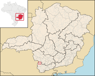
Bandeira do Sul is a Brazilian municipality located in the state of Minas Gerais. Its population as of 2006 is estimated to be 5,490 people living in an altitude between 660 and 989 meters.

Microregion of Jaguarão Microregion in Rio Grande do Sul, Brazil

The Jaguarão microregion is a microregion in the southern part of the state of Rio Grande do Sul, Brazil. Its total area is of 6,331.228 km².

Microregion of Litoral Lagunar Micro-region in Rio Grande do Sul, Brazil

The Litoral Lagunar Microregion is a microregion in the southern part of the state of Rio Grande do Sul, Brazil. Its total area is of 9,379.518 km².

Microregion of Serras de Sudeste Micro-region in Rio Grande do Sul, Brazil

The Serras de Sudeste Microregion is a microregion in the southern part of the state of Rio Grande do Sul, Brazil. It is named after a hill range named Serras de Sudeste, which means Southeastern Mountain Ranges. The area is 16,512.614 km².

Juatuba city and municipality in Minas Gerais, Brazil

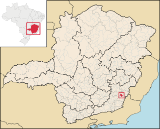
Juatuba is a Brazilian municipality located in the state of Minas Gerais. The city belongs to the mesoregion Metropolitana de Belo Horizonte and to the microregion of Belo Horizonte.

Miradouro Brazilian municipality located in the state of Minas Gerais

Miradouro is a Brazilian municipality located in the state of Minas Gerais. The city belongs to the mesoregion of Zona da Mata and to the microregion of Muriaé.

Centro Ocidental Rio-Grandense Mesoregion in Rio Grande do Sul, Brazil

The Centro Ocidental Rio-Grandense is one of the seven mesoregions of the state of Rio Grande do Sul in Brazil. It consists of 31 municipalities, grouped in three microregions:

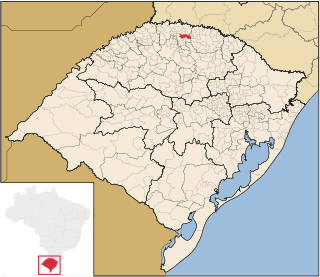
Constantina, Rio Grande do Sul is a municipality in the state of Rio Grande do Sul, Brazil. Founded April 14, 1959. The municipality's motto is "Celeiro da Hospitalidade", meaning "Barn Hospitality".

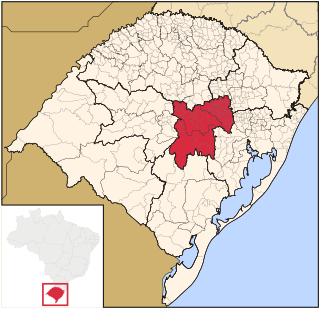
Espumoso is a municipality in the state of Rio Grande do Sul, Brazil. It belongs to the mesoregion "Nordeste Rio Grandense" and the microregion of "Cruz Alta" alongside with other 13 municipalities (Alto Alegre, Boa Vista do Cadeado, Boa Vista do Incra, Campos Borges, Cruz Alta, Fortaleza dos Valos, Ibirubá, Jacuizinho, Joia, Quinze de Novembro, Saldanha Marinho, Salto do Jacuí and Santa Bárbara do Sul. The estimated population in 2015 was 15,809 inhabitants, and its total area corresponds to 783.065 km².

Trindade do Sul Municipality in South, Brazil

Trindade do Sul is a municipality in the state of Rio Grande do Sul, Brazil.

The Arroio das Caneleiras is a watercourse which drains in the municipality of Pelotas, a town in the state of Rio Grande do Sul. It rises in the municipality of Canguçu, and enters the territory of Pelotas from the North-West. When it joins with the Arroio do Quilombo, it becomes the Arroio Pelotas.

Centro Oriental Rio-Grandense Mesoregion in Rio Grande do Sul, Brazil

The Centro Oriental Rio-Grandense is one of the seven Mesoregion of the state of Rio Grande do Sul in Brazil. It consists of 54 municipalities, grouped in three Microregions:

Sudoeste Rio-Grandense Mesoregion in Rio Grande do Sul, Brazil

Sudoeste Rio-Grandense is one of the seven mesoregions of the state of Rio Grande do Sul in Brazil. It consists of 19 municipalities, grouped in three microregions:

Sudeste Rio-Grandense Mesoregion in Rio Grande do Sul, Brazil

Sudeste Rio-Grandense is one of the seven Mesoregions of the state of Rio Grande do Sul in Brazil. It consists of 25 municipalities, grouped in four Microregions:

Microregion of Campanha Central Micro-region in Rio Grande do Sul, Brazil

The Campanha Central micro-region is a microregion in the western part of the state of Rio Grande do Sul, Brazil.

Microregion of Frederico Westphalen Microregion in Rio Grande do Sul, Brazil

The Microregion of Frederico Westphalen was one of the Microregions of the Rio Grande do Sul state, in Brazil. It belonged to the mesoregion of the Noroeste Rio-Grandense. Its population was estimated by the IBGE to be of 175,391 in 2005, divided in 27 municipalities. Its total area is of 5,182.529 km². The IBGE has since discontinued the microregion system for population tracking, replacing it with the term "immediate geographic region".

Microregion of Ijuí Microregion in Rio Grande do Sul, Brazil

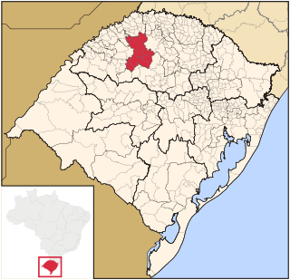
The Microregion of Ijuí is one of the Microregions of the Rio Grande do Sul state, in Brazil. It belongs to the mesoregion of the Noroeste Rio-Grandense. Its population was estimated by the IBGE to be of 183.142 inhabitants in 2005, and it is divided in 15 Municipalities. Its total area is of 5.100,402 km².

References

Coordinates: 31°46′19″S52°20′34″W / 31.77194°S 52.34278°W / -31.77194; -52.34278

Geographic coordinate system Coordinate system

A geographic coordinate system is a coordinate system that enables every location on Earth to be specified by a set of numbers, letters or symbols. The coordinates are often chosen such that one of the numbers represents a vertical position and two or three of the numbers represent a horizontal position; alternatively, a geographic position may be expressed in a combined three-dimensional Cartesian vector. A common choice of coordinates is latitude, longitude and elevation. To specify a location on a plane requires a map projection.