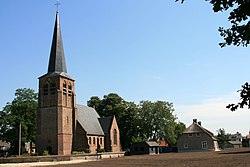
Heeswijk is a Dutch village. It is located in the province of North Brabant, in the south of the Netherlands.

Oud-Vossemeer is a village on the island of Tholen in the Dutch province of Zeeland. It is a part of the municipality of Tholen, and lies about 13 km northwest of Bergen op Zoom, close to the Eendracht, part of the Scheldt-Rhine Canal.

Berghem is a town in the Dutch municipality of Oss. It is located about 4 km northeast of Oss itself.

's-Heerenhoek is a village in the Dutch province of Zeeland. It is a part of the municipality of Borsele, and lies about 12 km east of Middelburg.
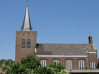
Ellewoutsdijk is a village in the Dutch province of Zeeland. It is a part of the municipality of Borsele, and lies about 18 km east of Vlissingen.

Ossenisse is a village in the Dutch province of Zeeland. It is a part of the municipality of Hulst, and lies about 24 km west of Bergen op Zoom.

Diessen is a village in the Dutch province of North Brabant. It is located in the municipality of Hilvarenbeek.

Esch is a village in the Dutch province of North Brabant. It is located in the municipality of Boxtel.

Vlierden is a village in the Dutch province of North Brabant. It is located in the municipality of Deurne, about 20 km east of Eindhoven.

Langenboom is a village in the Dutch province of North Brabant. It is part of the municipality of Land van Cuijk. Langenboom is located in the Peel region, and lies about 18 kilometres (11 mi) south-west of Nijmegen.
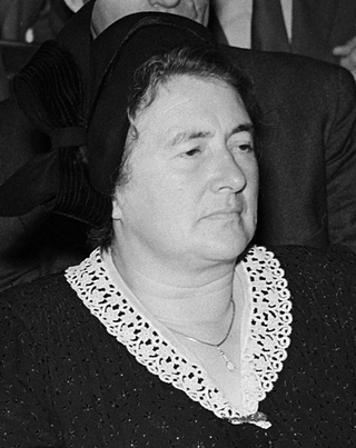
Geertruida Catharina Theresia Maria "Truus" Smulders-Beliën was a Dutch politician and teacher who was the mayor of Oost-, West- en Middelbeers in North Brabant from 1946 to 1966. The first female mayor in the Netherlands, she succeeded her husband Jan Smulders after he was executed by Nazi soldiers.
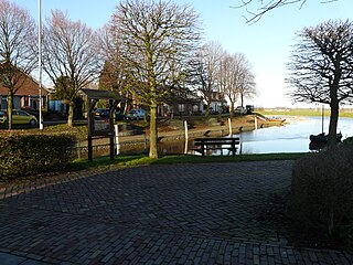
Hooge Zwaluwe is a village in the Dutch province of North Brabant. It is located in the municipality of Drimmelen, about 3.5 km north-west of Made.

Den Andel is a village in the municipality Het Hogeland which is part of the province Groningen in the Netherlands. It is located about 20 kilometres (12 mi) north of the city of Groningen near the Wadden Sea coast.
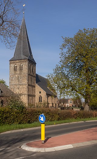
Drempt is a village in the Dutch province of Gelderland. It is located in the municipality of Bronckhorst. It used to consists of two villages: Achter-Drempt (behind) and Voor-Drempt which have merged. Drempt is located about 9 kilometres (5.6 mi) north-west of Doetinchem.

Soerendonk is a village in the Dutch province of North Brabant. It is located in the municipality of Cranendonck. The former Cranendonck Castle used to be located in the village. It is located about 17 kilometres (11 mi) south-south-east of Eindhoven.

Wagenberg is a village in the Dutch province of North Brabant. It is located in the municipality of Drimmelen. The village is located about 6 kilometres (3.7 mi) north of Breda.

De Mortel is a village in the Dutch province of North Brabant. It is located in the municipality of Gemert-Bakel. The village is located about 19 kilometres (12 mi) north-east of Eindhoven.
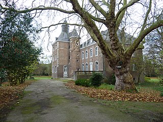
Nijswiller is a village in the southern part of the Dutch province of Limburg. It is a part of the municipality of Gulpen-Wittem, and is located about 19 kilometres (12 mi) east of Maastricht.
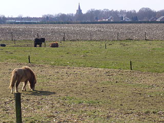
Tienray is a village in the Dutch province of Limburg. It is a part of the municipality of Horst aan de Maas, and is located about 15 kilometres (9.3 mi) north of Venlo.

Beugen is a village in the Dutch province of North Brabant. It is part of the municipality of Land van Cuijk. Beugen is located along the Maas and about 20 kilometres (12 mi) south of Nijmegen.
