 Middle Island (King Sound) | |
| Geography | |
|---|---|
| Coordinates | 16°26′55″S123°05′02″E / 16.44861°S 123.08389°E Coordinates: 16°26′55″S123°05′02″E / 16.44861°S 123.08389°E [1] |
| Administration | |
Middle Island is an island in King Sound, Western Australia.
| Middle Island (King Sound) | |
| Geography | |
|---|---|
| Coordinates | 16°26′55″S123°05′02″E / 16.44861°S 123.08389°E Coordinates: 16°26′55″S123°05′02″E / 16.44861°S 123.08389°E [1] |
| Administration | |
Middle Island is an island in King Sound, Western Australia.

The Bahamas, known officially as the Commonwealth of The Bahamas, is a country within the Lucayan Archipelago of the West Indies in the Atlantic. It takes up 97% of the Lucayan Archipelago's land area and is home to 88% of the archipelago's population. The archipelagic state consists of more than 700 islands, cays, and islets in the Atlantic Ocean, and is located north of Cuba and northwest of the island of Hispaniola and the Turks and Caicos Islands, southeast of the US state of Florida, and east of the Florida Keys. The capital is Nassau on the island of New Providence. The Royal Bahamas Defence Force describes The Bahamas' territory as encompassing 470,000 km2 (180,000 sq mi) of ocean space.

Bermuda is a British Overseas Territory in the North Atlantic Ocean. It is about 1,035 km (643 mi) east-southeast of Cape Hatteras, North Carolina ; 1,236 km (768 mi) south of Cape Sable Island, Nova Scotia; 1,759 km (1,093 mi) northeast of Cuba, and 1,538 km (956 mi) due north of the British Virgin Islands. Though typically referred to in the singular, Bermuda has 181 islands; the largest of these being Main Island. Bermuda's capital city is Hamilton. Bermuda is internally self-governing, with its constitution and cabinet of ministers selected from the elected Members of the lower house of a Parliament that enacts local laws. As the national government, the Government of the United Kingdom is ultimately responsible for ensuring good governance within British Overseas Territories, and retains responsibility for defence and foreign relations. As of July 2018, it had a population of 71,176, making it the most populous of the British overseas territories. Bermuda's largest industries are offshore insurance, reinsurance, and tourism. Bermuda had one of the world's highest GDP per capita for most of the 20th century.

The Cayman Islands are a self-governing British Overseas Territory, the largest by population, in the western Caribbean Sea. The 264-square-kilometre (102-square-mile) territory comprises the three islands of Grand Cayman, Cayman Brac and Little Cayman, which are located to the south of Cuba and northeast of Honduras, between Jamaica and Mexico's Yucatán Peninsula. The capital city is George Town on Grand Cayman, which is the most populous of the three islands.

The Canary Islands, also known informally as the Canaries, is a Spanish archipelago in the Atlantic Ocean, in a region known as Macaronesia. At their closest point to the African mainland, they are 100 kilometres west of Morocco. They are the southernmost of the autonomous communities of Spain, and are located in the African Tectonic Plate. The archipelago is economically and politically European, and is part of the European Union.

The Cook Islands is a self-governing island country in the South Pacific Ocean in free association with New Zealand. It comprises 15 islands whose total land area is 240 square kilometres (93 sq mi). The Cook Islands' Exclusive Economic Zone (EEZ) covers 1,960,027 square kilometres (756,771 sq mi) of ocean.
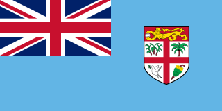
Fiji, officially the Republic of Fiji, is an island country in Melanesia, part of Oceania in the South Pacific Ocean. It lies about 1,100 nautical miles northeast of New Zealand. Fiji consists of an archipelago of more than 330 islands—of which about 110 are permanently inhabited—and more than 500 islets, amounting to a total land area of about 18,300 square kilometres (7,100 sq mi). The most outlying island group is Ono-i-Lau. About 87% of the total population of 883,483 live on the two major islands, Viti Levu and Vanua Levu. About three-quarters of Fijians live on Viti Levu's coasts: either in the capital city of Suva; or in smaller urban centres such as Nadi—where tourism is the major local industry; or in Lautoka, where the sugar-cane industry is dominant. The interior of Viti Levu is sparsely inhabited because of its terrain.

The Isle of Man, also known as Mann, is an island and self-governing British Crown Dependency in the Irish Sea between Great Britain and Northern Ireland. The head of state, Queen Elizabeth II, holds the title Lord of Mann and is represented by a Lieutenant Governor. The United Kingdom is responsible for the isle's military defence.

Kiribati, officially the Republic of Kiribati, is an independent island nation in the central Pacific Ocean. The permanent population is over 119,000 (2020), more than half of whom live on Tarawa atoll. The state comprises 32 atolls and one raised coral island, Banaba. They have a total land area of 811 square kilometres and are dispersed over 3.5 million km2 (1.4 million sq mi).

Mauritius, officially the Republic of Mauritius, is an island nation in the Indian Ocean about 2,000 kilometres (1,200 mi) off the southeast coast of the African continent, east of Madagascar. It includes the main island, as well as Rodrigues, Agaléga and St. Brandon. The islands of Mauritius and Rodrigues, along with nearby Réunion, are part of the Mascarene Islands. The capital and largest city, Port Louis, is located in Mauritius, where most of the population is concentrated. The country spans 2,040 square kilometres (790 sq mi) and has an exclusive economic zone covering 2.3 million square kilometres.

Oceania is a geographic region that includes Australasia, Melanesia, Micronesia and Polynesia. Spanning the Eastern and Western Hemispheres, Oceania has a land area of 8,525,989 square kilometres (3,291,903 sq mi) and a population of over 41 million. When compared with the continents, the region of Oceania is the smallest in land area and the second smallest in population after Antarctica.
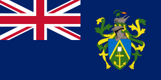
The Pitcairn Islands, officially the Pitcairn, Henderson, Ducie and Oeno Islands, also known as the British Polynesia, is a group of four volcanic islands in the southern Pacific Ocean that form the sole British Overseas Territory in the Pacific Ocean. The four islands — Pitcairn, Henderson, Ducie, and Oeno — are scattered across several hundred kilometres of ocean and have a combined land area of about 18 square miles (47 km2). Henderson Island accounts for 86% of the land area, but only Pitcairn Island is inhabited. The islands nearest to the Pitcairn Islands are Mangareva to the west and Easter Island to the east.

Rhode Island, officially the State of Rhode Island, is a state in the New England region of the United States. It is the smallest U.S. state by area and the seventh-least populous, but it is also the second-most densely populated behind New Jersey. The state takes its name from Rhode Island; however, most of the state is on the mainland. The state has land borders with Connecticut to the west, Massachusetts to the north and east, and the Atlantic Ocean to the south via Rhode Island Sound and Block Island Sound. It also shares a small maritime border with New York. Providence is the state capital and most populous city in Rhode Island.
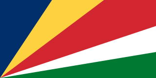
Seychelles, officially the Republic of Seychelles, is an archipelagic island country in the Indian Ocean at the eastern edge of the Somali Sea. It consists of 115 islands. Its capital and largest city, Victoria, is 1,500 kilometres (932 mi) east of mainland Africa. Other nearby island countries and territories include the Comoros, Madagascar, Mauritius, and the French overseas regions of Mayotte and Réunion to the south; and Maldives and the Chagos Archipelago to the east. Its estimated population of 98,462 is the smallest population of any sovereign African country.

The Turks and Caicos Islands are a British Overseas Territory consisting of the larger Caicos Islands and smaller Turks Islands, two groups of tropical islands in the Lucayan Archipelago of the Atlantic Ocean and northern West Indies. They are known primarily for tourism and as an offshore financial centre. The resident population was 31,458 in 2012, of whom 23,769 lived on Providenciales in the Caicos Islands; July 2020 estimates put the population at 55,926. It is the third largest of the British overseas territories by population.

The United States Virgin Islands, officially the Virgin Islands of the United States, are a group of Caribbean islands and an unincorporated and organized territory of the United States. The islands are geographically part of the Virgin Islands archipelago and are located in the Leeward Islands of the Lesser Antilles to the east of Puerto Rico and west of the British Virgin Islands.

Andaman and Nicobar Islands is a union territory of India consisting of 572 islands, of which 38 are inhabited, at the junction of the Bay of Bengal and the Andaman Sea.

Territories of the United States are sub-national administrative divisions overseen by the United States federal government. The various U.S. territories differ from the U.S. states and Native American tribes in that they are not sovereign entities. In contrast, each state has a sovereignty separate from that of the federal government and each federally recognized Native American tribe possesses limited tribal sovereignty as a "dependent sovereign nation". Territories are classified by incorporation and whether they have an "organized" government through an organic act passed by the Congress. U.S. territories are under U.S. sovereignty and, consequently, may be treated as part of the United States proper in some ways and not others. Unincorporated territories in particular are not considered to be integral parts of the United States, and the Constitution of the United States applies only partially in those territories.

Great Britain is an island in the North Atlantic Ocean off the northwest coast of continental Europe. With an area of 209,331 km2 (80,823 sq mi), it is the largest of the British Isles, the largest European island, and the ninth-largest island in the world. The island is dominated by a maritime climate with narrow temperature differences between seasons. The 60% smaller island of Ireland is to the west – and together these islands, along with over 1,000 smaller surrounding islands and named substantial rocks, form the British Isles archipelago.

The Faroe Islands, or simply the Faroes or Faeroes, are a North Atlantic archipelago located 320 kilometres (200 mi) north-northwest of Scotland, and about halfway between Norway and Iceland. Like Greenland, it is a constituent country of the Kingdom of Denmark. The islands have a total area of about 1,400 square kilometres (540 sq mi) with a population of 53,358 as of June 2021.
| | This article about a location in Western Australia is a stub. You can help Wikipedia by expanding it. |