
Kurnool is a city in the state of Andhra Pradesh, India. It formerly served as the capital of Andhra State (1953–1956) and was proposed as the judicial capital of Andhra Pradesh from 2024, although this is awaiting a Supreme Court decision. The city is often referred to as "The Gateway of Rayalaseema". Kurnool is also known as The City of Gem Stones. It also serves as the district headquarters of its Kurnool district. As of 2011 census, it is the fifth most populous city in the state with a population of 484,327. It is located on the banks of the Tungabhadra river. Although the area has been inhabited for thousands of years, modern Kurnool was founded in the 16th century CE with the construction of the Konda Reddy Fort.

Rampachodavaram is a census town in Alluri Sitharama Raju district of the Indian state of Andhra Pradesh. It is located in Rampachodavaram mandal of Rampachodavaram revenue division. Rampachodavaram is known for its dense jungle and waterfalls which can be accessed by road transport only.

Tadipatri or Tadpatri is a city in Anantapur district of the Indian state of Andhra Pradesh at the border of Kurnool district and Kadapa district. It is the mandal headquarters of Tadipatri mandal in Anantapur revenue division. The Chintala Venkataramana Temple is located on a five-acre site in Tadipatri. The Bugga Ramalingeswara Temple is located one kilometer from the town, overlooking the Penna River.
Porumamilla is a village in YSR district of the Indian state of Andhra Pradesh. It is famous for sound quality of burnt clay bricks near around here. It is located in Porumamilla mandal of Badvel revenue division.
Pulivendula is a town located in the YSR Kadapa district, Andhra Pradesh, India. It is a small town which became 3rd grade municipality in 2008 from nagar Panchayat.
Kotturu is a village in Srikakulam district of the Indian state of Andhra Pradesh. It is located in Kothuru mandal of Palakonda revenue division.
Meliaputti or Meliyaputti is a village in Srikakulam district of the Indian state of Andhra Pradesh. It is located in Meliaputti mandal of Palakonda revenue division.

Pathapatnam is a town in Srikakulam district of the Indian state of Andhra Pradesh. It is located in Pathapatnam mandal of Palakonda revenue division. Pathapatnam is located on the border of Srikakulam district of Andhra Pradesh and Gajapati district of Odisha. Parlakhemundi, the headquarters of Gajapati District, can be considered as twin town of Pathapatnam because of its close proximity. It is located around 65 km from srikakulam. It was the old capital of Paralakhemundi Gajapati Maharajah of his erstwhile kingdom.

Darsi is a municipality town in Prakasam district of the Indian state of Andhra Pradesh. It is the mandal headquarters of Darsi mandal in Kanigiri revenue division. It is located at the foot of the Nallamala Hills. It is approximately 20 kilometres (12 mi) away from Podili and approx. 33 kilometres (21 mi) away from Addanki.
Mahal is a small town located in Kalikiri mandal of Annamayya district in Andhra Pradesh, India. The place has not seen much development over the years mainly due to lack of economic and educational infrastructure in the town forcing majority of educated to migrate to different areas. Agriculture which is a primary source of income for majority is monsoon dependent, which has made it vulnerable over the past few decades due to continuous failing monsoons.

Allagadda is a town in Nandyal district of the Indian state of Andhra Pradesh. It is located in Nandyal Revenue division. The town is located at 15°08′00″N78°31′00″E.
Uyyalawada is a village in Uyyalawada mandal, located in Nandyal district of the Indian state of Andhra Pradesh.
Kalasapadu is a village in YSR Kadapa district of the Indian state of Andhra Pradesh. It is located in Kalasapadu mandal of Badvel revenue division.
Khajipet Sunkesula is a village in Kadapa district of the Indian state of Andhra Pradesh. It is located in Khajipet mandal of Badvel revenue division.
Chintalapalle is a village in Midthur mandal, located in Kurnool district of the Indian state of Andhra Pradesh.
The Tummalapalle Mine is a uranium mine in Tumalapalli village located in Kadapa of the Indian state of Andhra Pradesh. Results from research conducted by the Atomic Energy Commission of India, in 2011, led the analysts to conclude that this mine might have one of the largest reserves of uranium in the world.
Giddalur Assembly constituency is a constituency in Prakasam district of Andhra Pradesh that elects representatives to the Andhra Pradesh Legislative Assembly in India. It is one of the seven assembly segments of the Ongole Lok Sabha constituency. It was part of kurnool district till 1969 later it was merged into Prakasam district in 1970. Till 2008 it was under Nandyal parliament segment after delimitation it was moved to Ongole MP segment.
Banaganapalle Assembly constituency is a constituency in Nandyal district of Andhra Pradesh that elects representatives to the Andhra Pradesh Legislative Assembly in India. It is one of the seven assembly segments of the Nandyal Lok Sabha constituency.
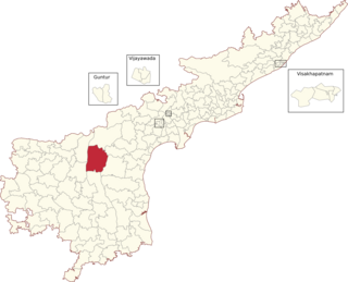
Kurnool mandal is one of the 54 mandals in Kurnool district of the Indian state of Andhra Pradesh. It is administered under Kurnool revenue division and its headquarters are located at Kurnool. The mandal is situated on the banks of Krishna River and is bounded by C.Belagal, Gudur, Kallur, Orvakal, Midthur and Nandikotkur mandals. As of the 2011 census, it has 406,797 residents.

Nandyal district is a district in the Indian state of Andhra Pradesh with Nandyal as its administrative headquarters, it was formed on 4 April 2022 to become one of the resultant 26 districts. It is part of the Rayalaseema region. The district consists of Nandyal revenue division and a newly formed Dhone revenue division and Atmakur revenue division from Kurnool district.

