De Meer Stadion is the former stadium of AFC Ajax. It was opened in 1934 as a result of the club's former stadium being too small. Upon completion, it could hold 22,000 spectators, but accommodating up to 29,500 at its maximum. Increasing safety requirements gradually reduced this number to 19,000.
Jackman Flats Provincial Park is a provincial park in British Columbia, Canada, comprising approximately 615 ha. and located just southeast of Tête Jaune Cache in the Rocky Mountain Trench, near the Yellowhead Pass. The park features several hiking trails.

Mvoung is a department of Ogooué-Ivindo Province in northern-central Gabon. The capital lies at Ovan.

Jeziorowo is a village in the administrative district of Gmina Szubin, within Nakło County, Kuyavian-Pomeranian Voivodeship, in north-central Poland. It lies approximately 8 kilometres (5 mi) south of Szubin, 25 km (16 mi) south-east of Nakło nad Notecią, and 25 km (16 mi) south-west of Bydgoszcz.

Zielonka is a village in the administrative district of Gmina Tuchola, within Tuchola County, Kuyavian-Pomeranian Voivodeship, in north-central Poland. It lies approximately 9 kilometres (6 mi) north-east of Tuchola and 61 km (38 mi) north of Bydgoszcz.

Machnacz is a village in the administrative district of Gmina Brześć Kujawski, within Włocławek County, Kuyavian-Pomeranian Voivodeship, in north-central Poland. It lies approximately 6 kilometres (4 mi) north-east of Brześć Kujawski, 7 km (4 mi) west of Włocławek, and 49 km (30 mi) south-east of Toruń.
The Meadows is an unincorporated community in Northampton County, Virginia, United States.

Kamionaczyk is a village in the administrative district of Gmina Sieradz, within Sieradz County, Łódź Voivodeship, in central Poland. It lies approximately 8 kilometres (5 mi) north of Sieradz and 53 km (33 mi) west of the regional capital Łódź.

Baszków is a village in the administrative district of Gmina Warta, within Sieradz County, Łódź Voivodeship, in central Poland. It lies approximately 5 kilometres (3 mi) south of Warta, 11 km (7 mi) north-west of Sieradz, and 59 km (37 mi) west of the regional capital Łódź.

Ferdynandów is a village in the administrative district of Gmina Adamów, within Łuków County, Lublin Voivodeship, in eastern Poland. It lies approximately 11 kilometres (7 mi) south of Adamów, 31 km (19 mi) south-west of Łuków, and 53 km (33 mi) north-west of the regional capital Lublin.

Jajuravan ; is a village in the Shirak Province of Armenia.
Kimsquit is a former village of the Nuxalk at the mouth of the Dean River on the northeast side of Dean Channel in the Central Coast region of British Columbia, Canada. Kemsquit Indian Reserve No. 1 is nearby at 52°49′00″N126°58′00″W, which is on Kimsquit Bay; Kimsquit Mountain is nearby.

Zastocze is a village in the administrative district of Gmina Zwoleń, within Zwoleń County, Masovian Voivodeship, in east-central Poland. It lies approximately 9 kilometres (6 mi) south-east of Zwoleń and 112 km (70 mi) south-east of Warsaw.

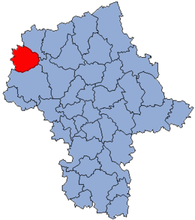
Kazuń Polski is a village in the administrative district of Gmina Czosnów, within Nowy Dwór Mazowiecki County, Masovian Voivodeship, in east-central Poland. It lies approximately 6 kilometres (4 mi) west of Czosnów, 4 km (2 mi) south of Nowy Dwór Mazowiecki, and 31 km (19 mi) north-west of Warsaw.

Jacewko is a village in the administrative district of Gmina Chodzież, within Chodzież County, Greater Poland Voivodeship, in west-central Poland. It lies approximately 6 kilometres (4 mi) south-west of Chodzież and 62 km (39 mi) north of the regional capital Poznań.

Ciążyń is a village in the administrative district of Gmina Czarnków, within Czarnków-Trzcianka County, Greater Poland Voivodeship, in west-central Poland. It lies approximately 9 kilometres (6 mi) south-east of Czarnków and 53 km (33 mi) north of the regional capital Poznań.

Czarnolesie is a settlement in the administrative district of Gmina Dobiegniew, within Strzelce-Drezdenko County, Lubusz Voivodeship, in western Poland. It lies approximately 14 kilometres (9 mi) east of Dobiegniew, 31 km (19 mi) east of Strzelce Krajeńskie, and 55 km (34 mi) north-east of Gorzów Wielkopolski.

Borsk is a village in the administrative district of Gmina Karsin, within Kościerzyna County, Pomeranian Voivodeship, in northern Poland. It lies approximately 6 kilometres (4 mi) north of Karsin, 19 km (12 mi) south of Kościerzyna, and 66 km (41 mi) south-west of the regional capital Gdańsk.

Unieszynko is a village in the administrative district of Gmina Cewice, within Lębork County, Pomeranian Voivodeship, in northern Poland. It lies approximately 5 kilometres (3 mi) west of Cewice, 13 km (8 mi) south-west of Lębork, and 64 km (40 mi) west of the regional capital Gdańsk.

Stoki is a village in the administrative district of Gmina Chojna, within Gryfino County, West Pomeranian Voivodeship, in north-western Poland, close to the German border. It lies approximately 6 kilometres (4 mi) west of Chojna, 35 km (22 mi) south of Gryfino, and 55 km (34 mi) south of the regional capital Szczecin.


