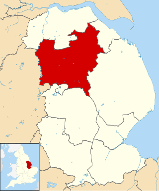
Lincolnshire is a county in the east of England, with a long coastline on the North Sea. It is divided between the East Midlands and the Yorkshire and Humber regions. It borders Norfolk to the south-east, Cambridgeshire to the south, Rutland to the south-west, Leicestershire and Nottinghamshire to the west, South Yorkshire to the north-west, and the East Riding of Yorkshire to the north. It also borders Northamptonshire in the south for just 20 yards (19 m), England's shortest county boundary. The county town is Lincoln, where the county council is also based.

The East Riding of Yorkshire, or simply East Riding or East Yorkshire, is a ceremonial county and unitary authority area in the Yorkshire and the Humber region of England. It borders North Yorkshire to the north and west, South Yorkshire to the south-west, and Lincolnshire to the south.

Louth is a market town and civil parish in the East Lindsey district of Lincolnshire, England. Louth serves as an important town for a large rural area of eastern Lincolnshire. Visitor attractions include St James Church, Hubbard's Hills, the market, many independent retailers, and Lincolnshire's last remaining cattle market.

West Lindsey is a local government district in Lincolnshire, England. Its council is based in Gainsborough.

The Lincolnshire Wolds Railway (LWR) is a heritage railway based at Ludborough station, near Louth, Lincolnshire, England and the only standard gauge steam railway in Lincolnshire open to the public. The line is part of the original Great Northern Railway (GNR), a rail system that opened in 1848 and once linked Grimsby, Louth and East Lincolnshire with London. In early 2002, 2009 and 2013 the Lincolnshire Wolds Railway received a top national award from the Heritage Railway Association for its heritage railway efforts.

The Lincolnshire Wolds are a range of low hills in the county of Lincolnshire, England which run roughly parallel with the North Sea coast, from the Humber Estuary in the north-west to the edge of the Lincolnshire Fens in the south-east. They are a designated Area of Outstanding Natural Beauty (AONB), and the highest area of land in eastern England between Yorkshire and Kent.
The ceremonial county of Lincolnshire is the second largest of the English counties and one that is predominantly agricultural in character. Despite its relatively large physical area, it has a comparatively small population. The unusually low population density that arises gives the county a very different character from the much more densely populated an urbanised counties of south-east and northern England, and is, in many ways, key to understanding the nature of the county.

Cleethorpes is a constituency created in 1997, represented in the House of Commons of the UK Parliament since 2010 by Martin Vickers of the Conservative Party.

The Bluestone Heath Road is an ancient route and ridgeway across the Lincolnshire Wolds in Lincolnshire, England. The surviving parts are somewhat fragmented in places, but many still bear the name.
The Lincolnshire Marsh is a belt of reclaimed salt marsh and sand dune in Lincolnshire, England and between the Lincolnshire Wolds and the North Sea coast. It is up to seven kilometres wide. It is part of one of the national character areas defined by Natural England.

Royal Air Force Elsham Wolds or more simply RAF Elsham Wolds is a former Royal Air Force station in England, which operated in the First World War and the Second World War. It is located just to the north east of the village of Elsham in north Lincolnshire.

The A158 road is a major route that heads from Lincoln in the west to Skegness on the east coast. The road is located entirely in the county of Lincolnshire and is single carriageway for almost its entirety. The road is approximately 40 miles (64 km) long. The road gets quite congested with holiday traffic during the summer.

The A607 is an A road in England that starts in Belgrave, Leicester and heads northeastwards through Leicestershire and the town of Grantham, Lincolnshire, terminating at Bracebridge Heath, a village on the outskirts of Lincoln. It is a primary route from Thurmaston to the A1 junction at Grantham.

The A631 is a road running from Sheffield, South Yorkshire to Louth, Lincolnshire in England. It passes through the counties of South Yorkshire, Nottinghamshire and Lincolnshire. The road has many towns on its route including Rotherham, Maltby, Gainsborough and Market Rasen. It is mostly single road throughout its length but has some stretches of dual carriageway as well.

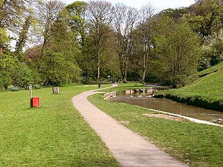
Hubbard's Hills is an area of natural beauty directly to the west of Louth, Lincolnshire, England and is popular for family picnics, school field trips and dog walking. The park is dedicated to the memory of Annie Pahud.
Hainton Street Halt was a railway halt on the East Lincolnshire Railway which served the Welholme Road area of Grimsby in Lincolnshire between 1905 and 1961. The station was opened as part of a new motor train service between Grimsby and Louth. The station briefly closed in 1939 as a Second World War economy measure, but reopened in 1940. The line through Hainton Street remained open for freight until December 1980. The trackbed was later reused by Humberside County Council to construct the A16 Peaks Parkway which now runs through the site. Building of the road put an end to the aspirations of the Great Northern and East Lincolnshire Railway plc to reopen the line as a heritage railway.
Wilksby is a hamlet in the East Lindsey district of Lincolnshire. A former civil parish in itself, it was amalgamated with the parish of Wood Enderby in 1936.
Greetham with Somersby is a civil parish in the East Lindsey district of Lincolnshire, England. It is situated approximately 3 miles (5 km) north-east from the market town of Horncastle.

The Great Eau is a river in Lincolnshire, England, rising from the Chalk Streams of the Lincolnshire Wolds and running to Saltfleet Haven on the coast. It is joined by its companion stream, the Long Eau.

The Long Eau is a river in Lincolnshire, England, rising from the Chalk Streams of the Lincolnshire Wolds and joining its companion stream, the Great Eau south of Saltfleetby All Saints.


