Related Research Articles

The Bay of Bengal is the northeastern part of the Indian Ocean. The world's largest bay, geographically it is positioned between the Indian subcontinent and the Indochinese peninsula, located below the Bengal region.
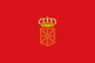
Navarre, officially the Chartered Community of Navarre, is a landlocked foral autonomous community and province in northern Spain, bordering the Basque Autonomous Community, La Rioja, and Aragon in Spain and Nouvelle-Aquitaine in France. The capital city is Pamplona. The present-day province makes up the majority of the territory of the medieval Kingdom of Navarre, a long-standing Pyrenean kingdom that occupied lands on both sides of the western Pyrenees, with its northernmost part, Lower Navarre, located in the southwest corner of France.

Santa Rosa County is a county located in the northwestern portion of the U.S. state of Florida. As of 2020, the population was 188,000. The county seat is Milton, which lies in the geographic center of the county. Other major communities within Santa Rosa County are Navarre, Pace, and Gulf Breeze. Navarre is the most populated community with a population of approximately 45,000 residents. Santa Rosa County is included in the Pensacola—Ferry Pass—Brent, Florida Metropolitan Statistical Area, which also includes Escambia County.

Port Jackson, consisting of the waters of Sydney Harbour, Middle Harbour, North Harbour and the Lane Cove and Parramatta Rivers, is the ria or natural harbour of Sydney, New South Wales, Australia. The harbour is an inlet of the Tasman Sea. It is the location of the Sydney Opera House and Sydney Harbour Bridge. The location of the first European settlement and colony on the Australian mainland, Port Jackson has continued to play a key role in the history and development of Sydney.

Narragansett Bay is a bay and estuary on the north side of Rhode Island Sound covering 147 square miles (380 km2), 120.5 square miles (312 km2) of which is in Rhode Island. The bay forms New England's largest estuary, which functions as an expansive natural harbor and includes a small archipelago. Small parts of the bay extend into Massachusetts.

The Kamchatka Peninsula is a 1,250-kilometre-long (777 mi) peninsula in the Russian Far East, with an area of about 270,000 km2 (100,000 sq mi). The Pacific Ocean and the Sea of Okhotsk make up the peninsula's eastern and western coastlines, respectively. Immediately offshore along the Pacific coast of the peninsula runs the 10,500-metre-deep (34,449 ft) Kuril–Kamchatka Trench.

The Florida panhandle is the northwestern part of the U.S. state of Florida. It is a salient roughly 200 miles (320 km) long, bordered by Alabama on the north and the west, Georgia on the north, and the Gulf of Mexico to the south. Its eastern boundary is arbitrarily defined. It is defined by its southern culture and rural geography relative to the rest of Florida, as well as closer cultural links to French-influenced Louisiana, Mississippi, and Alabama. Its major communities include Pensacola, Navarre, Destin, Panama City, and Tallahassee.

Navarre is a census-designated place and unincorporated community in Santa Rosa County in the northwest Florida Panhandle. It is a major bedroom community for mostly U.S. military personnel, federal civil servants, local population, retirees and defense contractors. Due to Navarre Beach and the 4 miles (6.4 km) of beach front on the Gulf of Mexico thereof, as well as several miles of beaches within the Navarre Beach Marine Park and the Gulf Islands National Seashore, it has a small, but rapidly growing community of nature enthusiasts and tourists. Navarre has grown from being a small town of around 1,500 in 1970 to a town with a population estimated at 43,540 as of 2022, if including both the Navarre and Navarre Beach Census Designated Places. The Navarre CDP recorded a population of 40,817 at the 2020 census.

False Bay is a body of water in the Atlantic Ocean between the mountainous Cape Peninsula and the Hottentots Holland Mountains in the extreme south-west of South Africa. The mouth of the bay faces south and is demarcated by Cape Point to the west and Cape Hangklip to the east. The north side of the bay is the low-lying Cape Flats, and the east side is the foot of the Hottentots Holland Mountains to Cape Hangklip which is at nearly the same latitude as Cape Point. In plan the bay is approximately square, being roughly the same extent from north to south as east to west, with the southern side open to the ocean. The seabed generally slopes gradually down from north to south, and is mostly fairly flat unconsolidated sediments. Much of the bay is off the coast of the City of Cape Town, and it includes part of the Table Mountain National Park Marine Protected Area and the whole of the Helderberg Marine Protected Area. The name "False Bay" was applied at least three hundred years ago by sailors returning from the east who confused Cape Point and Cape Hangklip, which are somewhat similar in profile when approached from the southeast.

San Adrián is a town and municipality located in the province and autonomous community of Navarre, northern Spain. There was an ancient monastery dedicated to San Adrián y la Virgen de la Palma there, after which the village is named.

Sames is a commune in the Pyrénées-Atlantiques department in southwestern France. It is considered part of the Basque Country province of Lower Navarre.
The Bidasoa is a river in the Basque Country of northern Spain and southern France that runs largely south to north. Named as such downstream of the village of Oronoz-Mugairi in the province of Navarre, the river actually results from the merger of several streams near the village Erratzu, with the stream Baztan that rises at the north-eastern side of the mount Autza being considered the source of the Bidasoa. It joins the Cantabrian Sea between the towns of Hendaye and Hondarribia.

The East Bay River in Florida is a 15-mile-long (24 km) river located in Santa Rosa and Okaloosa counties. It flows from east to west, forming near Hurlburt Field, and empties into the eastern portion of East Bay (Florida) near the towns Holley and Navarre. The river forms part of the southern boundary of Eglin Air Force Base.

East Bay is a bay located in the far western Florida Panhandle. Unusually, East Bay is connected to open waters via Pensacola Bay to its southwest. The bay is fed primarily by the Blackwater River and the East Bay River.

The Basque Autonomous Community [ A.C.] also officially called Euskadi [] is an autonomous community in northern Spain. It includes the Basque provinces of Araba, Bizkaia, and Gipuzkoa. It also surrounds an enclave called Treviño.

The physical geography of the Basque Country is very diverse despite the small size of the region. The territory hosts a blend of green and brown to yellowish tones, featuring hilly terrain altogether. The Basque Country spreads from the rough coastal landscape to the semi-desert of the Bardenas on the south-eastern fringes of Navarre.
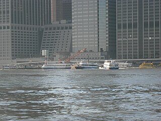
Pier 11/Wall Street is a pier providing slips to ferries and excursion boats on the East River in the Port of New York and New Jersey. It is located east of South Street and FDR Drive just south of Wall Street in Lower Manhattan, New York City. The ferry terminal has five landings, each with two berths, and is used by four privately owned companies.

Axelson Point is a small cape along the shore of the East Bay in Navarre, Florida. The point is sometimes mistakenly called Diana's Point by local residents, though the origin of this is unclear.
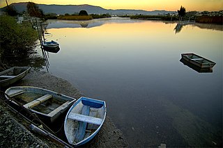
Poplar Creek is a creek tributary of the narrowed river-like side of East Bay, in the Holley neighborhood of Navarre, Florida.
References
- ↑ "GNIS Detail - Miller Point". United States Geological Survey. Retrieved November 20, 2020.
- ↑ "Navarre's earliest recorded heritage began with Spanish explorers in 1693". Navarre Press. July 6, 2016. Retrieved November 20, 2020.