Related Research Articles

Trenton is the capital city of the U.S. state of New Jersey and the county seat of Mercer County. It was the capital of the United States from November 1 until December 24, 1784. Trenton and Princeton are the two principal cities of the Trenton–Princeton metropolitan statistical area, which encompasses those cities and all of Mercer County for statistical purposes and constitutes part of the New York combined statistical area by the U.S. Census Bureau. However, Trenton directly borders the Philadelphia metropolitan area to its west, and the city was part of the Philadelphia combined statistical area from 1990 until 2000.

Lawrenceville is an unincorporated community and census-designated place (CDP) within Lawrence Township in Mercer County, in the U.S. state of New Jersey. The community is situated roughly halfway between Princeton and Trenton. Lawrenceville is part of the Trenton–Princeton metropolitan area within the New York combined statistical area; however, the CDP actually is located approximately 15 miles closer to Philadelphia than to New York City, and as with the remainder of Mercer County, lies within the Federal Communications Commission's Philadelphia Designated Market Area. As of the 2020 census, the CDP's population was 3,751, a decrease of 136 (−3.5%) from the 3,887 recorded at the 2010 census, which in turn had reflected a decrease of 194 (−4.8%) from the 4,081 counted in the 2000 census.

Ewing Township is a township in Mercer County, in the U.S. state of New Jersey. The township falls within the New York metropolitan area as defined by the U.S. Census Bureau. It borders the Philadelphia metropolitan area and is part of the Federal Communications Commission's Philadelphia Designated Market Area. As of the 2020 United States census, the township's population was 37,264, its highest decennial count ever and an increase of 1,474 (+4.1%) from the 35,790 recorded at the 2010 census, which in turn reflected an increase of 83 (+0.2%) from the 35,707 counted in the 2000 census.

Lawrence Township is a township in Mercer County, in the U.S. state of New Jersey. Located at the cross-roads between the Delaware Valley region to the southwest and the Raritan Valley region to the northeast, the township is an outer-ring suburb of New York City in the New York Metropolitan area, as defined by the United States Census Bureau, while also directly bordering the Philadelphia metropolitan area and is part of the Federal Communications Commission's Philadelphia Designated Market Area.

The Delaware and Raritan Canal is a canal in central New Jersey, built in the 1830s, that connects the Delaware River to the Raritan River. It was an efficient and reliable means of transportation of freight between Philadelphia and New York City, transporting anthracite coal from eastern Pennsylvania during much of the 19th and early 20th centuries. The canal allowed shippers to cut many miles off the existing route from the Pennsylvania Coal Region down the Delaware, around Cape May, and up the occasionally treacherous Atlantic Ocean coast to New York City.

Central Jersey, or Central New Jersey, is the middle region of the U.S. state of New Jersey. The designation Central Jersey is a distinct administrative toponym. While New Jersey is often divided into North Jersey and South Jersey, many residents recognize Central Jersey as a distinct third entity. As of the 2020 census, Central Jersey has a population of 3,580,999.

The Millstone River is a 38.6-mile-long (62.1 km) tributary of the Raritan River in central New Jersey in the United States.
New Jersey's 12th congressional district is represented by Democrat Bonnie Watson Coleman, who has served in Congress since 2015. The district is known for its research centers and educational institutions such as Princeton University, Rider University, The College of New Jersey, Institute for Advanced Study, Johnson & Johnson and Bristol-Myers Squibb. The district is primarily suburban in character, covering portions of Mercer, Somerset, Union, and Middlesex counties, although the district contains the state capital of Trenton as well as the smaller city of Plainfield.
Bergen Township was a township that existed in the U.S. state of New Jersey, from 1661 to 1862, first as Bergen, New Netherland, then as part Bergen County, and later as part of Hudson County. Several places still bear the name: the township of North Bergen; Bergen Square, Old Bergen Road, Bergen Avenue, Bergen Junction, Bergen Hill and Bergen Arches in Jersey City; Bergen Point in Bayonne; and Bergenline Avenue and Bergen Turnpike in North Hudson.

The Port Mercer Canal House is a historic house along the Delaware and Raritan Canal. It is located at 4278 Quakerbridge Road in the Port Mercer section of Lawrence Township, Mercer County, New Jersey, United States, near the border of West Windsor Township and Princeton, New Jersey. The house was built in the 1830s as housing for bridgetender and his family. The bridgetender was needed to open the swing bridge when canal boats came through, then close it to allow traffic to cross over the canal. From approximately 1900 to 1934, the bridgetender was John Arrowsmith. He and his wife lived in the three-bedroom house with their eight children. The Arrowsmiths loved living at the house and their children enjoyed sleeping outside by the canal in the summer and skating on the frozen canal to Trenton in the winter. Around 1900, a first-floor kitchen was added. Prior to this addition, Mrs. Arrowsmith, who was known as a good cook, did all of the cooking for the large family and friends by the fireplace in the basement of the house.

East Trenton is a neighborhood located within the city of Trenton in Mercer County, in the U.S. state of New Jersey. It borders Hamilton Township and is home to a sizable African-American community, besides having small pockets of Latinos and Italians.
Nottingham Township was a township that existed for almost 168 years in New Jersey, United States, from 1688 until it was dissolved in 1856.
Clinton Township was a township located in Essex County, New Jersey, United States, which existed from 1834 to 1902.
Elizabeth Township, also called Elizabethtown, was a township that existed in Essex County, in the U.S. state of New Jersey, from 1664 until 1855.
Windsor was a township (1751–1797) in early Middlesex County, in an area that is now within Mercer County, New Jersey, United States.

The Richard J. Coffee Mercer County Park is a recreational park located in West Windsor Township and small western sections of Hamilton and Lawrence Townships in Mercer County, New Jersey, United States. Originally and still more commonly known as Mercer County Park, the park was renamed in October 2009 in honor of New Jersey State Senator Richard J. Coffee.
The Central Delaware Valley AVA is an American Viticultural Area located in southeastern Pennsylvania and New Jersey. The wine appellation includes 96,000 acres (38,850 ha) surrounding the Delaware River north of Philadelphia. Its southern boundary is near Titusville, New Jersey, just north of Trenton, and its northern border is near Musconetcong Mountain. A variety of Vitis vinifera and Vitis labrusca grape varieties can be grown in the area. It has a hot-summer humid continental climate (Dfa) and the hardiness zone is mostly 7a and ranges from 6b to 7b.
Plainfield Township was a township in New Jersey, United States, that existed from 1847 until it was dissolved in 1878.
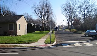
Slackwood is an unincorporated community located within Lawrence Township in Mercer County, in the U.S. state of New Jersey. The area is named for the owners of the land that was subdivided into the neighborhood today, Joseph Slack and William Wood. The neighborhood was first developed in 1890 as the first suburban development in the reconfigured Lawrence Township. Its location between Princeton Pike and Brunswick Pike allowed for an easy walk to nearby Trenton factories. Today, most of the homes in Slackwood are still small bungalows with some businesses along with Princeton and Brunswick Pikes. The neighborhood is bounded by the two highways on the northwest and southeast, Slackwood Park and forest on the southwest, and Shabakunk Creek and Park on the northeast.

Top Road is a neighborhood located within the city of Trenton in Mercer County, in the U.S. state of New Jersey. Much of Top Road was once part of Lawrence Township and then was added to the now-defunct Millham Township before being annexed by Trenton in 1888.
References
- ↑ Woodward, Evan Morrison (1883). History of Burlington and Mercer Counties, New Jersey: With Biographical Sketches of Many of Their Pioneers and Prominent Men. Everts & Peck. pp. 858–859.
- ↑ Snyder, John P. The Story of New Jersey's Civil Boundaries: 1606-1968, Bureau of Geology and Topography; Trenton, New Jersey; 1969. p. 163. Accessed November 28, 2012.
- ↑ "North Ward Historic Resource Survey, City of Trenton". Trenton Historical Society. Retrieved 2015-01-18.
When the City of Trenton first incorporated in 1792, its boundaries included the neighborhood known as East Trenton. However, in 1844, Lawrence Township annexed this area. It remained part of Lawrence Township until 1882, when East Trenton became an independent jurisdiction known as Millham Township, which included much of Top Road. On May 1, 1888, Millham once again became part of the City. of Trenton.
40°15′54″N74°45′25″W / 40.265°N 74.757°W
| | This Mercer County, New Jersey state location article is a stub. You can help Wikipedia by expanding it. |