
Thuringia, officially the Free State of Thuringia, is a state of Germany.

The Saale, also known as the Saxon Saale and Thuringian Saale, is a river in Germany and a left-bank tributary of the Elbe. It is not to be confused with the smaller Franconian Saale, a right-bank tributary of the Main, or the Saale in Lower Saxony, a tributary of the Leine.
Hof is a Landkreis (district) in Bavaria, Germany. It is bounded by the districts of Wunsiedel, Bayreuth, Kulmbach and Kronach, the states of Thuringia and Saxony, and the Czech Republic. The city of Hof is an enclave within the district, as well as being the district's administrative seat.
Saale-Orla is a Kreis (district) in the east of Thuringia, Germany. Neighboring districts are the districts Saale-Holzland, Greiz, the Vogtlandkreis in Saxony, the Bavarian districts Hof and Kronach, and the district Saalfeld-Rudolstadt.
Saalfeld-Rudolstadt is a Kreis (district) in the south of Thuringia, Germany. Neighboring districts are the districts Weimarer Land, Saale-Holzland, Saale-Orla, the district Kronach in Bavaria, and the districts Sonneberg, Hildburghausen and Ilm-Kreis.

The Rhön Mountains are a group of low mountains in central Germany, located around the border area where the states of Hesse, Bavaria and Thuringia come together. These mountains, which are at the extreme southeast end of the East Hesse Highlands, are partly a result of ancient volcanic activity. They are separated from the Vogelsberg Mountains by the river Fulda and its valley. The highest mountain in the Rhön is the Wasserkuppe which is in Hesse. The Rhön Mountains are a popular tourist destination and walking area.
Rhön-Grabfeld is a Landkreis (district) in Bavaria, Germany. It is bounded by the districts of Hassberge, Schweinfurt and Bad Kissingen, and the states of Hesse and Thuringia.
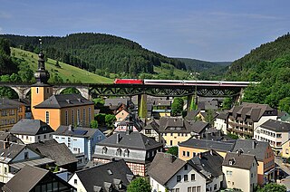
Ludwigsstadt is a town in the district of Kronach, in the Upper Franconian region of Bavaria, Germany.

The Saxon Eastern March was a march of the Holy Roman Empire from the 10th until the 12th century. The term "eastern march" stems from the Latin term marchia Orientalis and originally could refer to either a march created on the eastern frontier of the East Frankish duchy of Saxony or another on the eastern border of the Duchy of Bavaria: the Bavarian marchia Orientalis, corresponding to later Austria.

The Itz is a river of Thuringia and Bavaria, Germany.

The Selbitz is a river of Bavaria, Germany.
At 927.9 m above sea level (NN) the Dammersfeldkuppe in Bavaria is the second highest mountain after the Wasserkuppe in the Rhön, a low mountain range straddling the states of Bavaria, Hesse and Thuringia in Germany.
Lauer is a river of Bavaria, Germany. It flows into the Franconian Saale in Niederlauer.
The Streu is a river of Thuringia and Bavaria, Germany.

Steinach is a river of Thuringia and Bavaria, Germany. Its source is near Neuhaus am Rennweg, and it flows to the south, passing through the towns Steinach and Sonneberg. It is a right tributary of the Rodach, which it joins near Redwitz an der Rodach.

Tannbach is a brook that is 8.7 kilometres (5.4 mi) long in north-east Bavaria and southern Thuringia, Germany.
The Loquitz is a river in Bavaria and Thuringia, Germany. It flows into the Saale in Kaulsdorf (Saale).
Premich is a river of Bavaria, Germany. It arises from the confluence of Kellersbach and Kleiner Steinach near the village Premich, part of Burkardroth. It flows into the Franconian Saale in Steinach an der Saale, part of Bad Bocklet. Its length is 7.2 km (4.5 mi), 18.4 km (11.4 mi) including its longest source river Kellersbach.
Thüringische Muschwitz is a river on the border of Bavaria and Thuringia, Germany. It flows into the Selbitz near Lichtenberg.
