Minneapolis Air Route Traffic Control Center

Last updated

Minneapolis Air Route Traffic Control Center (ZMP), (radio communications, "Minneapolis Center") is one of 22 [1] Area Control Centers. It is located at 512 Division Street in Farmington, Minnesota, United States. [2]

Contents

The primary responsibility of Minneapolis Center is sequencing and separation of overflights, arrivals, and departures, in order to provide safe, orderly, and expeditious flow of aircraft filed under instrument flight rules (IFR).

Minneapolis Center is the 13th busiest ARTCC in the United States. Between January 1, 2017 and December 31, 2017, Minneapolis Center handled 1,986,502 aircraft. [3] Minneapolis Center covers approximately 330,000 square miles of the United States Midwest region, including all or parts of Minnesota, South Dakota, North Dakota, Wisconsin, Michigan, Nebraska, Kansas, Iowa, and Missouri. [4]

Minneapolis Center employs close to 400 air traffic employees, approximately 300 of whom are air traffic controllers. Minneapolis Center lies adjacent to 7 separate Area Control Centers, including Toronto Center, Winnipeg Center, Cleveland Center, Salt Lake City Center, Denver Center, Kansas City Center, and Chicago Center. ZMP overlies or abuts 18 approach control facilities (including APN, MBS, GRB, M98, DLH, YQT, GFK, FAR, MOT, BIS, FSD, SUX, LNK, OMA, DSM, STJ, RST, and MKE approaches) and is responsible for approximately 210 uncontrolled airports with authorized instrument approach procedures. [5]

Basic Breakdown of Airspace

Minneapolis Center is divided into six Areas, numbered 1 through 6. Each area contains up to 7 sectors. Each of the six areas is delegated at least one high altitude and one low altitude sector.

AREA 1

Area 1 is located over the northern Great Lakes. It contains four low altitude sectors and two high altitude sectors. Area 1 borders or overlies 9 approach control facilities, three class D airports, and borders 4 Area Control centers. Area 1 handles a wide array of traffic, including sequencing into Minneapolis and Chicago, several large military complexes, and provides arrival and departure services at many smaller airports. Traffic in Area 1 is extremely seasonal in nature, with traffic increasing in volume and complexity during the summer months, particularly during the EAA AirVenture air show in late July and Early August.

AREA 2

Area 2 is a terminal arrival/departure area located to the north and east of Minneapolis and is concerned primarily with commercial aviation into and out of Minneapolis St. Paul International Airport (MSP). Traffic flow is consistent through the year with a small increase in workload in the summer due to increased general aviation activity. Area 2 also controls low altitude traffic, FL230 and below in the north half of Minnesota and most of Wisconsin. It provides approach and arrival services to all aircraft in those areas who do not have a dedicated approach control of their own.

AREA 3

Area 3 is a terminal arrival/departure area located to the south and west of Minneapolis and is also concerned primarily with commercial aviation into and out of MSP. Area 3 works with both Minneapolis and Rochester approaches, and provides radar and non-radar services for numerous secondary airports. Complexity is increased with additional aircraft spacing to multiple large airports, including JFK, EWR, DEN and DFW and ORD.

AREA 4

Area 4 overlies a large portion of the Midwest, including most of North Dakota, South Dakota, and northern Minnesota. A combination of low and high altitude sectors, Area 4 provides initial sequencing of MSP arrivals from the west, manages westbound MSP departures, sequences ORD arrivals, and implements traffic management initiatives for traffic landing in the northeast portion of the country. Area 4 also contains significant portions of non-radar, provides services to over 100 uncontrolled airports, works with six approach controls, and deals with significant levels of military activity.

AREA 5

Area 5 overlies southeastern South Dakota, northeastern Nebraska, and northwestern Iowa. Area 5 is split evenly between high and low altitude, and handles a wide variety of over flight, arrival, international, and local traffic. Area 5 works with several Class D airports and 5 approach control facilities. Area 5 sequences for DEN, MSP, ORD, JFK on a daily basis and handles a wide array of military and non-radar activity.

AREA 6

Area 6 is primarily a high altitude area, serving eastern Nebraska, and western Iowa. Area 6 consists of five high altitude sectors, and one low altitude sector and is situated between Kearney, Nebraska and Des Moines, Iowa. The area deals primarily with high altitude east and west bound traffic. Area 6 deals with sequencing to DEN, ORD, MDW, EWR, OMA, and DSM. Traffic complexity and load remains fairly consistent throughout the year.

Related Research Articles

Instrument flight rules one set of regulations governing all aspects of civil aviation aircraft operations

Instrument flight rules (IFR) is one of two sets of regulations governing all aspects of civil aviation aircraft operations; the other is visual flight rules (VFR).

Air traffic control A public service provided for the purpose of maintaining the safe and orderly flow of air traffic

Air traffic control (ATC) is a service provided by ground-based air traffic controllers who direct aircraft on the ground and through controlled airspace, and can provide advisory services to aircraft in non-controlled airspace. The primary purpose of ATC worldwide is to prevent collisions, organize and expedite the flow of air traffic, and provide information and other support for pilots. In some countries, ATC plays a security or defensive role, or is operated by the military.

Air traffic controller specialist responsible for the safe, orderly, and expeditious flow of air traffic

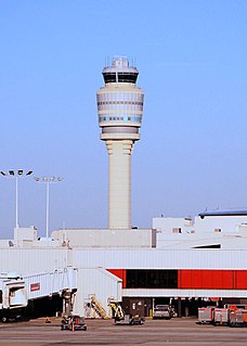
Air traffic control officers abbreviated ATCO are personnel responsible for the safe, orderly, and expeditious flow of air traffic in the global air traffic control system. Usually stationed in air traffic control centers and control towers on the ground, they monitor the position, speed, and altitude of aircraft in their assigned airspace visually and by radar, and give directions to the pilots by radio. The position of air traffic controller is one that requires highly specialized knowledge, skills, and abilities. Controllers apply separation rules to keep aircraft at a safe distance from each other in their area of responsibility and move all aircraft safely and efficiently through their assigned sector of airspace, as well as on the ground. Because controllers have an incredibly large responsibility while on duty and make countless real-time decisions on a daily basis, the ATC profession is consistently regarded around the world as one of the most mentally challenging careers, and can be notoriously stressful depending on many variables. Many controllers, however, would cite high salaries, and a very large, unique, and privileged degree of autonomy as major advantages of their jobs.

Area control center Air route control entity

In air traffic control, an area control center (ACC), also known as a center or en-route center, is a facility responsible for controlling aircraft flying in a particular volume of airspace at high altitudes between airport approaches and departures. In the US, such a center is referred to as an air route traffic control center (ARTCC).

ERAM is an FAA Air Traffic Control system designed to "allow faster processing of route requests and in flight route changes".

Boston Air Route Traffic Control Center is one of 22 Air Route Traffic Control Centers in the United States, located in Nashua, New Hampshire.

Washington Air Route Traffic Control Center

Washington Air Route Traffic Control Center (ZDC) is an Area Control Center operated by the Federal Aviation Administration and located in Leesburg, Virginia, United States. The primary responsibility of ZDC is the separation of airplane flights and the expedited sequencing of arrivals and departures along STARs and SIDs for the Washington-Baltimore Metropolitan Area, the New York Metropolitan Area, and Philadelphia among many other areas.

Boston Consolidated TRACON

The Boston Consolidated TRACON (A90) is located in Merrimack, New Hampshire. A90 opened in 2004 after 8 years of development. The A90 function transferred to the new Boston Consolidated TRACON on February 22, 2004. The MHT function transferred over on March 7, 2004. Manchester TRACON used to be located at Manchester Airport below the old ATCT. Boston TRACON used to be located at the Logan International Airport Control Tower before being consolidated. The new facility is 63,000 square feet (5,900 m2). A Terminal Radar Approach Control, or TRACON, is responsible for descending airplanes from the ARTCC and lining them up for landing at their destination airport, as well as climbing departures before handing off to the ARTCC.

The National Airspace System (NAS) is the airspace, navigation facilities and airports of the United States along with their associated information, services, rules, regulations, policies, procedures, personnel and equipment. It includes components shared jointly with the military. It is one of the most complex aviation systems in the world, and services air travel in the United States and over large portions of the world's oceans.

Chicago Air Route Traffic Control Center

Chicago Air Route Traffic Control Center (ZAU) is one of 22 Air Route Traffic Control Centers (ARTCCs) operated by the United States Federal Aviation Administration. It is located at 619 W. New Indian Trail Rd., Aurora, Illinois.

"Denver Air Route Traffic Control Center (ZDV), is one of 22 US Area Control Centers. It is located at 2211 17th Ave, Longmont, Colorado, United States.

Indianapolis Air Route Traffic Control Center (ZID), is one of 22 established FAA Area Control Centers, and is physically located at 1850 South Sigsbee Street, Indianapolis, Indiana,.

Jacksonville Air Route Traffic Control Center (ZJX), is one of 22 Area Control Centers in the United States. It is located at 37075 Aviation Ln, Hilliard, Florida.

Kansas City Air Route Traffic Control Center

Kansas City Air Route Traffic Control Center, is one of 22 Federal Aviation Administration (FAA) Area Control Centers. It is located at 250 S. Rogers Rd. Olathe, Kansas, United States.

Salt Lake City Air Route Traffic Control Center (ZLC) is one of 22 FAA Area Control Centers in the United States. It is located in Salt Lake City, Utah, adjacent to Salt Lake City International Airport. It was opened in 1939 and was originally located on the third floor of the old Salt Lake City International Airport terminal. The Salt Lake Center (ZLC) covers one of the largest geographical areas of any other control center, totaling approximately 350,000 squares miles.

Miami Air Route Traffic Control Center is one of 22 United States air route traffic control centers (ARTCs), or area control centers, located at 7500 N.W. 58th st, Miami, Florida.

"Memphis Air Route Traffic Control Center (ZME) is one of 22 United States Federal Aviation Administration (FAA) Area Control Centers and is located at 3229 Democrat Rd. Memphis, Tennessee 38118, United States

Oakland Air Route Traffic Control Center (ZOA), is one of 22 Area Control Centers in the United States. It is located at 5125 Central Ave, Fremont, California.

Atlanta Air Route Traffic Control Center

"Atlanta Air Route Traffic Control Center (ZTL) is one of 22 Air Route Traffic Control Centers operated by the United States Federal Aviation Administration. It is located at 299 Woolsey Rd, Hampton, Georgia, United States.

The Cape TRACON (K90) was located Joint Base Cape Cod, Massachusetts next to the airfield for Coast Guard Air Station Cape Cod. This radar approach facility is operated by the Federal Aviation Administration (FAA).

References

  1. Federal Aviation Administration (FAA). (2010, April 28). Air route traffic control centers. Retrieved from https://www.faa.gov/about/office_org/headquarters_offices/ato/service_units/air_traffic_services/artcc/
  2. StuckMic.com. (2012). Minnesota air traffic control facilities. Retrieved from http://www.stuckmic.com/minnesota-air-traffic-control-facilities.html
  3. Federal Aviation Administration. (2018). Air Traffic Activity System (ATADS. Retrieved from http://aspm.faa.gov/opsnet/sys/Center.asp
  4. Federal Aviation Administration. "Facility Orientation Guide: Minneapolis ARTCC; Farmington, Minnesota". Federal Aviation Administration. Retrieved 18 March 2013.
  5. Federal Aviation Administration. "Facility Orientation Guide: Minneapolis ARTCC; Farmington, Minnesota". Federal Aviation Administration. Retrieved 18 March 2013.


Coordinates: 44°38′14″N93°09′08″W / 44.6372°N 93.1521°W / 44.6372; -93.1521