Related Research Articles

The Stour is a river flowing through the counties of Worcestershire, the West Midlands and Staffordshire in the West Midlands region of England. The Stour is a major tributary of the River Severn, and it is about 25 miles (40 km) in length. It has played a considerable part in the economic history of the region.
Raccoon Creek is a 22.6-mile-long (36.4 km) tributary of the Delaware River in southern New Jersey in the United States.

The name Rea Brook can refer to either of two brooks in Shropshire, England.
Dillons Run is a 12.9-mile-long (20.8 km) tributary stream of the Cacapon River, belonging to the Potomac River and Chesapeake Bay watersheds. The stream is located in Hampshire County in the U.S. state of West Virginia's Eastern Panhandle.

The South Branch Raritan River is a 50-mile-long (80 km) tributary of the Raritan River in New Jersey.
The Jones River is a 7.5-mile-long (12.1 km) river running through Kingston, Massachusetts. The river drains about 30 square miles (78 km2), has its source in Silver Lake and drains into Kingston Bay. Land surrounding the river is 52% forested, of which 22% has been developed for residential use. There is a USGS stream gauge along 16 square miles (41 km2) of the river and it has measured the flow at 0.7 cubic feet per second (0.020 m3/s) per square mile of drainage area.
Young Womans Creek is an 11.3-mile-long (18.2 km) tributary of the West Branch Susquehanna River in Pennsylvania in the United States.

Chew Valley in Saddleworth, Greater Manchester, England, follows the course of Chew Brook on the western slopes of Black Chew Head to where it joins the River Tame at Greenfield, east of Manchester. Part of the higher fringes of the valley towards the peak of Black Chew Head lie across the boundary in Derbyshire. The eastern part of the valley including the reservoirs of Dovestone and Chew are within the north western extremity of the Peak District National Park.

The River Roddlesworth is a river in Lancashire, England, a tributary of the River Darwen.

The Limb Brook is a stream in Sheffield, South Yorkshire, England. It rises at the village of Ringinglow, flowing east through Whirlow and Ecclesall Woods into Abbeydale in the Beauchief area, where it merges with the River Sheaf. Near this point part of the stream has been diverted to provide the goit for the Abbeydale Industrial Hamlet millpond, and this channel flows through what is now Beauchief Gardens.
Artle Beck is a minor river of Lancashire.

The River Bourne or the Chertsey Bourne is in Berkshire and Surrey; it runs from sources in Windsor Great Park and Swinley Forest through to the River Thames.

Pymmes Brook is located in North London and named after William Pymme, a local land owner. It is a minor tributary of the River Lea. The brook mostly flows through urban areas and is particularly prone to flooding in its lower reaches. To alleviate the problem the brook has been culverted in many areas. Part of it is a Site of Borough Importance for Nature Conservation, Grade II.

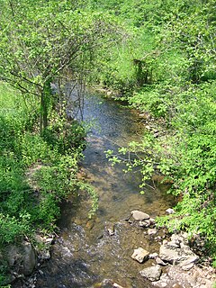
A stream is a body of water with surface water flowing within the bed and banks of a channel. The flow of a stream is controlled by three inputs – surface water, subsurface water and groundwater. The surface and subsurface water are highly variable between periods of rainfall. Groundwater, on the other hand, has a relatively constant input and is controlled more by long-term patterns of precipitation. The stream encompasses surface, subsurface and groundwater fluxes that respond to geological, geomorphological, hydrological and biotic controls.

Siston Brook rises in two separate streams which issue from a ridge just north of the village of Siston, South Gloucestershire, England. The brook is approximately 6 miles (9.7 km) long and is a tributary of the Bristol Avon. Much of its course is through the eastern suburbs of Bristol, although it remains outside the city boundaries. Tributaries include the Warmley Brook and an unnamed tributary from Bridgeyate.

The Wom Brook is a stream in South Staffordshire, England. It flows through the large village of Wombourne, and has played an important part in its industrial history. It is an important tributary of the River Smestow and part of the Severn catchment.

Nine Mile Run, known as Ninemile Run according to the USGS GNIS, is a moderately large tributary of the Six Mile Run, one of the branches of the Millstone River, in central New Jersey in the United States.

Cross Brook is a tributary of Six Mile Run in Somerset and Middlesex Counties, New Jersey in the United States.

The River Eitha is a small river in Wrexham County Borough, Wales. It is part of the River Dee catchment. Its name was probably derived from the Welsh word eithaf - "extremity", "farthest".

Mearley Brook is a minor river in Lancashire, England. It is approximately 4.5 miles (7.2 km) long and has a catchment area of 8.79 square miles (22.77 km2).
References
| | This Shropshire location article is a stub. You can help Wikipedia by expanding it. |