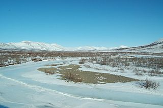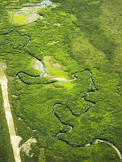
The Kiwalik River is a stream on the Seward Peninsula in the U.S. state of Alaska. The headwaters of the river originate in the eastern portion of the peninsula, around Granite Mountain. The river flows north to its mouth at Kiwalik Lagoon, Chukchi Sea. The start of the 20th century mining town of Candle is found on its western bank at the confluence of Candle Creek. The ore minerals and materials found in the river basin are galena, gold, pyrite, scheelite, silver and sphalerite, and the primary commodities are tungsten, lead and zinc.

The Fish River is a waterway in the U.S. state of Alaska. The 47-mile-long (76 km) river rises in the Bendeleben Mountains and flows south to Golovnin Lagoon, before emptying into Golovnin Bay, Norton Sound, and the Bering Sea. The basin formed by the Fish River is known for its placer gold deposits, and in particular, the Niukluk River and its tributaries; production from this tributary valley is reported to be more than from any other place in the region. A galena mine existed 40 miles (64 km) from the sea, worked on occasion by a San Francisco corporation with a few hundred tons of ore taken to the city for smelting and refining for silver. Walter Curran Mendenhall found obscure fossils on Fish River at White Mountain.

The Tubutulik River is a waterway in the U.S. state of Alaska. The 25-mile (40 km) long river is situated on the Seward Peninsula. It flows southeastwards to the Kwiniuk Inlet at the northwestern end of Norton Bay, 25 miles (40 km) southwest of Koyuk in the Bering Sea. Its Inuit name was reported as "Tubuktulik" in 1849 by Capt. Mikhail Dmitrievich Tebenkov of the Imperial Russian Navy. Exploration for placer gold occurred in the Council district area where the river valley is located, and in 1898, mining commenced. The production was substantial and ranked second only to that of Nome.

Davidson Ditch is a 90-mile (140 km) conduit built in the 1920s to supply water to gold mining dredges in central Alaska. It was the first large-scale pipeline construction project in Alaska, and lessons learned in its construction were applied to the building of the Trans-Alaska Pipeline System. It is eligible for inclusion on the National Register of Historic Places, but has not been listed due to a lack of information. Despite this, the remains of the conduit are partially protected by its inclusion in the White Mountains National Recreation Area.

Cape Nome is a headland on the Seward Peninsula in the U.S. state of Alaska. It is situated on the northern shore of Norton Sound, 15 miles (24 km) to the east of Nome also on Norton Sound. It is delimited by the Norton Sound to the south, Hastings Creek on the west, a lagoon on the east and an estuary formed by the Flambeau River and the Eldorado River. From the sea shore, Cape Nome extends inland by about 4 miles (6.4 km), connected by road with Nome.

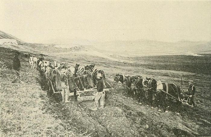
The Nome Gold Rush was a gold rush in Nome, Alaska, approximately 1899–1909. It is separated from other gold rushes by the ease with which gold could be obtained. Much of the gold was lying in the beach sand of the landing place and could be recovered without any need for a claim. Nome was a sea port without a harbor, and the biggest town in Alaska.

Candle Creek is a western tributary of the Kiwalik River, located on the Seward Peninsula of the U.S. state of Alaska. The unincorporated community of Candle is less than a mile away, while the village of Kiwalik is about 13 miles (21 km) away. The creek's name is attributed to the resemblance of the trees on the banks of the creek to candles when they are covered with snow. With the discovery of gold in 1901, Candle Creek's reputation as a top gold-yielding site was fixed.

The Kruzgamepa River is a 55-mile (89 km) tributary of the Kuzitrin River on the Seward Peninsula in the U.S. state of Alaska. The river begins at Salmon Lake, elevation 447 feet (136 m), and descends to 20 feet (6.1 m) above sea level at its mouth. In turn, the Kuzitrin River empties into the Imuruk Basin. The basin drains via the bay of Port Clarence to the Bering Sea.
Solomon River is a waterway in the U.S. state of Alaska, near Nome.

Casadepaga River is a waterway in the U.S. state of Alaska, near Nome. It is the largest southern branch of the Niukluk River. It has a length of about 30 miles (48 km) and a general northeasterly course.
Anikovik River is a waterway in the U.S. state of Alaska. It heads in the York Mountains about 15 miles (24 km) from the Bering Sea. As it leaves the mountains, it has a westerly course, but bending sharply to the south, it flows in that direction to the sea. It has a broad, flat flood plain, from 300 feet (91 m) to 0.5 miles (0.80 km) in width. In the upper part of its course, the river flows in greenstones, but below its bend, to the south, it cuts phyllites and slates. A rough estimate of the fall of river makes it about 15–18 feet (4.6–5.5 m) per mile. Buhner Creek joins Anakovik River about 2 miles (3.2 km) above the mouth of Deer Creek.

Nome River is a waterway on the Seward Peninsula in the U.S. state of Alaska. It has its source in a narrow valley in the southern margin of the Kigluaik Mountains, 4.5 miles (7.2 km) west of Salmon Lake.

Council City and Solomon River Railroad is an abandoned railroad in the U.S. state of Alaska. Its name refers to Solomon River and the city of Council in the Nome Census Area. The railway operated from 1903 to 1907. The remains of the railroad at Mile 31 of the Nome-Council Highway, comprising three locomotives, two flat cars and a boiler, were listed as an historic district on the National Register of Historic Places in 2001.

Serpentine River is a waterway on the Seward Peninsula in the U.S. state of Alaska. It debouches at Shishmaref Inlet from the southeast. It was explored and named in 1900 by the prospector Charles McLennan.

Salmon Lake is a natural lake on the Seward Peninsula in the U.S. state of Alaska. Situated 35 miles (56 km) north of Cape Nome, it drains into Port Clarence through Kruzgamepa River. The lake lies at the foot of the Kigluaik Mountains at an elevation of about 442 feet (135 m). It has a water surface area of 1,800 acres (730 ha) and a drainage area of 81 square miles (210 km2). Its principal supply comes from Grand Central River, which enters it at its western end. A number of small streams also enter the lake from both the north and the south; Fox Creek and Jasper Creek are the most notable of these. Efforts to dam the lake in order to provide power and water supply to mining endeavors occurred from 1906-1907, However these plans were later dropped due to disputes over land ownership and water rights.

Bluestone River is a waterway located on the Seward Peninsula in the U.S. state of Alaska. A tributary of the Tuksuk Channel from the south, Bluestone is a north-flowing stream situated 11 miles (18 km) southeast of Teller. It was named in 1900 by Edward Chester Barnard, topographer of the United States Geological Survey.

Grantley Harbor is a waterway located at the bay of Port Clarence, Alaska, on the Seward Peninsula in the U.S. state of Alaska. The inner harbor at the entrance to the northeast corner of the bay was named after Lord Grantley.
Charles D. Lane was a US millionaire mine owner, who is recognized as a founder of Nome, Alaska. Lane was born in Palmyra, Missouri November 15, 1840. His parents were Virginians of Scottish descent. He moved to California with his father in 1852 and almost immediately took up mining. After an unsuccessful attempt to develop a lode mine in Nevada, he achieved his first success on the Snake River in Idaho, followed some years later by a major strike at the Utica Mine at Angels, California. Lane also developed the Fortuna Mine in Arizona.

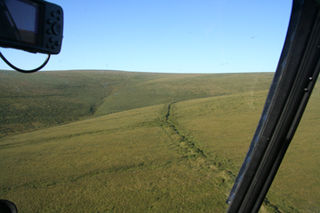
The Fairhaven Ditch is a historic canal on the Seward Peninsula of northwestern Alaska. Located in the Bering Land Bridge National Preserve, it is a 38-mile (61 km) ditch dug in 1906-07 without the benefit of heavy equipment in extremely hostile terrain. The ditch was dug by miners engaged in placer mining on the peninsula, and was used to transport water from Imuruk Lake, the largest body of fresh water on the peninsula, to mining areas north of the lake. It is one of a large number of such canals dug on the peninsula, and was one of the longest. At the bottom it was 11 feet (3.4 m) wide, and was hacked out of permafrost, a volcanic field surrounding the lake, and dirt. Cabins built to house workers and monitor water flow survive. The ditch was listed on the National Register of Historic Places in 1987.

George M. Ashford was a US civil engineer and surveyor. He was one of the pioneers of Northern Alaska. He was the first man of his profession to arrive in Nome.


