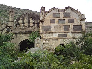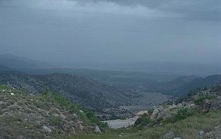
The Bangash, Bungish, Bangaš or Bangakh are a tribe of Pashtuns, inhabiting their traditional homeland, the Bangash district which stretches from Kohat to Tall in Hangu and Spīn Ghar, Kurram in Khyber Pakhtunkhwa, Pakistan. They also live as a smaller population in Dera Ismail Khel, Bannu while also a smaller population of Bangash inhabit mainly Gardez, Paktia and around the Lōya Paktia region of Afghanistan.

Kohat is a city that serves as the capital of the Kohat District in Khyber Pakhtunkhwa, Pakistan. It is regarded as a centre of the Bangash tribe of Pashtuns, who have lived in the region since the late 15th century. With a population of over 220,000 people, the city is the fourth-largest in Khyber Pakhtunkhwa and the 35th-largest in Pakistan in terms of population. Kohat's immediate environs were the site of frequent armed skirmishes between British colonialist forces and local tribesmen in the mid to late 19th century. It is centred on a British-era fort, various bazaars, and a military cantonment. Pashto and the Kohati dialect of Hindko are the main languages spoken in Kohat.

Parachinar is a city and the capital of the Kurram District in the province of Khyber Pakhtunkhwa, Pakistan.

Tirah, also spelled Terah, also called the Tirah Valley, is a mountainous region located in the Orakzai District and the southern part of the Khyber District, positioned between the Khyber Pass and the Khanki Valley in Pakistan. Due to its proximity to the Afghan-Pakistan border and challenging terrain, maintaining control of Tirah has been historically difficult for the Government of Pakistan. In 2003, for the first time since Pakistan's independence, the Army entered the Tirah Valley.

Orakzai District is a district in the Kohat Division of the Khyber Pakhtunkhwa province of Pakistan. Before 1973, it was part of FR Kohat. Up until 2018, it was an agency within the erstwhile Federally Administered Tribal Areas. However, with the merger of the FATA with Khyber Pakhtunkhwa, it attained the status of a district.

Hangu District is a district within the Kohat Division of the Khyber Pakhtunkhwa. The district takes its name from the town of Hangu, which is its administrative centre. The name Hangu may also sometimes be applied to the Miranzai Valley which is partly within the district, bordering the Samana Range.

The Turi or Torai are a Pashtun tribe residing primarily in the Kurram Valley, of Pakistan's Khyber Pakhtunkhwa province, with a smaller population across the Durand line in Afghanistan's Paktia province. They speak Pashto and follow the Twelver Shia sect of Islam. Unlike most Pashtun tribes, who are predominantly Sunni, the Turi's adherence to Shia Islam has historically contributed to tensions with neighbouring Sunni Pashtun tribes, such as the Mangal and Bangash, who also inhabit the Kurram Valley. These tensions are further complicated by land disputes and historical factors.
The Orakzai are a Pashtun tribe native to the Orakzai Agency and parts of Kurram and Khyber Agencies in Pakistan's Khyber Pakhtunkhwa province. Additionally, a sub-tribe of the Orakzai resides in Afghanistan's Maidan Wardak Province. The Orakzai people predominantly speak Pashto.

Kohat Division is one of the seven divisions in the Khyber Pakhtunkhwa province of Pakistan. It consists of five districts: Hangu, Karak, Kohat, Kurram, and Orakzai. The division borders Bannu Division to the south and west, Peshawar Division to the north and east, the province of Punjab to the east, and Afghanistan to the northwest. CNIC code of Kohat Division is 14.

Kurram District is a district in the Kohat Division of the Khyber Pakhtunkhwa province of Pakistan. The name Kurram comes from the river Kwarma in Pashto which itself derives from the Sanskrit word Krumu.
Sadda is a city in Kurram District in the Khyber Pakhtunkhwa province of Pakistan. Located on the Kurram River, it is a big trade market for the people of Lower Kurram and Central Kurram. The main tribe living in Sadda is the Bangash. Sadda is located about 50 kilometres (31 mi) southeast of Parachinar. The nearest main city on the Afghan side of the border is Khost, which is located about 70 kilometres (43 mi) to the southwest of Sadda.
Doaba is a small city located in Tall tehsil, Hangu district, Pakistan. Its population is just above 20,000, but the city has only 1,942 households. The most spoken language in Doaba is Pashto. It is roughly 30 kilometres (19 mi) from Hangu and roughly 15 kilometres (9.3 mi) from Thall. Doaba is Hangu district's third-largest city.
Naryab/Nariäb(نرياب) is a village and union council located in Tehsil Thall, Hangu district, within the Khyber Pakhtunkhwa province of Pakistan. The predominant Pashtun tribe in this locale is the Bangash, however the village also accommodates Orakzai migrants who have resettled there following upheavals and conflict in Tirah and Orakzai Agency. Both the Bangash and Orakzai belong to the Karlanri confederation of Pashtuns.

Dara Adam Khel Tehsil is an administrative subdivision (tehsil) of Kohat District in Khyber Pakhtunkhwa province of Pakistan. This subdivision shares its boundary with Peshawar District to the north, Nowshera District to the east and Orakzai District to the west.

NA-36 Hangu-cum-Orakzai is a constituency for the National Assembly of Pakistan. It covers the whole of the district Hangu. The constituency was formerly known as NA-16 (Hangu) from 1977 to 2018. The name changed to NA-33 (Hangu) after the delimitation in 2018. NA-36 (Hangu-cum-Orakzai) and Orakzai District were also included after the delimitation in 2022.

In January 1505, Babur set out from Kabul towards India and proceeding by way of Badam Cheshmeh and Jagdalak reached Adinapur (Jalalabad). Nasir Mirza, his younger brother, joined him here. As the Aimaqs of that neighborhood with their followers had moved down with all their families into Lamghanat for the purpose of wintering there, they waited for this group and others till they were joined by them after which the army went on to Kush Gumbez lower down than Jui Shahi. Nasir Mirza having made some provision for his dependents and followers from the country under his government stayed behind at Kush Gumbez promising to follow in two or three days.
Lachi is one of the two tehsils in the Kohat District of Khyber Pakhtunkhwa province in Pakistan, located south of the district capital Kohat. It houses about 100,000 inhabitants, living in 1,161 square kilometres (448 sq mi). The tehsil is subdivided into nine union councils. About 40% of the working population is employed outside the tehsil.It is a rural area where most households' livelihood depends on remittances and subsistence farming. Education is provided through several private and government high schools, as well as a government degree college affiliated with Kohat University.
The Khan of Hangu, also known as Raees e Hangu, was the title of the tribal chiefs of Hangu valley. The first to take the title was(Ali mardankhan also known as mardu khan in the 16th century. After him, his clan, the Mardukhel, ruled the valley for more than 400 years from 1500 to 1915. They belong to the Miranzai sub-tribe of the larger Bangash tribe.


