RAF Ascension Island, also known as Wideawake Airfield or Ascension Island Auxiliary Field, is a military airfield and facility located on Ascension Island in the Atlantic Ocean. The airfield is jointly operated by the Royal Air Force (RAF) and the United States Space Force (USSF). Under the terms of an international agreement between the UK and US governments, only state aircraft are authorised to land at Ascension; however, it is also open to air services between Saint Helena and Ascension.

The Western Range (WR) is the space launch range that supports the major launch head at Vandenberg Space Force Base. Managed by the Space Launch Delta 30, the WR extends from the West Coast of the United States to 90° East longitude in the Indian Ocean where it meets the Eastern Range Operations involve military, government, and commercial interests. The WR has been operated by civilian contractors since its establishment, following the precedent of the Eastern Range. On 1 October 2003, InDyne Inc. took over the range contract from ITT Industries which had operated the range for the previous 44 years.

Naval Base Ventura County (NBVC) is a United States Navy base in Ventura County, California. Formed by the merger of NAS Point Mugu and CBC Port Hueneme, NBVC is a diverse installation composed of three main locations — Point Mugu, Port Hueneme, and San Nicolas Island. The base serves as an all-in-one mobilization site, deep water port, railhead, and airfield. NBVC supports more than 100 tenant commands with a base population of more than 19,000 personnel, making it the largest employer in Ventura County.

The Eastern Range (ER) is an American rocket range (Spaceport) that supports missile and rocket launches from the two major launch heads located at Cape Canaveral Space Force Station and the Kennedy Space Center (KSC), Florida. The range has also supported Ariane launches from the Guiana Space Centre as well as launches from the Wallops Flight Facility and other lead ranges. The range also uses instrumentation operated by NASA at Wallops and KSC.
The Downrange Anti-missile Measurement Program or DAMP was an applied research project to obtain scientific data, just prior to and during re-entry, on intermediate- and intercontinental-range ballistic missiles as they returned to earth. The program was funded by the Advanced Research Projects Agency (ARPA) under the technical direction of the Army Ordnance Missile Command (AOMC) during the period 1 January 1959 through 30 September 1963.

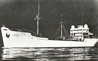
USAS American Mariner was a United States Army research vessel from January 1959 to 30 September 1963. She was originally assigned to the DAMP Project by the Advanced Research Projects Agency (ARPA) to attempt to collect radar signature data on incoming intercontinental ballistic missiles in the Caribbean, the South Atlantic Ocean, and the Indian Ocean. Her initial operations involved providing radar track on the Atlas missile, which was under development at the time. Subsequently, she provided track on other types of missiles as they proceeded through their development and operational stages. In September 1963 the original contract was transferred to the USAF until the completion of the testing phase in 1964.

SS Twin Falls Victory, named after Twin Falls, Idaho, was a Victory ship built for World War II. Converted to a Missile Range Instrumentation Ship, she was initially operated by the US Air Force as USAF Twin Falls Victory, before coming under US Navy control and being named USNS Twin Falls (T-AGM-11/T-AGS-37). She later had a third career as the training ship SS John W. Brown II.
RCA Service Company (RCAS) was headquartered at Cherry Hill, New Jersey, and was a division of RCA created to service appliances and equipment manufactured by RCA.
Pan American Airways Guided Missile Range Division was a distinct division of Pan American World Airways in the period 1950-1980, responsible as prime contractor of the U.S. Air Force Eastern Test Range, based out of Patrick Air Force Base, Florida. It was responsible for providing operations and maintenance for the Eastern Test Range, but subcontracted operation and maintenance of electronic equipment, such as missile tracking radars on the test range tracking ships and stations to the Missile Test Project of RCA Service Company (RCAS).

USNS General Hoyt S. Vandenberg (T-AGM-10) was a General G. O. Squier-class transport ship in the United States Navy in World War II named in honor of U.S. Army Chief of Engineers Harry Taylor. She served for a time as army transport USAT General Harry Taylor, and was reacquired by the navy in 1950 as USNS General Harry Taylor (T-AP-145).

USNS General H. H. Arnold (T-AGM-9) was a General G. O. Squier-class transport ship for the U.S. Navy in World War II. She was named in honor of U.S. Army general Robert Emmet Callan. She was transferred to the U.S. Army as USAT General R. E. Callan in 1946. On 28 April 1950 she was transferred to the Military Sea Transportation Service (MSTS) as USNS General R. E. Callan (T-AP-139). Placed in reserve in 1958, she was transferred to the U.S. Air Force in 1961 and renamed USAFS General H. H. Arnold in 1963, in honor of Henry H. Arnold, the first and only General of the Air Force. She was reacquired by the Navy in 1964 as USNS General H. H. Arnold (T-AGM-9). She was struck from the Naval Vessel Register on 1 March 1982.
The Manned Space Flight Network was a set of tracking stations built to support the American Mercury, Gemini, Apollo, and Skylab space programs.

USNS Range Recoverer (T-AG-161/T-AGM-2/YFRT-524) was a missile range instrumentation ship responsible for providing radar and/or telemetry track data on missiles launched from American launch sites.

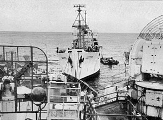
USNS Sword Knot (T-AGM-13) was a missile range instrumentation ship which operated as USAFS Sword Knot on the United States Air Force's Eastern Range during the late 1950s and early 1960s. Sword Knot operated under an Air Force contract with Pan American Airways Guided Missile Range Division headquartered in Cocoa Beach, Florida.

USNS Rose Knot (T-AGM-14) was a World War II era United States Maritime Commission small cargo ship built in 1945 and delivered to the War Shipping Administration for operation through agent shipping companies and for periods by the Military Sea Transportation Service (MSTS). In 1957 the ship was transferred to the Air Force and converted into a missile range instrumentation ship which operated as USAFS Rose Knot on the U.S. Air Force's Eastern Test Range during the late 1950s and early 1960s. Rose Knot operated under an Air Force contract with Pan American Airways Guided Missile Range Division headquartered in Cocoa Beach, Florida. In July 1964, all Air Force tracking ships were transferred to MSTS for operation with the Air Force in operational control while the ships were at sea as tracking ships. Rose Knot had special facilities for supporting the human spaceflight program and supported the early crewed flights. The ship was owned by the U.S. government until sold for non-transportation use in 1977.

USNS Timber Hitch (T-AGM-17) was a US Navy missile range instrumentation ship which earlier operated as the US Air Force Ocean Range VesselUSAFS Timber Hitch (ORV-17) on the US Air Force's Eastern Test Range during the late 1950s and early 1960s. Timber Hitch operated under an Air Force contract with Pan American Airways Guided Missile Range Division headquartered in Cocoa Beach, Florida.
USNS Sampan Hitch (T-AGM-18) was a missile range instrumentation ship which earlier operated as the U.S. Air Force Ocean Range VesselUSAFS Sampan Hitch (ORV-1836) on the U.S. Air Force's Eastern Test Range during the late 1950s and early 1960s. Sampan Hitch operated under an Air Force contract with Pan American Airways Guided Missile Range Division headquartered in Cocoa Beach, Florida.

The 23rd Space Operations Squadron is a satellite control unit of the United States Space Force. It is part of Space Delta 6 and is located at New Boston Space Force Station, New Hampshire. Prior to July 2020, part of the 50th Network Operations Group, itself a part of the 50th Space Wing.
Santa Rosa Island Air Force Station is a closed United States Air Force General Surveillance Radar station. It is 5.6 miles (9.0 km) south-southwest of Lompoc, California. It was closed in 1968 by the Air Force, and turned over to the Federal Aviation Administration (FAA).