Mochongoi

Last updated

Mochongoi
Kenya relief location map.jpg
Red pog.svg
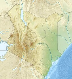
Mochongoi
Location of Mochongoi
Coordinates: 0°18′31″N36°11′32″E / 0.308635°N 36.192213°E / 0.308635; 36.192213
Country Kenya
County Baringo County

Mochongoi is a community and a division in Baringo County, Kenya. [1] Mochongoi is also an electoral ward in Marigat subcounty. [2] The town lies in the northern end of the Aberdare Range and is a relatively new settlement in what was the Ol Arabel forest reserve.

The Ol Arabel Forest Reserve is part of the Marmanet forests on the eastern escarpment of the Rift Valley, north of Nyahururu. The forest reserve, which is part of the upper catchment of the Ol Arabel River, once covered 9,629 hectares (23,790 acres), but 6,273 hectares (15,500 acres) were excised in 1993. No boundary plan was defined. [3] As a result, about 80% of the forest had been settled by the Mochongoi settlement scheme by 2008. [4]

The division covers 329 square kilometres (127 sq mi). In 2001 the population was 11,927. [5] The community includes a secondary school. [6] Maize farmers have protested that middlemen were not paying adequate prices. [7] In October 2007 President Mwai Kibaki said the government would pave the road from Mochongoi to Marigat so farmers could get their produce to market more easily. [8]

Related Research Articles

<span class="mw-page-title-main">Lake Baringo</span> Freshwater lake in Kenya

Lake Baringo is, after Lake Turkana, the most northern of the Kenyan Rift Valley lakes, with a surface area of 130 square kilometres (50 sq mi) and an elevation of 970 metres (3,180 ft). The lake is fed by several rivers: the Molo, Perkerra and Ol Arabel. It has no obvious outlet; the waters are assumed to seep through lake sediments into the faulted volcanic bedrock. It is one of the two freshwater lakes in the Rift Valley in Kenya, the other being Lake Naivasha.

<span class="mw-page-title-main">Nakuru</span> City in Nakuru County, Kenya

Nakuru is a city in the Rift Valley region of Kenya. It is the capital of Nakuru County, and is the third largest city in Kenya. As of 2019, Nakuru has a population of 570,674 inhabitants, making it the largest urban centre in the Rift Valley, succeeding Eldoret, Uasin Gishu County. The city lies along the Nairobi Nakuru Highway, 160 kilometres (99 mi) from Nairobi, Kenya.

<span class="mw-page-title-main">Alnwick/Haldimand</span> Township in Ontario, Canada

The Township of Alnwick/Haldimand is a township in central Ontario, Canada, in Northumberland County, situated between Lake Ontario and Rice Lake. It was formed in 2001 by the merger of Alnwick Township in the north and Haldimand Township in the south. Alderville First Nation is an autonomously governed First Nation contained within the township boundaries, in two non-contiguous sections along County Roads 45 and 18.

Kabarnet is a town in Baringo County, Kenya. As of the 2019 census,the town had a population of 22,474 with 10,943 (48.8%) of them being males and 11,531(51.1%) of them being females.

<span class="mw-page-title-main">Nandi County</span> County in Kenya

Nandi County is a county in Kenya in the North Rift, occupying an area of 2,884.4 square kilometres. Its capital, Kapsabet, is the largest town in the county while other towns include Mosoriot, Tinderet, Kobujoi, Kaiboi, Kabiyet and Nandi Hills. According to a 2019 census, the county had a population of 885,711, made up of a number of Kenyan communities, the majority of whom belong to the native tribe called Nandi.

<span class="mw-page-title-main">Turkana County</span> County in Kenya

Turkana County is a county in the former Rift Valley Province of Kenya. It is Kenya's largest county by land area of 71,597.8km2 followed by Marsabit County with an area of 66,923.1km2. It is bordered by the countries of Uganda to the west; South Sudan and Ethiopia, including the disputed Ilemi Triangle, to the north and northeast; and Lake Turkana to the east. To the south and east, neighbouring counties in Kenya are West Pokot, Baringo and Samburu Counties, while Marsabit County is on the opposite shore of Lake Turkana. Turkana's capital and largest town is Lodwar. The county had a population of 926,976 at the 2019 census.

<span class="mw-page-title-main">Kajiado County</span> County in Kenya

Kajiado County is a county in the former Rift Valley Province of Kenya. As of 2019, Kajiado county spanned an area of 21,292.7 km2, with a recorded population of 1,117,840. The county borders Nairobi and to its south it borders the Tanzanian regions of Arusha and Kilimanjaro. The county capital is Kajiado, but the largest town is Ongata Rongai. Its main tourist attraction is its wildlife.

<span class="mw-page-title-main">Local authorities of Kenya</span> Bodies controlling local governance in urban areas in Kenya

Local authorities in Kenya are the bodies controlling local governance in urban areas in Kenya.

<span class="mw-page-title-main">Mount Elgon National Park</span> National park in Uganda and Kenya

Mount Elgon National Park is a national park 140 kilometres (87 mi) northeast of Lake Victoria. The park covers an area of 1,279 square kilometres (494 sq mi) and is bisected by the border of Kenya and Uganda. The Ugandan part of the park covers 1,110 km2 (430 sq mi) while the Kenyan part covers 169 km2 (65 sq mi). The Kenyan part of the park was gazetted in 1968, the Ugandan part in 1992.

<span class="mw-page-title-main">Nyandarua County</span> County in Kenya

Nyandarua County is a County in the former Central Province of Kenya with its capital and largest town being Ol Kalou. Formerly the capital was Nyahururu, which is now part of the Laikipia County. Nyandarua County had a population of 596,268 by 2009 and 638,289 by 2019 and an area of 3,304 km2. The county is located on the northwestern part of the old Central Province, and contains the Aberdare Ranges.

<span class="mw-page-title-main">Baringo County</span> County in Kenya

Baringo County is one of the 47 counties in Kenya. It is located in the former Rift Valley Province. Its headquarters and largest town is Kabarnet. The county is home to Lake Baringo, Lake Bogoria and Lake Kamnarok.

<span class="mw-page-title-main">Macclesfield Forest</span>

Macclesfield Forest is an area of woodland, predominantly conifer plantation, located around 3 mi (5 km) south east of Macclesfield in the civil parish of Macclesfield Forest and Wildboarclough, in Cheshire, England.

<span class="mw-page-title-main">Gómez Farías Municipality, Tamaulipas</span> Municipality in Tamaulipas, Mexico

Gómez Farías Municipality is a municipality located in the Mexican state of Tamaulipas. The seat of government for the municipality is the town Gómez Farías. Gómez Farías Municipality has an area of 433 square kilometres (167 sq mi) and a population in 2010 of 8,786. The town of Gómez Farías had a population of 883 in 2010. 23,124 hectares of the municipal area is included in the El Cielo Biosphere Reserve.

Nakuru County Council is a defunct local authority in Kenya. It was one of the largest county councils in the country. It is home to a population of around 1.6 million, living on some 5,000 square kilometres in the central part of the country. The Nakuru area has a rich history, with human settlements dating back more than 3,000 years. The population is very diverse, with residents that have migratory background from different parts of the country. According to 2002 government statistics, on a population total of 1,312,555, the youth population up to age 25 years was 56%. The percentage of pre-primary and primary school going age residents was 31%, and the County’s total labour force population was 54%. The population growth rate is 3.4%.

<span class="mw-page-title-main">Timboroa</span>

Timboroa is a town in Baringo County, Kenya. It is located near the border with Uasin Gishu County with the boundary being the most northwesterly point of Timboroa Forest leading on to Tinderet Forest in a westerly direction. Timboroa lies along the Equator Line. The area is mainly covered with Bamboos Grasses. Other small townships located in Timboroa area are Matharu, Hilloti, Mumberes, Equator, Makutano, Mlango Moja through to Mlango Tano. The region has been home to a number of notable athletes, both male and female, including Bernard Barmasai.

Kuresoi Constituency was one of the five constituencies in Nakuru County, in the Rift valley province. Kenya. In 2012, Kuresoi district was split into two constituencies; Kuresoi North and Kuresoi South. A large part of kuresoi is the East Mau forest, part of the largest water catchment in Kenya, Mau forest. Two major rivers, Mara River and Sondu Miriu have their sources in Kuresoi, Molo River which drains into Lake Baringo has one of its tributaries Ribeti starting in Kuresoi.

<span class="mw-page-title-main">Perkerra River</span> River in Kenya

The Perkerra River is a river in the Great Rift Valley in Kenya that feeds the freshwater Lake Baringo. It is the only perennial river in the arid and semi-arid lands of the Baringo County. The Perkerra river supplies water to the Perkerra Irrigation Scheme in the Jemps flats near Marigat Township, just south of the lake.

Ol Arabel is a river in the Great Rift Valley of Kenya that feeds Lake Baringo. It gives its name to a forest covering its headwaters and to a region.

<span class="mw-page-title-main">Witu Forest</span>

The Witu Forest, is a protected area in Lamu District, Kenya, East Africa. It was formed in 1927 by combining the Utwani Forest Reserve with the adjacent Gongoni Forest Reserve, although the previous names remained in use. The independent Kenyan government confirmed the reservation, gazetting the forest in 1962, with 701 hectares more gazetted in 2002. The forest covers 4,639 hectares of gazetted land, with approximately 900 hectares of additional un gazetted, but enclosed, forest. The adjacent Mungajini Forest on the Nairobi Ranch contains approximately 1,100 hectares. As of 2007, there was no management plan for the forest, although it is to be managed under the Forests Act, 2005, by the Kenya Forest Service (KFS) which replaced the prior Forest Department in 2005.

<span class="mw-page-title-main">Protected areas of Vietnam</span>

Many areas of Vietnam are under protection. While the national reserves cover small areas of scientific significance with restricted access, the national parks also cover wetlands of Ramsar designated areas and BirdLife International inscribed bird areas. The largest of the national parks initially covered were the Cúc Phương National Park, the Cát Tiên National Park, and the Côn Đảo National Park which to start with were forest areas cum reserves or prohibited areas. The objective for creating national parks was to allow access to the reserved areas as a part of ecotourism and cultural needs with full attention to the basic approach of conservation of natural environmental resources.

References

  1. "BARINGO DISTRICT" (PDF). Reliefweb. Retrieved 2012-04-12.
  2. Rita Damary (19 January 2012). "Marigat protests IEBC boundary proposals". The Star. Retrieved 2012-04-12.
  3. "Mau Complex and Marmanet forests" (PDF). UNEP. 20 May 2008. Retrieved 2012-04-12.
  4. Hilary Kiprop. "Forest Allocation in Kenya". SMS Network. Retrieved 2012-04-12.[ permanent dead link ]
  5. "BARINGO DISTRICT - DISTRICT STRATEGIC PLAN 2005 - 2010" (PDF). National Coordinating Agency for Population and Development. May 2005. Retrieved 2012-04-12.[ permanent dead link ]
  6. "Mochongoi Secondary School". Education in Kenya. Retrieved 2012-04-12.
  7. "Maize Farmers Exploited". Kass Media. Archived from the original on 2012-03-08. Retrieved 2012-04-12.
  8. "President meets a goodwill delegation from Baringo Central". State House Kenya. October 18, 2007. Archived from the original on September 28, 2013. Retrieved 2012-04-12.