Related Research Articles

The Passaic River is a river, approximately 80 miles (130 km) long, in northern New Jersey. The river in its upper course flows in a highly circuitous route, meandering through the swamp lowlands between the ridge hills of rural and suburban northern New Jersey, called the Great Swamp, draining much of the northern portion of the state through its tributaries.

The Awash River is a major river of Ethiopia. Its course is entirely contained within the boundaries of Ethiopia and empties into a chain of interconnected lakes that begin with Lake Gargori and end with Lake Abbe on the border with Djibouti, some 100 kilometres from the head of the Gulf of Tadjoura. The Awash River is the principal stream of an endorheic drainage basin covering parts of the Amhara, Oromia and Somali Regions, as well as the southern half of the Afar Region. The Awash River basin, spanning 23 administrative zones, covers 10% of Ethiopia's area.

The Mareb River, also known as the Gash River, is a river flowing out of central Eritrea. Its chief importance is defining part of the boundary between Eritrea and Ethiopia, between the point where the Mai Ambassa enters the river at 14°53.6′N37°54.8′E to the confluence of the Balasa with the Mareb at 14°38′N39°1.3′E.

The Omo River in southern Ethiopia is the largest Ethiopian river outside the Nile Basin. Its course is entirely contained within the boundaries of Ethiopia, and it empties into Lake Turkana on the border with Kenya. The river is the principal stream of an endorheic drainage basin, the Turkana Basin.
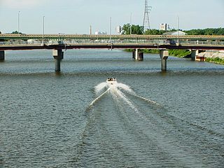
The Saginaw River is a 22.4-mile-long (36.0 km) river in the U.S. state of Michigan. It is formed by the confluence of the Tittabawassee and Shiawassee rivers southwest of Saginaw. It flows northward into the Saginaw Bay of Lake Huron, passing through the cities of Saginaw and Bay City, both of which developed around it in the 19th century. The watershed area is 8,595 square miles (22,260 km2). At its mouth, the river's estimated average discharge is 4,827 cubic feet per second (136.7 m3/s).
Ambassel is a woreda in Amhara Region, Ethiopia, and an amba, or mountain fortress, located in the woreda. The word Ambasel is derived from two words "Amba" from the Amharic word for plateau, and “Asel” from the Arabic language, which means honey. Together, it means “plateau of honey” or the “land of honey” the woreda is named for this feature. Located in the Debub Wollo Zone, Ambassel woreda is bordered on the west by the Bashilo which separates it from Tenta, on the north by the Semien Wollo Zone, on the southeast by the Mille River which separates it from Tehuledere, and on the south by Kutaber; the Walano, a tributary of the Bashilo, defines most of its southern border. Its largest town is Wuchale.

The Río Grande de Santiago, or Santiago River, is a river in western Mexico. It flows westwards from Lake Chapala via Ocotlán through the states of Jalisco and Nayarit to empty into the Pacific Ocean. It is one of the longest rivers in Mexico, measuring up 433 km (269 mi) long.
Ada'a is a woreda in Oromia Region, Ethiopia. It is part of the former Ada'a Chukala woreda what was divided between Ada'a and Liben woredas. Part of the East Shewa Zone located in the Great Rift Valley, Ada'a is bordered on the south by Dugda Bora, on the west by the West Shewa Zone, on the northwest by Akaki, on the northeast by Gimbichu, and on the east by Lome.
Lome, also spelled Lume, is a district of Ethiopia in Oromia State, Ethiopia. Part of the East Shewa Zone located in the Great Rift Valley, Lome is bordered on the south by the Koka Reservoir, on the west by Ada'a Chukala, on the northwest by Gimbichu, on the north by the Amhara Region, and on the east by Adama. Mojo is the capital of the woreda; other towns and cities include Ejerie and Koka.
Gimbichu is a woreda in Oromia Region, Ethiopia. Part of the East Shewa Zone, Gimbichu is bordered on the south by Lome, on the southwest by Ada'a Chukala, on the northwest by the Amhara Region, and on the east by the Afar Region. The administrative center is Chefe Donsa.
Digeluna Tijo is a woreda in Oromia Region, Ethiopia. Part of the Arsi Zone, Digeluna Tijo is bordered on the south by Bekoji, on the southwest by Munesa, on the northwest by Tiyo, on the north by Hitosa, on the northeast by Tena, and on the east by Sherka. The administrative center of this woreda is Sagure; other towns include Digelu and Tijo.
Dodola is one of the Aanaas in the Oromia of Ethiopia. It is named after the administrative center of the woreda, Dodola. It was the capital city of Ganale Awraja. Ganale's modern administration leadership was begun by Fit Awrary Woldemeckael Buie Falama(fiit awraarii Woldamikaa'el Bu'ii Falamaa). He was a single charismatic leader who attracted both his nation and the last Ethiopian king, Haile Selassie. Because of his impact and legacy, thousands of Ganale Awraja residents still remember him as their transforming leader who thought ahead of his time. Because he transformed his nation, a nation which never had school, road, telephone, or airport, to test the modern services, by starting modern education in 1940s and the second school 1950s, airport, road, and telephone. His nephew, Mekonnen Hassen Buie, who is best known as a great mediator and inclusiveness, kept his uncle's legacy and helped to build the first high school in the Awraja Ganale in 1961 and get adequate drinking water for his city. Today, Dodola is part of the West Arsi Zone with the capital city of west arsi zone is shashamene(Shaashamannee), Dodola is bordered on the south by Nensebo, on the west by Kokosa, on the north by the Shebelle River which separates it from the Kofele and Gedeb Asasa, and on the east by Adaba. Other towns include Herero.
Adaba is one of the Aanaas in the Oromia of Ethiopia; it shares the name of its administrative center, Adaba. Part of the West Arsi Zone, Adaba is bordered on the southwest by Nensebo, on the west by Dodola, on the northwest by the Shabelle River which separates it from the Gedeb Asasa, and on the east and south by Bale Zone.
Berbere is a woreda in Oromia Region, Ethiopia. Part of the Bale Zone, Berbere is bordered on the south by Mennana Harena Buluk, on the northwest by Goba, on the north by Sinanana Dinsho, on the northeast by Goro, and on the east by Guradamole; the Mena River separates it from Shinanana Dinsho and Goro. The administrative center of the woreda is Haro Dumal.

The ongoing pollution of the Ganges, the largest river in the Indian subcontinent, poses a significant threat to both human health and the environment. The river supplies water to approximately 40% of India's population across 11 states and serves an estimated 500 million people—more than any other river in the world.

Mojo is a town in central Ethiopia, named after the nearby Modjo River. Located in the East Shewa Zone of the Oromia Region, it has a latitude and longitude of 8°39′N39°5′E with an elevation between 1788 and 1825 meters above sea level. It is the administrative center of Lome district.
Gonde is a town in central Ethiopia. Located in the Arsi Zone of the Oromia Region to the south of Asella, on the river of the Gonde River, the town has a latitude and longitude of 8°03′N39°18′E with an elevation of 2,295 meters.

The Nura is a major watercourse of northeast-central Kazakhstan. It is 978 kilometres (608 mi) long and drains an area of 60,800 square kilometres (23,500 sq mi).

The River Calder is a river in West Yorkshire, in Northern England.
Haryana Environment Protection Council (HEPC) is an advisory committee formed in 2006 to advise the Ministry of Environment, Govt. of Haryana on environment issues. It is headquartered at Chandigarh. The committee was scheduled to be reconstituted in year 2011.
References
- ↑ Habtamu Dugo, "Environment in Peril in Oromia, Ethiopia", Independence Institute website, published 8 May 2009
- ↑ Wondwossen Sintayehu, "Action Professionals’ Association for the People vs. Environmental Protection Authority: Report on the Public Interest Litigation Case instituted at the Federal First Instance Court of Ethiopia" Archived 2011-07-25 at the Wayback Machine , submission to the Thematic Workshop on Governance, Civil Society Participation and Strengthening Partnerships for Chemicals and Waste Management and SAICM Implementation, United Nations Institute for Training and Research (accessed 24 April 2011)