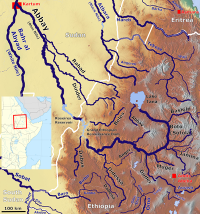
This is a list of streams and rivers in Ethiopia , arranged geographically by drainage basin. There is an alphabetic list at the end of this article.

This is a list of streams and rivers in Ethiopia , arranged geographically by drainage basin. There is an alphabetic list at the end of this article.


Abay River - Adabay River - Akaki River - Akobo River - Ala River - Alero River - Angereb River - Ataba River - Ataye River - Atbarah River - Awash River - Awetu River - Ayesha River-Dhadheba River-Lugita River
Balagas River - Baro River - Bashilo River - Beles River - Bilate River - Birbir River - Blue Nile - Borkana River
Dabus River - Dawa River - Dechatu River - Dembi River - Denchya River - Didessa River - Dinder River - Doha River - Dukem River
Galetti River - Ganale Dorya River - Gebba River - Gebele River - Germama River - Gestro River - Gidabo River - Gibe River - Gilgel Gibe River - Gilo River - Gojeb River - Golima River - Gololcha River - Greater Angereb River - Guder River - Gumara River
Jamma River - Jerer River - Jikawo River - Jubba River
Kabenna River - Karsa River - Katar River - Keleta River - Kibish River - Kulfo River
Lagabora River - Lesser Abay - Lesser Angereb - Logiya River
Mago River - Magech River - Mareb River - Meki River - Mena River - Mille River - Modjo River - Mofar River - Muger River - Mui River
Tekezé River Tella River Usno River - Ubbi Ubbi River
Wabe River - Walaqa River - Wajja River - Wanchet River - Wari River - Weito River - Weyib River - Welmel River

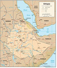
Ethiopia is located in the Horn of Africa. It is bordered by Eritrea to the north, Djibouti and Somalia to the east, Sudan and South Sudan to the west, and Kenya to the south. Ethiopia has a high central plateau, the Abyssinian Highlands that varies from 1,290 to 3,000 m above sea level, with some 25 mountains whose peaks rise over 4,000 meters (13,200ft), the highest being Ras Dashen at 4,543 meters (14,538ft).