Atlantic Ocean

- Campo River (Ntem River)
- Benito River (Mbini River) (Woleu River)
- Utamboni River
- Noya River
- Komo River
- Ogooué River
- Nkomi River
- Nyanga River
- Douigni River
This is a list of rivers in Gabon. This list is arranged by drainage basin, with respective tributaries indented under each larger stream's name.

The Mississippi River is the second-longest river and chief river of the second-largest drainage system on the North American continent, second only to the Hudson Bay drainage system. From its traditional source of Lake Itasca in northern Minnesota, it flows generally south for 2,340 miles (3,770 km) to the Mississippi River Delta in the Gulf of Mexico. With its many tributaries, the Mississippi's watershed drains all or parts of 32 U.S. states and two Canadian provinces between the Rocky and Appalachian mountains. The main stem is entirely within the United States; the total drainage basin is 1,151,000 sq mi (2,980,000 km2), of which only about one percent is in Canada. The Mississippi ranks as the thirteenth-largest river by discharge in the world. The river either borders or passes through the states of Minnesota, Wisconsin, Iowa, Illinois, Missouri, Kentucky, Tennessee, Arkansas, Mississippi, and Louisiana.

The Ohio River is a 981-mile (1,579 km) long river in the United States. It is located at the boundary of the Midwestern and Southern United States, flowing southwesterly from far-western Pennsylvania south of Lake Erie to its mouth on the Mississippi River at the southern tip of Illinois. It is the third largest river by discharge volume in the United States and the largest tributary by volume of the north-south flowing Mississippi River that divides the eastern from western United States. It is also the 6th oldest river on the North American continent. The river flows through or along the border of six states, and its drainage basin includes parts of 14 states. Through its largest tributary, the Tennessee River, the basin includes several states of the southeastern U.S. It is the source of drinking water for three million people.

The Yukon River is a major watercourse of northwestern North America. From its source in British Columbia, Canada, it flows through Canada's territory of Yukon. The lower half of the river continues westwards through the U.S. state of Alaska. The river is 3,190 kilometres (1,980 mi) long and empties into the Bering Sea at the Yukon–Kuskokwim Delta. The average flow is 6,400–7,000 m3/s (230,000–250,000 cu ft/s). The total drainage area is 833,000 km2 (321,500 sq mi), of which 323,800 km2 (125,000 sq mi) lies in Canada. The total area is more than 25% larger than Texas or Alberta.

The St. Lawrence River is a large river in the middle latitudes of North America, flowing from Lake Ontario in a roughly northeasterly direction into the Gulf of St. Lawrence, connecting the Great Lakes to the North Atlantic Ocean and forming the primary drainage outflow of the Great Lakes Basin. The river traverses the Canadian provinces of Ontario and Quebec as well as the U.S. state of New York, and is part of the international boundary between Canada and the United States. It also provides the basis for the commercial St. Lawrence Seaway.
The Merrimack River is a 117-mile-long (188 km) river in the northeastern United States. It rises at the confluence of the Pemigewasset and Winnipesaukee rivers in Franklin, New Hampshire, flows southward into Massachusetts, and then flows northeast until it empties into the Gulf of Maine at Newburyport. From Pawtucket Falls in Lowell, Massachusetts, onward, the Massachusetts–New Hampshire border is roughly calculated as the line three miles north of the river.

The Fraser River is the longest river within British Columbia, Canada, rising at Fraser Pass near Blackrock Mountain in the Rocky Mountains and flowing for 1,375 kilometres (854 mi), into the Strait of Georgia just south of the City of Vancouver. It is the 11th longest river in Canada. The river's annual discharge at its mouth is 112 cubic kilometres (27 cu mi) or 3,550 cubic metres per second (125,000 cu ft/s), and it discharges 20 million tons of sediment into the ocean.

The Tennessee River is the largest tributary of the Ohio River. It is approximately 652 miles (1,049 km) long and is located in the southeastern United States in the Tennessee Valley. The river was once popularly known as the Cherokee River, among other names, as the Cherokee people had their homelands along its banks, especially in what are now East Tennessee and northern Alabama. In addition, its tributary the Little Tennessee River, flows into it from Western North Carolina and northeastern Georgia, where it also was bordered by numerous Cherokee towns. Its current name is derived from the Cherokee town, Tanasi, which was located on the Tennessee side of the Appalachian Mountains.

The Dnieper, Dnipro or Dnyapro is one of the major rivers of Europe, rising in the Valdai Hills near Smolensk, Russia, before flowing through Belarus and Ukraine to the Black Sea. It is the longest river of Ukraine and Belarus and the fourth-longest river in Europe, after the Volga, Danube, and Ural rivers. The total length is approximately 2,200 km (1,400 mi) with a drainage basin of 504,000 square kilometres (195,000 sq mi).

The headwaters of a river or stream is the farthest place in that river or stream from its estuary or downstream confluence with another river, as measured along the course of the river. It is also known as a river's source.

The Cumberland River is a major waterway of the Southern United States. The 688-mile-long (1,107 km) river drains almost 18,000 square miles (47,000 km2) of southern Kentucky and north-central Tennessee. The river flows generally west from a source in the Appalachian Mountains to its confluence with the Ohio River near Paducah, Kentucky, and the mouth of the Tennessee River. Major tributaries include the Obey, Caney Fork, Stones, and Red rivers.
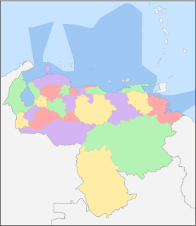
The Bolivarian Republic of Venezuela is a federation made up of twenty-three states, a Capital District and the Federal Dependencies, which consist of many islands and islets on the Caribbean Sea. Venezuela also claims the Guayana Esequiba territory which comprises six districts in the independent nation of Guyana.

The Yass River, a perennial river that is part of the Murrumbidgee catchment within the Murray–Darling basin, is located in the Southern Tablelands and South Western Slopes districts of New South Wales, Australia.
These historic properties and districts in the state of Texas are listed in the National Register of Historic Places. Properties and/or districts are listed in most of Texas's 254 counties.

A river is a natural flowing watercourse, usually freshwater, flowing towards an ocean, sea, lake or another river. In some cases, a river flows into the ground and becomes dry at the end of its course without reaching another body of water. Small rivers can be referred to using names such as stream, creek, brook, rivulet, and rill. There are no official definitions for the generic term river as applied to geographic features, although in some countries or communities a stream is defined by its size. Many names for small rivers are specific to geographic location; examples are "run" in some parts of the United States, "burn" in Scotland and northeast England, and "beck" in northern England. Sometimes a river is defined as being larger than a creek, but not always: the language is vague.
| Wikimedia Commons has media related to Rivers of Gabon . |