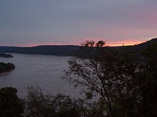
The Rio Grande, known in Mexico as the Río Bravo del Norte or simply the Río Bravo, is one of the principal rivers in the southwestern United States and in northern Mexico. The length of the Rio Grande is 1,896 miles (3,051 km). It originates in south-central Colorado, in the United States, and flows to the Gulf of Mexico. The Rio Grande drainage basin (watershed) has an area of 182,200 square miles (472,000 km2); however, the endorheic basins that are adjacent to and within the greater drainage basin of the Rio Grande increase the total drainage-basin area to 336,000 square miles (870,000 km2).

The Pecos River originates in north-central New Mexico and flows into Texas, emptying into the Rio Grande. Its headwaters are on the eastern slope of the Sangre de Cristo mountain range in Mora County north of Pecos, New Mexico, at an elevation of over 12,000 feet (3,700 m). The river flows for 926 miles (1,490 km) before reaching the Rio Grande near Del Rio. Its drainage basin encompasses about 44,300 square miles (115,000 km2).
The Uruguay River is a major river in South America. It flows from north to south and forms parts of the boundaries of Brazil, Argentina, and Uruguay, separating some of the Argentine provinces of La Mesopotamia from the other two countries. It passes between the states of Santa Catarina and Rio Grande do Sul in Brazil; forms the eastern border of the provinces of Misiones, Corrientes, and Entre Ríos in Argentina; and makes up the western borders of the departments of Artigas, Salto, Paysandú, Río Negro, Soriano, and Colonia in Uruguay.

Neuquén is a province of Argentina, located in the west of the country, at the northern end of Patagonia. It borders Mendoza Province to the north, Rio Negro Province to the southeast, and Chile to the west. It also meets La Pampa Province at its northeast corner.

Mount Saint Elias, the second-highest mountain in both Canada and the United States, stands on the Yukon and Alaska border about 26 miles (42 km) southwest of Mount Logan, the highest mountain in Canada. The Canadian side of Mount Saint Elias forms part of Kluane National Park and Reserve, while the U.S. side of the mountain is located within Wrangell-St. Elias National Park and Preserve.

Elías Piña is a westernmost province which composing one of the 32 provinces of the Dominican Republic. It is divided into 6 municipalities and its capital city is Comendador. It is bordered by the provinces of Dajabón to the north-west, Santiago Rodríguez to the north-east, San Juan to the east, Independencia to the south and the Nord-Est department of Haiti to the west.

The Yaqui River is a river in the state of Sonora in northwestern Mexico. It was formerly known as the Rio del Norte. Being the largest river system in the state of Sonora, the Yaqui river is used for irrigation, especially in the Valle del Yaqui.

Atna Peaks is an eroded stratovolcano or shield volcano in the Wrangell Mountains of eastern Alaska. It is located in Wrangell–Saint Elias National Park about 6 miles (9.7 km) east of Mount Blackburn, the second-highest volcano in the United States, and just south of the massive Nabesna Glacier. Because the mountain is almost entirely covered in glaciers, no geological studies have been done, but published references state and the geological map shows that the mountain is an old eroded volcanic edifice.

Novo Airão is a municipality located in the state of Amazonas in northern Brazil on the Rio Negro River about 180 km upstream of Manaus. Its population was 19,928 (2020) and its area is 37,771 km². The town is reachable both by river and road.
Río Matilde is a short river in the municipality of Ponce, Puerto Rico. It forms from the confluence of Rio Pastillo and Rio Canas. Río Matilde is one of the 14 rivers in the municipality and, forming at an altitude of just 15 feet (4.6 m), it forms at an altitude lower than any other river in the municipality.

Prieto River is a river in the municipality of Ponce, Puerto Rico. It is located in the northeastern area of the municipality. Forming at an altitude of 3,920 feet (1,190 m), Río Prieto originates at the second highest point of any river in the municipality after Río Inabon. It empties into Río Cerrillos. Together with Río Blanco, Río Prieto is one of the two rivers in Ponce with mouths at the highest elevation. This river is one of the 14 rivers in the municipality.
Tarairiú is an extinct and very poorly known language of eastern Brazil. The Tarairiu nation was divided into several tribes: the Janduí, Kanindé, Paiaku, Jenipapo, Jenipabuçu, Javó, Kamaçu, Tukuriju, Ariu, and "Xukuru" / Xacó.