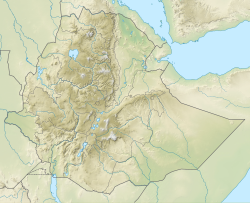
Germama River | |
---|---|
Location | |
Country | Ethiopia |
Physical characteristics | |
Source | |
• coordinates | 9°06′37″N39°11′49″E / 9.1104°N 39.1969°E |
• elevation | 1,989 m (6,526 ft) |
Mouth | Awash River |
• coordinates | 9°13′22″N40°08′38″E / 9.2229°N 40.144°E |
The Germama (or Kesem or Kessem) River, is a tributary of the Awash River in Ethiopia. The name Germama comes from the Amharic word which means "frolicking", "boisterous", or "frisky". [1]
The Germama is not a navigable stream, and flows with a great volume during the rainy season. It rises west of Kese Koremash, flowing east to the Awash, its course delineating a few kilometers of the northern boundary of the Awash National Park. The Kessem River passes an altitude drop from more than 2000 m on a flow length of ca.130 km. [2] The steep gadient of the river profile is the reason for its turbulent flow regime, which is also reflected in its name. The lowlands of the upper Germama was the location of the former Shewan district of Bulga; [3] the lower course defines the northern boundary of the Shewan district of Menjar.
The Ethiopian Ministry of Water Resources began construction of a dam on the Germama in 2005, which would help irrigate areas along both sides of the river, and in the Dofen and Kebena Mountains. [4] In December 2008, a spokesman for the Ministry announced that the project was 98% complete. [5]
Coordinates: 9°13′30″N40°05′49″E / 9.2250°N 40.0969°E
The Nile is a major north-flowing river in northeastern Africa. It flows into the Mediterranean Sea. The Nile is the longest river in Africa and has historically been considered the longest river in the world, though this has been contested by research suggesting that the Amazon River is slightly longer. Of the world's major rivers, the Nile is one of the smallest, as measured by annual flow in cubic metres of water. About 6,650 km (4,130 mi) long, its drainage basin covers eleven countries: the Democratic Republic of the Congo, Tanzania, Burundi, Rwanda, Uganda, Kenya, Ethiopia, Eritrea, South Sudan, Republic of the Sudan, and Egypt. In particular, the Nile is the primary water source of Egypt, Sudan and South Sudan. Additionally, the Nile is an important economic river, supporting agriculture and fishing.
Ethiopia is located in the Horn of Africa. It is bordered by Eritrea to the north, Djibouti and Somalia to the east, Sudan and South Sudan to the west, and Kenya to the south. Ethiopia has a high central plateau that varies from 1,290 to 3,000 m above sea level, with the highest mountain reaching 4,620 m (15,157 ft).
The Awash is a major river of Ethiopia. Its course is entirely contained within the boundaries of Ethiopia and empties into a chain of interconnected lakes that begin with Lake Gargori and end with Lake Abbe on the border with Djibouti, some 100 kilometres from the head of the Gulf of Tadjoura. It is the principal stream of an endorheic drainage basin covering parts of the Amhara, Oromia and Somali Regions, as well as the southern half of the Afar Region.
The Mareb River, or Gash River is a river flowing out of central Eritrea. Its chief importance is defining part of the boundary between Eritrea and Ethiopia, between the point where the Mai Ambassa enters the river at 14°53.6′N37°54.8′E to the confluence of the Balasa with the Mareb at 14°38′N39°1.3′E.
The Bashilo River is located in Ethiopia. Known for its canyon, which one source describes as almost as extensive as the canyon of its parent the Abay, also known as the Blue Nile, the river originates just west of Kutaber in the Amhara Region, flowing first to the northwest to where the Tergiya empties into it, then to the southwest to its confluence with the Abay. Its drainage area is about 13,242 square kilometers in size, covering portions of the Semien Gondar, Semien Wollo and Debub Wollo Zones. Its tributaries include the Checheho, and the Walano.
Asaita (Amharic: አሳይታ, Asayəta; Afar: Aysaqiita), known historically as Aussa (Awsa), is a town in northeastern Ethiopia, and until 2007 served as the capital of the Afar Region of Ethiopia. Located in the Afambo woreda, part of the region's Awsi Rasu zone, the town has a latitude and longitude of 11°34′N41°26′E and an elevation of 300 metres (980 ft).
Gabi Rasu, also known as Administrative Zone 3, is a zone in the Afar Region of Ethiopia. This zone is bordered on the south by the Oromia Region, on the southwest by the Amhara Region, on the west by Hari Rasu, on the north by Awsi Rasu, and on the east by the Somali Region.
Dubti is a woreda in Afar Region, Ethiopia. Part of the Administrative Zone 1, Dubti is bordered on the south by the Somali Region, on the southwest by Mille, on the west by Chifra, on the northwest by the Administrative Zone 4, on the north by Kori, on the northeast by Elidar, on the east by Asayita, and on the southeast by Afambo. Towns in Dubti include Dubti, Logiya, and Semera.
Awash Fentale is a woreda in Afar Region, Ethiopia. Part of the Administrative Zone 3, Awash Fentale is bordered on the south by the Oromia Region, on the west by the Amhara Region, on the north by Dulecha, and on the east by Amibara. Towns in Awash Fentale include Awash Sebat Kilo and Sabure.
Berehet is one of the woredas in the Amhara Region of Ethiopia. Part of the Semien Shewa Zone, Berehet is bordered on the south by the Germama River which separates it from Menjarna Shenkora, on the west by Hagere Mariamna Kesem, on the north by Asagirt, and on the east by the Afar Region. The major town in Berehet is Metiteh Bila.
Minjarna Shenkora, also Menjarna Shenkora is a woreda in Amhara Region, Ethiopia. It is named in part after the historic Shewan district of Minjar, which was the southernmost district of Shewa and near the location of the modern woreda. Located at the southern end of the Semien Shewa Zone, Minjarna Shenkora is bordered on the east, south and west by the Oromia Region, on the northwest by Hagere Mariamna Kesem, and on the northeast by Berehet; the Germama river forms the boundary between this woreda and Hagere Mariamna Kesem and Berehet. The administrative center of this woreda is Arerti; other towns in the woreda include Balchi and Eranbuti.
Akaki is a woreda in Oromia Region, Ethiopia. Part of the Oromia Special Zone Surrounding Finfinne, Akaki is bordered on the southwest by the Southwest Shewa Zone, on the west by Sebeta Hawas, on the northwest by Addis Ababa, on the north by the Bereh, and on the east by East Shewa Zone. The administrative center of this woreda is Dukem.
The Koka Reservoir is a reservoir in south-central Ethiopia. It was created by the construction of the Koka Dam across the Awash River. The reservoir has an area of 180 square kilometers.
Mieso is a town in eastern Ethiopia. Located in the West Hararghe Zone of the Oromia Region, it has a latitude and longitude of 9°14′N40°45′E with an elevation of 1394 meters above sea level.
The Jamma River is a river in central Ethiopia and a tributary to the Abay. It drains parts of the Semien Shewa Zones of the Amhara and Oromia Regions. The Upper Jamma flows through steep, deep canyons cut first through volcanic rock and then through the Cretaceous sandstone and shaly sandstone, with Jurassic limestone at the bottom. It has a drainage area of about 15,782 square kilometers in size. Tributaries include the Wanchet.
The Muger River is a north-flowing tributary of the Abay River in central Ethiopia, which is notable for its deep gorge. Its confluence with the Abay is at: 9°55′07″N37°55′50″E. Tributaries of the Muger include the Labbu. The Muger has a drainage area of about 8,188 square kilometers.
The Ganale Doria River is a perennial river in southeastern Ethiopia. Rising in the mountains east of Aleta Wendo, the Ganale flows south and east to join with the Dawa at the border with Somalia to become the Jubba. The river's tributaries include the Welmel, Weyib, Dumale, Doya, Hawas and the Hambala. The Del Verme Falls is a notable feature of its middle course.
The Logiya, or Logia, is a river of east-central Ethiopia, a left tributary of the Awash River.
Bulga is a former historical region of Ethiopia in the central part of Shewa. It was bounded by the Germama river to the south, which formed the historical boundary between it and Minjar in the south. It presently encompasses the modern woredas of Hagere Mariamna Kesem, Asagirt, and Berehet.