Mogolo موقولو | |
---|---|
Town | |
Coordinates: 15°18′43″N37°38′31″E / 15.31194°N 37.64194°E Coordinates: 15°18′43″N37°38′31″E / 15.31194°N 37.64194°E | |
Country | |
Region | Gash-Barka |
District | Mogolo |
Elevation | 675 m (2,215 ft) |
Mogolo (Arabic : موقولو) is a city in the western Gash-Barka region of Eritrea.
Gash-Barka is one of the six regions of Eritrea. It is situated in the south-west of the country, bordering the Anseba region to the north, and the Maekel (Central) and Debub (Southern) regions to the east; the country of Sudan lies to the west and Ethiopia to the south.
The regions of Eritrea are the primary geographical divisions through which Eritrea is administered. Six in total, they include the Maekel/Central, Anseba, Gash-Barka, Debub/Southern, Northern Red Sea and Southern Red Sea regions.
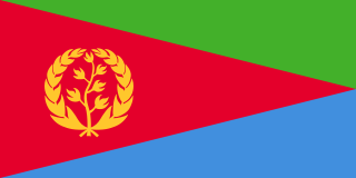
EritreaState of Eritrea, is a country in the Horn of Africa, with its capital at Asmara. It is bordered by Sudan in the west, Ethiopia in the south, and Djibouti in the southeast. The northeastern and eastern parts of Eritrea have an extensive coastline along the Red Sea. The nation has a total area of approximately 117,600 km2 (45,406 sq mi), and includes the Dahlak Archipelago and several of the Hanish Islands. Its toponym Eritrea is based on the Greek name for the Red Sea, which was first adopted for Italian Eritrea in 1890.
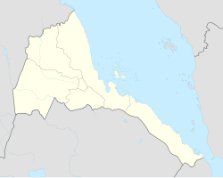
It is the principal town in the Mogolo district of the Gash-Barka region.
Mogolo Subregion is a subregion in the Gash-Barka region of western Eritrea. Its capital lies at Mogolo.
The six regions of Eritrea are divided into administrative subregions.
Nearby towns and villages include Chibabo (2.3 nm), Attai (4.1 nm), Abaredda (6.7 nm), Algheden (14.7 nm), Bet Mahala (18.6 nm), Aula (8.0 nm) and Samero (8.0 nm).
Chibabo is a village in western Eritrea. It is located in Mogolo Subregion in the Gash-Barka region.
Attai is a village in western Eritrea.
Abaredda is a town in western Eritrea. It is located in Mogolo subregion in the Gash-Barka region.
This Eritrea location article is a stub. You can help Wikipedia by expanding it. |
Tidjikja is the capital of the Tagant region of central Mauritania, lying on the Tagant plateau. Founded in 1680, it has a population of around 11,000 people.
Barentu is a town in north-western Eritrea, lying south of Agordat, and is the capital of Gash-Barka Region. The town is integrated with different types of tribes: Kunama, Nara, Tigre and Tigrigna being the dominant.
Hambok is a village in western Eritrea. It is located in Gogne District in the Gash-Barka region.
Mescul is a town in western Eritrea.
Akurdet Subregion is a subregion in the western Gash-Barka region of Eritrea. Its capital lies at Akurdet.
Dghe Subregion is a subregion in the western Gash-Barka region of Eritrea. Its capital lies at Dghe.
Haykota Subregion is a subregion in the western Gash-Barka region of Eritrea. Its capital lies at Haykota.
Shambuko Subregion is a subregion in the western Gash-Barka region of Eritrea. Its capital lies at Shambuko.
Molki Subregion is a subregion in the Gash-Barka region of western Eritrea. Its capital lies at Molki.
The Upper Gash Subregion is a subregion in the Gash-Barka region of western Eritrea.
Markaughe is a town in western Eritrea. It is located in the Gogne subregion of the Gash-Barka region, approximately 35 km northwest of Barentu.
Ad Casub is a village in western Eritrea. It is located in Gogne District in the Gash-Barka region.
Antalla is a village in western Eritrea. It is situated approximately 50 km north-west of Barentu.
Bitama is a village in western Eritrea.
Adendema is a village in western Eritrea. It is located 5.8 miles south-west of the district capital of Haykota in Haykota District in the Gash-Barka region. It lies on the north-east boundary of the Gash-Setit wildlife reserve.
Tauda is a town in western Eritrea.