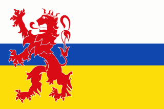
Limburg is the southernmost of the 12 provinces of the Netherlands. The province is bordered by the province of Gelderland to the north and by North Brabant to its west. Its long eastern boundary forms the international border with the state of North Rhine-Westphalia in Germany. To the west is the international border with the similarly named Belgian province of Limburg, part of which is delineated by the river Meuse. The Vaalserberg is on the extreme south-eastern point, marking the tripoint of the Netherlands, Germany and Belgium.

The Meuse or Maas is a major European river, rising in France and flowing through Belgium and the Netherlands before draining into the North Sea from the Rhine–Meuse–Scheldt delta. It has a total length of 925 km.

Gelderland, also known as Guelders in English, is a province of the Netherlands, occupying the centre-east of the country. With a total area of 5,136 km2 (1,983 sq mi) of which 173 km2 (67 sq mi) is water, it is the largest province of the Netherlands. Gelderland shares borders with six other provinces and the German state of North Rhine-Westphalia.

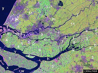
IJsselmonde is a river island in the Netherlands, between the Nieuwe Maas, Noord and Oude Maas branches rivers of the Rhine-Meuse delta in the province of South Holland. The city of Rotterdam now occupies most of the northern part of the island and includes the eponymous former village of IJsselmonde, once a separate community. The island was once a rich agricultural region, but is mostly suburbs today. Only the mid-south parts of the island have retained their agricultural character.

Mook en Middelaar is a municipality in the upper southeastern part of the Netherlands, at the northern tip of the province of Limburg and is a part of Stadsregio Arnhem Nijmegen. The municipality is located about 100 km from provincial capital Maastricht and has an area of 18.81 km2 (7.26 sq mi) of which 1.43 km2 (0.55 sq mi) is water.

Druten is a municipality and a town in the eastern Netherlands. The municipality covers the eastern part of the Land van Maas en Waal region of the province of Gelderland.

West Maas en Waal is a municipality in the Dutch province of Gelderland.

The Afgedamde Maas is a former distributary of the Maas River in the Dutch provinces of North Brabant and Gelderland. The Maas splits near Heusden with one channel flowing north until its confluence with the river Waal to form the Merwede, while the other channel continues west as the main distributary of the Maas.

Angeren is a village in the municipality of Lingewaard, Gelderland province, Netherlands. It has a population of 2,851, and is located in the very eastern tip of the Betuwe, 2 km to the south of Huissen, between the cities of Arnhem and Nijmegen.

Arcen is a village in the Dutch province of Limburg. In 2010, it became part of the municipality of Venlo. Previously, it had been part of the municipality of Arcen en Velden and the seat of the town hall.

Alem is a village in the Dutch province of Gelderland. It is a part of the municipality of Maasdriel, and lies about 10 km north of 's-Hertogenbosch.

Appeltern is a village in the Dutch province of Gelderland. It is a part of the municipality of West Maas en Waal, and lies about 9 km northeast of Oss. Until 1984, Appeltern was an independent municipality.

Beneden-Leeuwen is a town in the Dutch province of Gelderland. It is a part of the municipality of West Maas en Waal, and lies about 7 km east of Tiel, on the opposite (southern) bank of the river Waal. Beneden-Leeuwen has 6,925 inhabitants on 1 July 2021. It is the Catholic part of the former village Leeuwen.
Molenhoek is the name of several Dutch and Belgian villages:

Bern is a hamlet in the Dutch province of Gelderland. It is located in the municipality of Zaltbommel, about 10 kilometres south of the town Zaltbommel.
Hard and soft G in Dutch refers to a phonological phenomenon of the pronunciation of the letters ⟨g⟩ and ⟨ch⟩ and also a major isogloss within that language.

The Maas–Waal Canal is a canal in the Netherlands that connects the river Meuse to the river Waal. The channel is about 13.5 kilometres (8.4 mi) long and runs from Weurt to the south and ends at Heumen. The connection of the Meuse and the Maas–Waal Canal is the tripoint between the provinces of Gelderland, Limburg and North Brabant.

The Rijk van Nijmegen is a region in the southeast of Gelderland. The region is located around the city of Nijmegen, south of the Waal and east of the Land van Maas en Waal.

Moordhuizen is a hamlet in the Dutch province of Gelderland. It is a part of the municipality of West Maas en Waal and is located about 3 kilometres (1.9 mi) from Alphen. The hamlet is notable for its name, and is the location of the Quarles van Ufford pumping station.


