
Aarhus is the second-largest city in Denmark and the seat of Aarhus Municipality. It is located on the eastern shore of Jutland in the Kattegat sea and approximately 187 kilometres (116 mi) northwest of Copenhagen.

Skejby is a neighbourhood and former village in Aarhus, Denmark. The neighbourhood is part of the city district Aarhus N.

Brabrand is a postal district of Aarhus Municipality, Denmark. South of Brabrand, in the Aarhus river-valley, is the largest recreational area of Aarhus Municipality, comprising the Brabrand Lake and the meadow-lake of Årslev, with surrounding natural sites.
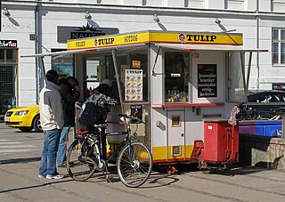
Pølsevogn(e) are hot dog stands that sell Danish-style hot dogs, such as rød pølse, and sausages as street food. Today, some are mobile, and some are, despite their names, permanent structures. They are equipped with a small kitchen, boilers, an external desk and room for a pølsemand (sausage-man) preparing and selling hot dogs to passing customers. Pølsevogne are numerous across Denmark and are popular among Danes and tourists alike.

Vestereng is a nature site in the environs of northern Aarhus and the suburb of Skejby. The name literally translates as 'westward meadow'. The Municipality of Aarhus took ownership in 1939.
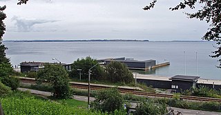
Den Permanente is a sea bath and a beach in Aarhus, Denmark.
Hasle is a large neighbourhood of Aarhus in Denmark. It is located 3 km north-west of the Aarhus city centre and is part of postal district Aarhus V.

Skåde is a neighbourhood of Højbjerg, a southern district of Aarhus in Denmark. It is located 6 km south from the city centre.
Trige is a town and suburb of Aarhus in Denmark. It has a population of 3,263.
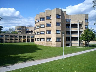
Vejlby is a north-eastern neighbourhood of Aarhus in Denmark. It is located 5km from the city centre and is administratively part of the district of Risskov.
Aarhus N is a postal district in the city of Aarhus, consisting of Trøjborg, Risskov, Vejlby, Skejby, Vorrevangen and Christiansbjerg, all with postal code 8200. Aarhus N is an abbreviation for Aarhus Nord and is located north of the city centre. It is the highest lying area of Aarhus.
Aarhus Vest or Aarhus V, is a postal district in the city of Aarhus, consisting of Hasle, Herredsvang, Møllevangen and Frydenlund.

Riis Skov is a forest and park in Århus, Denmark. It is located south of the district of Risskov, along the Bay of Aarhus.

Skjoldhøjkilen is a recreational and natural site, in the district of Brabrand in the western part of Aarhus in Denmark. It stretches westwards from Hasle Hills, like a wavy green strip of meadows, small lakes and woodlands. It is 3.5 km long and just as Hasle Hills, it is administered by the self-governing institution 'Hasle Bakker'.
New Forests of Aarhus is the collective name for a series of woodlands near the city of Aarhus in Denmark. All the forests have recently been planted as part of the plan called Aarhus omkranset af skov. The plan was initiated by the Aarhus city council in 1988, with the overall aim of doubling the municipality's forested area by the year 2000. As the old forests comprised 1,300 ha, there is controversy whether this goal has been met entirely.
Marselisborg is a small borough of Aarhus, Denmark. Being small and situated just south of Frederiksbjerg, Marselisborg is often considered part of Frederiksbjerg.

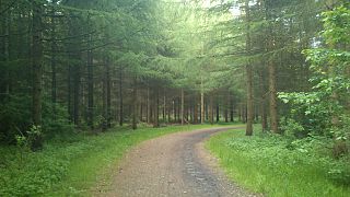
True Skov is a 385 hectares woodland, west of Skjoldhøjkilen in Aarhus, Denmark.

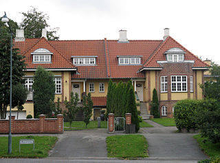
Trøjborg is a neighborhood in the city of Aarhus, Denmark in Skt. Johannes parish with about 11,000 residents as of 2015. The neighborhood is part of the district Aarhus N and borders the neighborhoods Nørre Stenbro to the South West, Risskov to the North and Riis Skov and the Bay of Aarhus to the East. Trøjborg is delimited by the streets Dronning Margrethesvej, Trøjborgvej and Nordre Ringgade.

Marienlyst Park is a public park in Hasle in the Aarhus V district, north-west Aarhus, Denmark. The park is situated west of the Herredsvang neighborhood along the street Fjældevænget Busvej to the south and Brendstrup Forest to the west. Marienlyst Park is one of the largest parks in Aarhus and features both landscaped lawns and artificial forested hills. Facilities include an amphitheatre, soccer fields, playgrounds and a 6-hole golf course. Marienlyst Park was established in connection with the development of western Hasle in the 1970s and today forms part of a green corridor extending from Vestereng to Brabrand Lake. The park is owned by Aarhus Municipality and is managed by the municipal department Natur og Miljø. Marienlyst Park can be rented for public events.

Bellevue Beach is a public Blue Flag beach park in Aarhus, Denmark. It is located in the northern district of Aarhus N, 4 kilometres from the city centre, on the Bay of Aarhus.

