
Rock County is a county located in the southwestern corner of the U.S. state of Minnesota. According to the 2020 census, its population was 9,704. The county seat is Luverne. It is located within the Sioux Falls MSA.

Renville County is a county in the U.S. state of Minnesota. As of the 2020 census the population was 14,723. Its county seat is Olivia.

Nobles County is a county in the U.S. state of Minnesota. As of the 2020 census, the population was 22,290. Its county seat is Worthington. Nobles County comprises the Worthington, MN Micropolitan Statistical Area.

Lyon County is a county in the U.S. state of Minnesota. As of the 2020 census, the population was 25,269. Its county seat is Marshall.

Le Sueur County is a county located in the south central portion of the U.S. state of Minnesota. As of the 2020 census, the population was 28,674. Its county seat is Le Center.

Lake County is a county in the U.S. state of Minnesota. As of the 2020 census, the population was 10,905. Its county seat is Two Harbors.

Hubbard County is a county in the northwestern part of the U.S. state of Minnesota. As of the 2020 census, the population was 21,344. Its county seat is Park Rapids.

Cottonwood County is a county in the U.S. state of Minnesota. As of the 2020 census, the population was 11,517. Its county seat is Windom.

Chisago County is a county in the east-central part of the U.S. state of Minnesota. The county covers an area of 442 square miles and, as of the 2020 Census, had a population of 56,621 people. It is part of the Minneapolis-St. Paul-Bloomington Metropolitan Statistical Area. The county's largest city is North Branch. Within Chisago County is the Chisago Lakes area, which includes the combined areas of Shafer, Chisago City, Lindström, and Center City. Center City is the county seat. The county has a diverse economy, including manufacturing, agriculture, and tourism.

Brown County is a county in the U.S. state of Minnesota. As of the 2020 census, the population was 25,912. Its county seat is New Ulm. The county was formed in 1855 and organized in 1856.

Alexandria is a city in and the county seat of Douglas County, Minnesota, United States. The population was 14,335 as of the 2020 census. Alexandria is near I-94, along Minnesota State Highways 27 and 29. It is ten miles south of Lake Carlos State Park.
Stark Township is a township in Brown County, Minnesota, United States. The population was 384 as of the 2000 census.

Chanhassen is a city in Carver County, Minnesota about 16 miles southwest of Minneapolis. A small portion extends into Hennepin County. Located in the southwest Minneapolis–Saint Paul suburbs, there is a mix of suburban residential neighborhoods and rural landscapes. The population was 25,947 at the 2020 census, with a 2024 estimate of 26,469.

Northeast Ohio is a geographic and cultural region that comprises the northeastern counties of the U.S. state of Ohio. Definitions of the region consist of 16 to 23 counties between the southern shore of Lake Erie and the foothills of the Appalachian Mountains, home to over 4.5 million people. It is anchored by the metropolitan area of Cleveland, the most populous city in the region with over 372,000 residents in 2020. Other metropolitan centers include Akron, Canton, Mansfield, Sandusky, and Youngstown. Northeast Ohio includes most of the area known historically as the Connecticut Western Reserve.

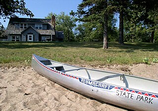
Lake Louise State Park is a Minnesota state park just north of the Iowa border near the small town of Le Roy in Mower County, Minnesota, directly south of Rochester. It has a 25 acre man-made lake and 1,168 acres (5 km2) of mixed prairie and deciduous forest. It is used for picnics, swimming, camping, hiking, horseback riding, and other outdoor recreation. It is noted for butterfly watching, as some rare species have been seen. It features a picnic shelter which dates to the Public Works Administration era.
Bachelor Lake is a lake in Brown County, Minnesota in the northeastern part of Stark township. Covering 79.80 acres, it is an officially protected water of the State of Minnesota. The lake is within the Cottonwood River Major Watershed. The lake’s elevation is 1,004 feet (306 m), and it is zoned as a shoreland area which is regulated as a shoreland management water.
Glendalough State Park is a state park of Minnesota, USA, in Otter Tail County near Battle Lake close to Minnesota State Highway 78. It is named after Glendalough in Ireland. The park was once used as a resort and game farm by the owners of Cowles Media Company, owner of what is today the Star Tribune newspaper. The park contains 1,931 acres (7.81 km2) on land and 1,000 acres (4.0 km2) on the water. Cowles Media Company transferred title to Glendalough to the Nature Conservancy in 1990, and the Nature Conservancy transferred title to the State of Minnesota in 1992. Glendalough was officially declared a state park with a celebration on Earth Day, April 22, 1992.

Molly Stark, née Elizabeth Page was the wife of General John Stark, made famous by his battle cry during the American Revolutionary War. Described as "mother of 11 children, homemaker, patriot, and defender of the household", there are locations and landmarks named for her in at least four states.

Nimishillen Township is one of the seventeen townships of Stark County, Ohio, United States. The 2020 census found 9,354 people in the township.

Wisconsin, a state in the Midwestern United States, has a vast and diverse geography famous for its landforms created by glaciers during the Wisconsin glaciation 17,000 years ago. The state can be generally divided into five geographic regions—Lake Superior Lowland, Northern Highland, Central Plain, Eastern Ridges & Lowlands, and Western Upland. The southwestern part of the state, which was not covered by glaciers during the most recent ice age, is known as the Driftless Area. The Wisconsin glaciation formed the Wisconsin Dells, Devil's Lake, and the Baraboo Range. A number of areas are protected in the state, including Devil's Lake State Park, the Apostle Islands National Lakeshore, and the Chequamegon–Nicolet National Forest.
