
The Aller is a 215-kilometre-long (134 mi) river in the states of Saxony-Anhalt and Lower Saxony in Germany. It is a right-hand, and hence eastern, tributary of the Weser and is also its largest tributary. Its last 117 kilometres (73 mi) form the Lower Aller federal waterway. The Aller was extensively straightened, widened and, in places, dyked, during the 1960s to provide flood control of the river. In a 20-kilometre-long (12 mi) section near Gifhorn, the river meanders in its natural river bed.

Lüneburg Heath is a large area of heath, geest, and woodland in the northeastern part of the state of Lower Saxony in northern Germany. It forms part of the hinterland for the cities of Hamburg, Hanover and Bremen and is named after the town of Lüneburg. Most of the area is a nature reserve. Northern Low Saxon is still widely spoken in the region.

The Sandy River is a 56-mile (90 km) tributary of the Columbia River in northwestern Oregon in the United States. The Sandy joins the Columbia about 14 miles (23 km) upstream of Portland.

Lake Superior Provincial Park is one of the largest provincial parks in Ontario, covering about 1,550 square kilometres (600 sq mi) along the northeastern shores of Lake Superior between Sault Ste. Marie and Wawa in Algoma District in Northeastern Ontario, Canada. Ontario Highway 17 now runs through the park. When the park was established by Ontario in 1944, there was no road access.

The Driftless Area, also known as Bluff Country and the Paleozoic Plateau, is a topographical and cultural region in the Midwestern United States that comprises southwestern Wisconsin, southeastern Minnesota, northeastern Iowa, and the extreme northwestern corner of Illinois. The Driftless Area is a USDA Level III Ecoregion: Ecoregion 52. The Driftless Area takes up a large portion of the Upper Midwest forest–savanna transition. The eastern section of the Driftless Area in Minnesota is called the Blufflands, due to the steep bluffs and cliffs around the river valleys. The western half is known as the Rochester Plateau, which is flatter than the Blufflands. The Coulee Region is the southwestern part of the Driftless Area in Wisconsin. It is named for its numerous ravines.

The Chester County Council is a Boy Scouts of America service council that serves members of the Cub Scouts, Scouts BSA, and Venturing programs in Chester County, Pennsylvania and Northeastern Cecil County, Maryland. It is one of the oldest councils in the nation, and is one of two single-county councils left in Pennsylvania, the other being Chief Cornplanter Council in Warren, PA.

Hogenakkal Falls is a waterfall in South India on the Kaveri river on the border between Dharmapuri district of Tamil Nadu and Chamrajnagar district of Karnataka. It is located 46 km (29 mi) from Dharmapuri and 199 km (124 mi) from Chamrajnagar. Carbonatite rocks in this site are considered to be the oldest of its kind in South Asia and one of the oldest in the world. The Government of Tamil Nadu made a proposal to convert the falls into providing drinking water for the state.

Dongondoutchi is a commune in Niger. It is located about 300 km east of the capital Niamey and 40 km from the Nigerian border. It lies on national route 1 which links the capital to the towns of Maradi and Zinder to the east and the RN25 heading to north to Tahoua, Agadez and Arlit.

Kiten is a seaside resort town on the Bulgarian Black Sea Coast, part of Burgas Province. It is situated on the small Urdoviza peninsula, near the mouth of the Kiten River, and has two beaches: Atliman and Urdoviza.
Ga-Rankuwa is a large settlement located about 37 km north-west of Pretoria. Provincially it is in Gauteng province, but it used to fall in Bophuthatswana during the apartheid years, and under the North West province until the early 2000s.

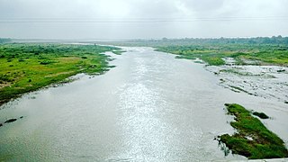
The Horyn or Haryn is a tributary of the Pripyat, which flows through Ukraine and Belarus. The Horyn is 659 kilometres (409 mi) long, and has a drainage basin of 27,700 square kilometres (10,700 sq mi). It has a maximum width of 80 m, and a maximum depth of 16 m. An important tributary of the Horyn River is the Sluch.
Velipojë is a village and a former municipality in Shkodër County, northwestern Albania. At the 2015 local government reform, it became a subdivision of the municipality of Shkodër. The population at the 2011 census was 5,031.

Athabasca Sand Dunes Provincial Park was created to protect the Athabasca sand dunes, a unique boreal shield ecosystem located in the far-northwest part of the Northern Saskatchewan Administration District. The Athabasca sand dunes are one of the most northerly active sand dune formations on Earth.
Ansongo is a rural commune and small town in the Gao Region of eastern Mali. The town lies on the left bank of the Niger River 90 km south of Gao. It is the administrative center for the surrounding Ansongo Cercle. The commune covers an area of 445 square kilometers and in the 2009 census had a population of 32,709.

The River Blithe is a river in Staffordshire, England. It is a tributary of the River Trent and runs for around 18 miles from source to its confluence with the River Trent.

Hkamti Township or Khamti Township is a township in Hkamti District in the Sagaing Region of Burma (Myanmar). The principal town is Hkamti. As of 2014 the township had a population of 47,658 people and covered an area of 8,174 square kilometres (3,156 sq mi). The township is dominated by the Chindwin River and its tributaries as well as thickly forested areas. Nearly half the active working population are employed in agriculture, forestry or fishing. The township is a producer of rice and has gold and jade reserves.
Skhiming is a village in South Africa, Limpopo Province, Mopani District Municipality, Greater Giyani, Bolobedu. It was founded in 1971 in the Bantustan created by the former Prime Minister of South Africa, Hendrik Verwoerd.

The Shambhavi River has its origins at Kudremukh in Chikkamagaluru district of Karnataka, India. It merges with the Nandini River at Mulki, Karnataka before flowing to the Arabian Sea. This river is the main source of water to many villages nearby the river.
Ga-Maphalle is a village situated along the R81 road between Mooketsi and Giyani towns in Bolobedu area. It is one of the villages under the reign of Her Royal Highness Queen Modjadji revered for her alleged ability to bring down rain.
The Orsang River flows through the Chhota Udaipur district and Vadodara district in Gujarat, India. It joins with the Narmada River at the village of Chandod. It is originates from the forest of Bhavra in Madhya Pradesh and enters in Gujarat near Chhota Udepur town.

