
Caldey Lighthouse is located on the south end of Caldey Island, three miles (5 km) off the south Pembrokeshire, Wales coastline, a small island inhabited by a Cistercian monastery.

Monkton is a village and parish adjoining Pembroke, Pembrokeshire, Wales. According to the 2001 census, the population was 1,688.

This is a list of Grade I-listed buildings in the county of Pembrokeshire, Wales.

St Mary the Virgin is a church located in the town of Pembroke in Pembrokeshire, west Wales. The church is in the Diocese of St David's within the Church in Wales, and members of the Anglican Communion. Since 2004, it has been a part of the Monkton Rectorial Benefice.

Brynberian is a small village in north Pembrokeshire, Wales, in the foothills of the Preseli Mountains in the Pembrokeshire Coast National Park. It is in the community of Eglwyswrw and the parish of Nevern, and is on the B4329 road between Crosswell and Tafarn y Bwlch. Afon Brynberian flows through the village under an ancient bridge and joins the River Nevern to the north.

Porth-y-Tŵr is a gatehouse and bell tower overlooking St Davids Cathedral in the small city of St Davids, Pembrokeshire, Wales, UK. It is the sole survivor of four medieval gates to the walled Cathedral Close. The 13th-century octagonal tower, adjoining the gateway, now contains the cathedral's bells.
Manorowen is a small settlement and parish on the A487 2 miles (3.2 km) southwest of Fishguard, Pembrokeshire, West Wales, in the Community of Scleddau; the parish includes the village of Scleddau—the eastern part of which is in the neighbouring parish of Llanstinan. A listed property bears the name of the parish, and the church is dedicated to St Mary.

St Brides Castle is a 19th-century castellated baronial-style mansion in the parish of St Brides and the community of Marloes and St Brides, Pembrokeshire, southwest Wales.

William Owen (1791–1879) was a Welsh architect working in Haverfordwest in the late Georgian and early Victorian periods. He built up a considerable practice in Pembrokeshire and Carmathenshire. He was the county surveyor of Pembrokeshire, four times Mayor of Haverfordwest and High Sheriff of Pembrokeshire in 1859.

The Church of St Michael and All Angels, Castlemartin, Pembrokeshire, Wales is a redundant church dating from the 13th century. A Grade I listed building, the church is now in the care of the Friends of Friendless Churches.

The Church of St Dogfael, Meline, Pembrokeshire, Wales is a redundant church dating from the 19th century. A Grade II listed building, the church is now in the care of the Friends of Friendless Churches.

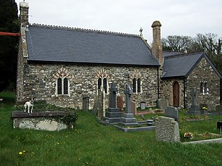
The Church of St Nicholas & St John, formerly the Priory Church of St Nicholas, is the parish church of Monkton, a village on the south bank of the Milford Haven Waterway, in south Pembrokeshire, Wales. The church's medieval origins link it to Monkton Priory, founded in the 11th century. It is a Grade I listed building.

Alban Square, in the centre of Aberaeron, Ceredigion, Wales is a range of early 19th century townhouses. The town of Aberaeron was developed around 1810 as a port by the Rev. Alban Thomas Jones Gwynne, a local landowner. After his father's death in 1819, Colonel A.T.J. Gwynne engaged Edward Haycock Sr. to plan a major expansion. Leases were sold in the early 1830s and Alban Square was designed, but largely unbuilt, by 1834. The town grew as a centre for shipbuilding and commerce. The expansion of the railways, and their arrival in Aberaeron in 1909 brought these commercial endeavours to an end and the town became a seaside resort and a centre for local government. No.s 9-20 inclusive on Alban Square are Grade II* listed buildings, their Cadw listing records describing the square as "a well preserved terrace in a key location".

Portland Place, in the centre of Aberaeron, Ceredigion, Wales is a terrace of mid-19th century townhouses. The town of Aberaeron was developed around 1810 as a port by the Rev. Alban Thomas Jones Gwynne, a local landowner. After his father's death in 1819, Colonel A.T.J. Gwynne engaged Edward Haycock Sr. to plan a major expansion. Leases were sold in the early 1830s and development continued for much of the rest of the 19th century, the town growing as a centre for shipbuilding and commerce. The expansion of the railways, and their arrival in Aberaeron in 1909 brought these commercial endeavours to an end and the town became a seaside resort and a centre for local government. No.s 1-7 inclusive on Portland Place are Grade II* listed buildings, forming "the finest single terrace" in Aberaeron.
Pembrokeshire is a county in the south-west of Wales. It covers an area of 1,619 km2 (625 sq mi). In 2021 the population was approximately 123,700.
Whitewell Ruins is a historic site on the edge of the village of Penally, Pembrokeshire, Wales. The site consists of three structures, called A, B and C. The purposes of the structures are not fully understood, although sources agree that the largest, Whitewell Ruins: Structure A, was a medieval manor house and that Structures B and C served as ancillary buildings of some type. All three structures are Grade I listed buildings and the site is a Scheduled monument.
West Tarr Mediaeval House is a historic site south of the village of St Florence, in the community of Penally, Pembrokeshire, Wales. The site consists of two structures, the remains of the house and an ancillary building. The house is a Grade I listed building and a Scheduled monument. The outbuilding is listed at Grade II.

The Tower at Eastington Manor is a historic site south of the village of Rhoscrowther, in the community of Angle, Pembrokeshire, Wales. The tower is to a tower house plan and dates from the 14th or 15th centuries. A range of later buildings is attached. The tower is a Grade I listed building and a Scheduled monument. The range is listed at Grade II.

Manorbier Dovecote stands in the village of Manorbier, Pembrokeshire, Wales. It is within the Manorbier Castle estate, about 100m north-west of the castle. Dating from the 12th or 13th centuries, the dovecote is a Grade II* listed building and a scheduled monument.

