| Mont Ngaoui | |
|---|---|
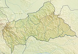 Mont Ngaoui Location in the Central African Republic (on the border with Cameroon) | |
| Highest point | |
| Elevation | 1,410 m (4,630 ft) |
| Listing | Country high point |
| Coordinates | 6°45′05″N14°57′35″E / 6.75139°N 14.95972°E Coordinates: 6°45′05″N14°57′35″E / 6.75139°N 14.95972°E |
| Geography | |
| Location | Central African Republic / Cameroon |
Mont Ngaoui is the highest mountain in the Central African Republic. It is located on the border with Cameroon and has a summit elevation of 1,410 metres (4,626 ft).

The Central African Republic is a landlocked country in Central Africa. It is bordered by Chad to the north, Sudan to the northeast, South Sudan to the east, the Democratic Republic of the Congo to the south, the Republic of the Congo to the southwest and Cameroon to the west. The CAR covers a land area of about 620,000 square kilometres (240,000 sq mi) and had an estimated population of around 4.6 million as of 2016. Currently, the C.A.R. is the scene of a civil war, ongoing since 2012.

Cameroon, officially the Republic of Cameroon, is a country in Central Africa. It is bordered by Nigeria to the west and north; Chad to the northeast; the Central African Republic to the east; and Equatorial Guinea, Gabon and the Republic of the Congo to the south. Cameroon's coastline lies on the Bight of Biafra, part of the Gulf of Guinea and the Atlantic Ocean. Although Cameroon is not an ECOWAS member state, it is geographically and historically in West Africa with the Southern Cameroons which now form her Northwest and Southwest Regions having a strong West African history. The country is sometimes identified as West African and other times as Central African due to its strategic position at the crossroads between West and Central Africa.