
Bergamo is a city in the alpine Lombardy region of northern Italy, approximately 40 km (25 mi) northeast of Milan, and about 30 km (19 mi) from Switzerland, the alpine lakes Como and Iseo and 70 km (43 mi) from Garda and Maggiore. The Bergamo Alps begin immediately north of the city.

Orio al Serio International Airport, branded as Milan Bergamo Airport, is the third busiest international airport in Italy. It is located in the municipal territory of Orio al Serio, 3.7 km (2.3 mi) southeast of Bergamo in Italy. The airport is 45 km (28 mi) north-east of Milan, where it operates alongside Malpensa Airport and Linate Airport, the city's other two primary airports. The airport served almost 13 million passengers in 2018.
Almè is a comune (municipality) in the Province of Bergamo in the Italian region Lombardy, located about 45 kilometres (28 mi) northeast of Milan and about 5 kilometres (3 mi) northwest of Bergamo.

Canonica d'Adda is a comune (municipality) in the Province of Bergamo in the Italian region of Lombardy, located about 30 kilometres (19 mi) northeast of Milan and about 15 kilometres (9 mi) southwest of Bergamo.
Chiuduno is a comune (municipality) in the Province of Bergamo, in Italian region of Lombardy; Chiuduno is located about 60 kilometres (37 mi) northeast of Milan and about 15 kilometres (9 mi) southeast of Bergamo, midway between the Bergamo plain and the Valcalepio.

Gromo is a comune (municipality) in the Province of Bergamo in the Italian region of Lombardy, located about 80 kilometres (50 mi) northeast of Milan and about 35 kilometres (22 mi) northeast of Bergamo. As of 31 December 2004, it had a population of 1,246 and an area of 20.0 square kilometres (7.7 sq mi).

Mozzo is a comune (municipality) in the Province of Bergamo in the Italian region of Lombardy, located about 45 kilometres (28 mi) northeast of Milan and about 5 kilometres (3 mi) west of Bergamo.
Osio Sotto is a comune (municipality) in the Province of Bergamo in the Italian region of Lombardy, located about 40 kilometres (25 mi) northeast of Milan and about 11 kilometres (7 mi) southwest of Bergamo. As of 31 December 2004, it had a population of 11,097 and an area of 7.5 square kilometres (2.9 sq mi).

Paladina is a comune (municipality) in the Province of Bergamo in the Italian region of Lombardy, located about 45 kilometres (28 mi) northeast of Milan and about 5 kilometres (3 mi) northwest of Bergamo.
Ponteranica is a comune (municipality) in the Province of Bergamo in the Italian region of Lombardy, located about 50 kilometres (31 mi) northeast of Milan and about 4 kilometres (2 mi) northwest of Bergamo. As of 31 December 2004, it had a population of 6,866 and an area of 8.4 square kilometres (3.2 sq mi).

Predore is a comune (municipality) in the Province of Bergamo in the Italian region of Lombardy, located about 70 kilometres (43 mi) northeast of Milan and about 25 kilometres (16 mi) east of Bergamo. As of 31 December 2004, it had a population of 1,837 and an area of 11.6 square kilometres (4.5 sq mi).

San Giovanni Bianco is a comune (municipality) in the Province of Bergamo in the Italian region Lombardy, located about 60 kilometres (37 mi) northeast of Milan and about 20 kilometres (12 mi) north of Bergamo, located in the Val Brembana.

Seriate is a comune (municipality) in the Province of Bergamo in the Italian region of Lombardy, located about 50 kilometres (31 mi) northeast of Milan and about 4 kilometres (2 mi) southeast of Bergamo. As of 31 August 2020, it had a population of 25,200 and an area of 12.4 square kilometres (4.8 sq mi).

Sorisole is a comune (municipality) in the Province of Bergamo in the Italian region of Lombardy, located about 50 kilometres (31 mi) northeast of Milan and about 4 kilometres (2 mi) north of Bergamo. As of 31 December 2004, it had a population of 8,507 and an area of 12.3 square kilometres (4.7 sq mi).

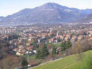
Torre Boldone is a comune (municipality) in the Province of Bergamo in the Italian region of Lombardy, located about 50 kilometres (31 mi) northeast of Milan and about 3 kilometres (2 mi) northeast of Bergamo, at the entrance of the Valle Seriana. Part of Torre Boldone's territory is part of Parco dei Colli di Bergamo

Valbrembo is a comune (municipality) in the Province of Bergamo in the Italian region of Lombardy, located about 45 kilometres (28 mi) northeast of Milan and about 4 kilometres (2 mi) northwest of Bergamo.

Verdellino is a comune (municipality) in the Province of Bergamo in the Italian region of Lombardy, located about 40 kilometres (25 mi) northeast of Milan and about 12 kilometres (7 mi) southwest of Bergamo. The town is easily reachable by train, the station of Verdello-Dalmine is in fact located on Verdellino's soil and the stop is one of several on the railroad line that connects the two cities of Bergamo and Milan. As of 31 December 2004, it had a population of 7,186 and an area of 3.8 square kilometres (1.5 sq mi).
Villa d'Almè is a comune (municipality) in the Province of Bergamo in the Italian region of Lombardy, located about 45 kilometres (28 mi) northeast of Milan and about 7 kilometres (4 mi) northwest of Bergamo.

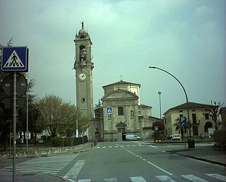
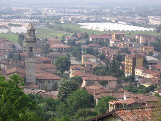
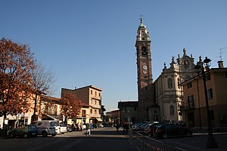
Zanica is a comune (municipality) of around 8,804 inhabitants in the Province of Bergamo in the Italian region of Lombardy, located about 45 kilometres (28 mi) northeast of Milan and 7 kilometres (4 mi) south of Bergamo. Zanica borders the following municipalities: Azzano San Paolo, Cavernago, Comun Nuovo, Grassobbio, Orio al Serio, Stezzano, Urgnano.
Torre de' Busi is a comune (municipality) in the Province of Bergamo in the Italian region Lombardy, located about 40 kilometres (25 mi) northeast of Milan and about 27 kilometres (17 mi) northwest of Bergamo.

