
The Arctic Archipelago, also known as the Canadian Arctic Archipelago, is an archipelago lying to the north of the Canadian continental mainland, excluding Greenland.

Neosho County is a county located in Southeast Kansas. As of the 2020 census, the county population was 15,904. The county seat is Erie.

Bala is a town and district of Ankara Province in the Central Anatolia region of Turkey, 67 km south-east of the city of Ankara. According to 2000 census, population of the district is 19,426 of which 8,506 live in the urban center of Bala. The district covers an area of 2,563 km2 (990 sq mi), and the average elevation is 1,310 m (4,298 ft).

Gložan is a village located in the Bački Petrovac municipality, in the South Bačka District of Serbia. It is situated in the Autonomous Province of Vojvodina. The population of the village numbering 2,283 people, of whom 1,985 are ethnic Slovaks.
Vodny, Vodnaya, or Vodnoye is the name of several inhabited localities in Russia.
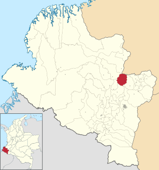
Taminango is a town and municipality in the Nariño Department, Colombia. It was founded in 1704. As of 2015, Taminango had a population of 20,537.

La Barca is a town and municipality in the Mexican state of Jalisco, and is about an hour and 20 minutes from the state capital Guadalajara.

The Comeragh Mountains are a glaciated mountain range situated in southeast Ireland in County Waterford. They are located between the town of Dungarvan and stretch inland to the town of Clonmel on the County Tipperary border and the villages of Kilrossanty and Kilmacthomas in County Waterford.

Kyon is a department or commune of Sanguié Province in central Burkina Faso. Its capital lies at the town of Kyon.
Folgowo is a village in the administrative district of Gmina Papowo Biskupie, within Chełmno County, Kuyavian-Pomeranian Voivodeship, in north-central Poland. It lies 4 kilometres (2 mi) north of Papowo Biskupie, 14 km (9 mi) south-east of Chełmno, and 28 km (17 mi) north of Toruń.
Truszczanek is a village in the administrative district of Gmina Rozprza, within Piotrków County, Łódź Voivodeship, in central Poland. It lies approximately 5 kilometres (3 mi) west of Rozprza, 16 km (10 mi) south-west of Piotrków Trybunalski, and 56 km (35 mi) south of the regional capital Łódź.
Dominikanówka is a village in the administrative district of Gmina Krasnobród, within Zamość County, Lublin Voivodeship, in eastern Poland. It lies approximately 8 kilometres (5 mi) north-east of Krasnobród, 18 km (11 mi) south of Zamość, and 91 km (57 mi) south-east of the regional capital Lublin.
Sterdyń is a village in Sokołów County, Masovian Voivodeship, in east-central Poland. It is the seat of the gmina called Gmina Sterdyń. It lies approximately 18 kilometres (11 mi) north of Sokołów Podlaski and 96 km (60 mi) north-east of Warsaw.
Sirakorola is a small town and commune in the Cercle of Koulikoro in the Koulikoro Region of south-western Mali. As of 1998 the commune had a population of 27859. It is located 18 kilometres from Koulikoro city.
Rozmierka is a village in the administrative district of Gmina Strzelce Opolskie, within Strzelce County, Opole Voivodeship, in south-western Poland. It lies approximately 8 kilometres (5 mi) north of Strzelce Opolskie and 28 km (17 mi) south-east of the regional capital Opole.
Mount Cis is a hill, 184 metres (604 ft) high, located 1.1 nautical miles (2 km) northeast of Cape Barne in western Ross Island. It was named by the British Antarctic Expedition, 1907–09, at the suggestion of geologist Raymond Priestley, after one of the expeditionary dogs.
Mercury Glacier is a wide glacier flowing south from the slopes of Mount Hughes in the Cook Mountains of Antarctica. It was named by the New Zealand Antarctic Place-Names Committee after Mercury, a god in Greek mythology, in association with other names in this area.
Bakeshluchay Rural District is a rural district (dehestan) in the Central District of Urmia County, West Azerbaijan Province, Iran. At the 2006 census, its population was 22,672, in 6,208 families. The rural district has 50 villages.
Nichiai Maru (Japanese:日愛丸) was a transport of the Imperial Japanese Army during World War II.

