The N19 road is a national primary road in Ireland, connecting from the N18 Limerick–Ennis–Galway road to Shannon Airport. It forms part of European route E20.

Alta Floresta is a municipality in Mato Grosso, Brazil. It is located at around 9°53′10″S56°5′14″W.
The 2003 IAAF World Cross Country Championships took place on March 29/30, 2003. The races were held at the L'Institut Équestre National in Avenches near Lausanne, Switzerland. Reports of the event were given in The New York Times, in the Herald, and for the IAAF.

The Chehalis Western Trail is a rail trail in Washington. Communities on the trail include Olympia, South Bay, Lacey, East Olympia, Skookumchuck, and Rainier.

Rainier High School, located in Rainier, Washington, United States, was established in 1909. As of the 2009–2010 school year, it provides instruction for approximately 300 students in grades 9–12 with a staff of about 20 full-time and part-time instructors. The school was named a 2007 Washington State School of Distinction based on its dramatically improved WASL scores. Its mascot is the Mountaineer and the school colors are orange and black. The current principal is John Beckman.

Yangpyeong Station is Line 5 subway station in Seoul, South Korea. The station lies near Yeouido and there are many apartment complexes. In fact, the confirmation was allowed to rebuild old complex.
Łańczyno is a village in the administrative district of Gmina Narewka, within Hajnówka County, Podlaskie Voivodeship, in north-eastern Poland, close to the border with Belarus. It lies approximately 9 kilometres (6 mi) east of Narewka, 25 km (16 mi) north-east of Hajnówka, and 58 km (36 mi) south-east of the regional capital Białystok.
Kyzylly is a village in the Davachi Rayon of Azerbaijan.

Ping Shan is an at-grade MTR Light Rail stop located at Castle Peak Road in Yuen Long District, near Ping Shan. It began service on 18 September 1988 and belongs to Zone 4.
Brzyno is a village in the administrative district of Gmina Krokowa, within Puck County, Pomeranian Voivodeship, in northern Poland. It lies approximately 10 kilometres (6 mi) west of Krokowa, 27 km (17 mi) west of Puck, and 61 km (38 mi) north-west of the regional capital Gdańsk. It is located within the historic region of Pomerania.
Manwan is a town of Shangla District in the Khyber Pakhtunkhwa province of Pakistan. It is located at 34°53′10″N72°39′20″E and has an average elevation of 2047 metres.
Sunnybank is an unincorporated community in Northumberland County, in the U.S. state of Virginia.

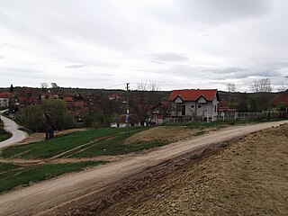
Velika Grabovnica is a village in the municipality of Leskovac, Serbia. According to the 2002 census, the village has a population of 1452 people.
The Gâm River is a river which derived from the Guangxi, China.

Ćurlina is a village situated in Doljevac municipality in Serbia.

Heer Land is a land area on the east coast of Spitsbergen, Svalbard. It is bordered by Rindersbukta to the southwest, Braganzavågen and Kjellströmdalen to the northwest, Storfjorden to the east and southeast, and Torell Land to the south. It is named after paleobotanist Oswald Heer. Heer Land mainly consist of glaciers and nunataks.
McDonaldsville is an unincorporated community in Stark County, in the U.S. state of Ohio.
Nemah is an unincorporated community in Pacific County, in the U.S. state of Washington, lying on the mainland bordering Willapa Bay.
Kzyloba, also known as Kyzyloba, is a town in Atyrau Region, west Kazakhstan. It lies at an altitude of 10 m (33 ft) below sea level.
Ellsworth is an unincorporated community in the Township Of Lynch in Texas County, in the U.S. state of Missouri.
This page is based on this
Wikipedia article Text is available under the
CC BY-SA 4.0 license; additional terms may apply.
Images, videos and audio are available under their respective licenses.


