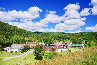
Loyall is a home rule-class city in Harlan County, Kentucky, in the United States. The population was 1,461 as of the 2010 census, up from 766 at the time of the 2000 census.

Westfield is a town in Aroostook County, Maine, United States. The population was 455 at the 2020 census.
Cape Farewell is a headland on the southern shore of Egger Island, Nunap Isua Archipelago, Greenland. As the southernmost point of the country, it is one of the important landmarks of Greenland.

The Struve Geodetic Arc is a chain of survey triangulations stretching from Hammerfest in Norway to the Black Sea, through ten countries and over 2,820 kilometres (1,750 mi), which yielded the first accurate measurement of a meridian arc.
East Leavenworth is an unincorporated community in Platte County, Missouri, United States. It is located on Route 45, approximately three miles east of Leavenworth, Kansas. It is within the Kansas City metropolitan area.

Wilstermarsch is an Amt in the county of Steinburg, in Schleswig-Holstein, Germany. It is situated around Wilster, which is the seat of the Amt, but not part of it.
Waverly Hills is a neighborhood in Southwestern Louisville, Kentucky which is centered at Dixie Highway and Pages Lane. It is located in a hilly section of the city, which is part of the larger Knobs Region which extends into southeastern Kentucky. Its boundaries are roughly Stonestreet Road and 3rd Street Road to the south, Dixie Highway to the west, St Andrews Church Road to the north, and Auburndale to the east.

The European Astronaut Centre (EAC), is an establishment of the European Space Agency and home of the European Astronaut Corps. It is near to Cologne, Germany, and is subdivided into six separate arms, these being Astronaut Training, Space Medicine, Astronaut Management, Human Exploration of the Moon as part of the Spaceship EAC initiative and Communications. It provides training facilities for European and international partner astronauts, particularly regarding ESA hardware for the ISS such as Columbus and formerly the ATV. The overall European Astronaut Centre organisation is also in charge of the organisation of the training of European astronauts in the centers of other partners, such as the United States, Russia, Canada (Saint-Hubert) or Japan (Tsukuba).
Chaplin is a farming, forestry and cottage community in the eastern Musquodoboit Valley, within the Halifax Regional Municipality Nova Scotia on the St. Mary's Rd. near Route 336. It is colloquially known as "Woodside Road" to locals, the "Chaplin" designation used on maps and for government reference.

The R752 road is a regional road in County Wicklow, Ireland. From its junction with the R772 in Rathnew on the outskirts of Wicklow Town it takes a generally south-westerly route to its junction with the R747 in the village of Woodenbridge, where it terminates. The road is 26 km (16 mi) long.

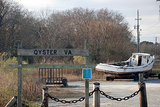
Oyster is a small unincorporated community on the Atlantic Coast of the Eastern Shore of the U.S. state of Virginia in Northampton County. It is at an elevation of 3 feet above sea level.
The canton of Montluel is a former administrative division in eastern France. It was disbanded following the French canton reorganisation which came into effect in March 2015. It had 23,713 inhabitants (2012).
Peeds is an unincorporated community in Westmoreland County, in the U. S. state of Virginia.

The Vallot Hut is a refuge in the Mont Blanc massif on the upper slopes of Mont Blanc in the Alps. It is located below the Bosses Ridge between the Dome du Gouter and Mont Blanc summit, at an altitude of 4,362 metres. Intended only as an emergency shelter, and not as a base for ascending Mont Blanc, this unheated duralumin box was designed to accommodate up to 12 people, but often contains considerably more.
Jäätma is a village in Väike-Maarja Parish, Lääne-Viru County, in northeastern Estonia.

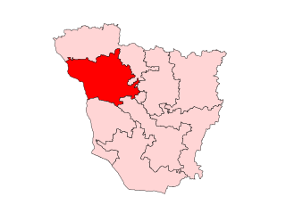
Lalganj Assembly constituency is an assembly constituency in Vaishali district in the Indian state of Bihar.
Prosperity is an unincorporated community in Holmes County, in the U.S. state of Florida.
Walnut is an unincorporated community in Pickaway County, in the U.S. state of Ohio.
Dilles Bottom is an unincorporated community in Belmont County, in the U.S. state of Ohio.
Amãna Bank is the first and only licensed commercial bank in Sri Lanka to conduct all its operations under the principles of Islamic banking and be fully disengaged from interest based transactions, offering the full spectrum of retail banking, SME banking, corporate banking, treasury and trade finance services.


