The Seven Summits are the highest mountains of each of the seven traditional continents. Climbing to the summit of all of them is regarded as a mountaineering challenge, first achieved on 30 April 1985 by Richard Bass. Climbing the Seven Summits and additionally reaching the North and South poles has been dubbed the Explorers Grand Slam.
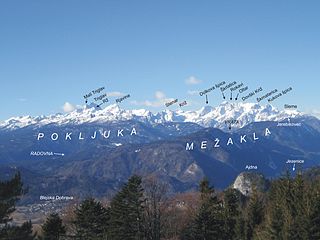
The Julian Alps are a mountain range of the Southern Limestone Alps that stretch from northeastern Italy to Slovenia, where they rise to 2,864 m at Mount Triglav, the highest peak in Slovenia and of the former Yugoslavia. A large part of the Julian Alps is included in Triglav National Park. The second highest peak of the range, the 2,755 m high Jôf di Montasio, lies in Italy.

Mount Saint Elias, the second-highest mountain in both Canada and the United States, stands on the Yukon and Alaska border about 26 miles (42 km) southwest of Mount Logan, the highest mountain in Canada. The Canadian side of Mount Saint Elias forms part of Kluane National Park and Reserve, while the U.S. side of the mountain is located within Wrangell-St. Elias National Park and Preserve.

A pyramidal peak, sometimes called a glacial horn in extreme cases, is an angular, sharply pointed mountain peak which results from the cirque erosion due to multiple glaciers diverging from a central point. Pyramidal peaks are often examples of nunataks.

The Grandes Jorasses is a mountain in the Mont Blanc massif, on the boundary between Haute-Savoie in France and Aosta Valley in Italy.

A volcanic plug, also called a volcanic neck or lava neck, is a volcanic object created when magma hardens within a vent on an active volcano. When present, a plug can cause an extreme build-up of high gas pressure if rising volatile-charged magma is trapped beneath it, and this can sometimes lead to an explosive eruption. In a plinian eruption the plug is destroyed and ash is ejected.

Rocca Priora is a small town and comune in the Metropolitan City of Rome, Lazio, Italy. It is one of the Castelli Romani on the Alban Hills about 25 kilometres (16 mi) southeast of Rome, situated in the Regional Park known as the "Parco Regionale dei Castelli Romani".

The Muskwa Ranges are a group of mountain ranges in northern British Columbia, Canada. They are part of the Northern Rockies section of the Rocky Mountains and are bounded on their west by the Rocky Mountain Trench and on their east by the Rocky Mountain Foothills. They are delimited on the north by the Liard River and on the south by the Peace Reach of the Lake Williston reservoir, south of which the next major grouping of the Rockies is the Hart Ranges.
Mount Cabot is a mountain located in Coos County, in the U.S. state of New Hampshire. The mountain is the highest peak of the Pilot Range of the White Mountains. Cabot is flanked to the northeast by The Bulge, and to the south of Bunnell Notch by Terrace Mountain. Mount Cabot was named in honor of the Italian explorer Sebastian Cabot.
The Southern Rocky Mountains are a major subregion of the Rocky Mountains of North America located in the southeastern portion of the U.S. state of Wyoming, the central and western portions of Colorado, the northern portion of New Mexico, and extreme eastern portions of Utah. The Southern Rocky Mountains are also commonly known as the Southern Rockies, and since the highest peaks are located in the State of Colorado, they are sometimes known as the Colorado Rockies, although many important ranges and peaks rise in the other three states. The Southern Rockies include the highest mountain ranges of the Rocky Mountains and include all 30 of the highest major peaks of the Rockies.

The topographic isolation of a summit is the minimum distance to a point of equal elevation, representing a radius of dominance in which the peak is the highest point. It can be calculated for small hills and islands as well as for major mountain peaks and can even be calculated for submarine summits.

Mount Saint Mary, originally known as Holm, is an inselberg in the north of Ljubljana, the capital of Slovenia. The mountain is part of the city's Šmarna Gora District. It is the highest hill in the city and a popular hiking destination.
Mountains of Azerbaijan cover approximately 60 percent of the country's land area. There are three mountain ranges in the territory of Azerbaijan, which are the Greater Caucasus, the Lesser Caucasus, and the Talysh Mountains.
This page is based on this
Wikipedia article Text is available under the
CC BY-SA 4.0 license; additional terms may apply.
Images, videos and audio are available under their respective licenses.

