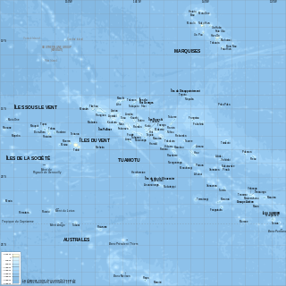
French Polynesia is located in Oceania. It is a group of six archipelagos in the South Pacific Ocean, about halfway between South America and Australia. Its area is about 4,167 km2, of which 3,827 km2 is land and 340 km2 is (inland) water. It has a coastline of 2,525 km but no land borders with other countries.

The Republic of the Congo is located in the western part of central Africa, on the Equator. Congo has several important ports. The Republic of the Congo covers an area of 342,000 km², of which 341,500 km² is land while 500 km² is water. Congo claims 200 nautical miles (370 km) of territorial sea.

Solomon Islands is an island country in the South Pacific Ocean, that lies east of Papua New Guinea.

Tanzania comprises many lakes, national parks, and Africa's highest point, Mount Kilimanjaro. Northeast Tanzania is mountainous, while the central area is part of a large plateau covered in grasslands. The country also contains the southern portion of Lake Victoria on its northern border with Uganda and Kenya.

Ruby is a pinkish red to blood-red colored gemstone, a variety of the mineral corundum. Ruby is one of the most popular traditional jewelry gems and is very durable. Other varieties of gem-quality corundum are called sapphires. Ruby is one of the traditional cardinal gems, alongside amethyst, sapphire, emerald, and diamond. The word ruby comes from ruber, Latin for red. The color of a ruby is due to the element chromium.

Inhambane is a province of Mozambique located on the coast in the southern part of the country. It has an area of 68,615 km2 and a population of 1,488,676. The provincial capital is also called Inhambane.
Zambezia is the second most-populous province of Mozambique, located in the central coastal region south-west of Nampula Province and north-east of Sofala Province. It has a population of 5.11 million, according to the 2017 census. The provincial capital is Quelimane.

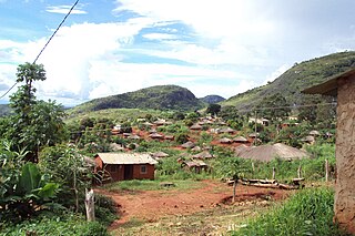
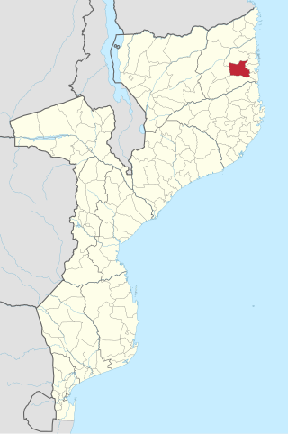
Cabo Delgado is the northernmost province of Mozambique. It has an area of 82,625 km2 (31,902 sq mi) and a population of 2,320,261 (2017). As well as bordering Mtwara Region in the neighboring country of Tanzania, it borders the provinces of Nampula and Niassa. The region is an ethnic stronghold of the Makonde tribe, with the Makua and Mwani as leading ethnic minorities.

Sofala is a province of Mozambique. It has a population of 2,259,248. Beira is the capital of the province, named for the ruined port of Sofala which is 35 kilometres (22 mi) to the south.
Nampula is the capital city of Nampula Province in Northern Mozambique. With a population of 743,125, it is the third-largest city in Mozambique after Maputo and Matola. The city is located in the interior of Nampula Province, approximately 200 kilometers from the coast and is surrounded by plains and rocky outcrops. The city is a major regional centre for the entire Northern region of Mozambique, as well as parts of Central Mozambique and border areas of Malawi and Tanzania.

Pemba is a port city and district in Mozambique. It is the capital and largest city of the Cabo Delgado province and lies on a peninsula in Pemba Bay, the third largest in Africa. It is located northeast of Maputo, Mozambique's capital.
Nacala, also known as Cidade de Nacala or Nacala-Porto is a city on the northern coast of Mozambique. Located in the southwestern indentation of inner Fernao Veloso Bay, it is the deepest natural port on the east coast of Africa. Nacala serves as the terminal for the Nacala railway, a rail line to the landlocked Malawi. South of Nacala is Mozambique Island, at one time the capital of Mozambique and now a World Heritage Site.

Montepuez District is a district of Cabo Delgado Province in northern Mozambique. It seat lies at Montepuez town.
Ancuabe District is a district of Cabo Delgado Province in northern Mozambique. It covers 4,984 km2 with 199,457 inhabitants in 2015. Its seat is the town of Ancuabe.

Zongolica is a city and its surrounding municipality located in the south of the Mexican state of Veracruz, about 100 km from the state capital Xalapa. The municipality has a surface of 63.34 km2. It is located at 18°40′N97°00′W. The name comes from Nahuatl Tzontli-coliuhqui 'crafty hair'.
Muniz Ferreira is a municipality in the state of Bahia in the North-East region of Brazil.
Gemfields Group Ltd is a British mining company incorporated in Guernsey and headquartered in London, United Kingdom, and is a supplier of coloured gemstones. The company specializes in the mining, processing and sale of coloured gemstones, in particular emeralds and rubies. The group sells rough, uncut gemstones and does not operate any cutting and polishing facilities. The company owns the Kagem emerald mine in Zambia and the Montepuez ruby mine in Mozambique. Gemfields produces around 25% of the world's emerald supply and around 50% of the world's ruby supply.
Estrela de Fura is a 101-carat ruby, and in its rough shape, is considered amongst the largest gem quality rubies ever mined. The stone is characterized by an extremely rare vivid red hue, fluorescence, and clarity. The gem was originally discovered in the Montepuez ruby mine in Mozambique, and its name is a Portuguese translation derived from Mozambique's official language. Estrela da Fura means "Star of Fura."
FURA Gems is a private global mining company that produces colored gemstones: emeralds, rubies, and sapphires. Founded in 2017 FURA has its headquarters in Dubai, United Arab Emirates, and operates mining subsidiaries in Colombia, Mozambique, and Australia. In 2021, the company managed approximately six million carats of Mozambican rubies and 300,000 carats of Colombian emeralds. In 2022, FURA Gems unveiled the world's largest gem-quality ruby ever mined, which was sold by Sotheby's for $34.8 million in 2023.

