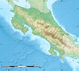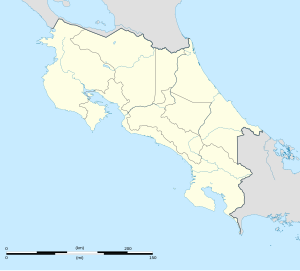
Costa Rica is located on the Central American Isthmus, surrounding the point 10° north of the equator and 84° west of the prime meridian. It has 212 km of Caribbean Sea coastline and 1,016 on the North Pacific Ocean.

The Pan-American Highway route in North America is the portion of a network of roads nearly 48,000 kilometres (30,000 mi) in length that travels through the mainland nations of the Americas. No definitive length of the Pan American Highway exists because the Canadian government has never officially defined any specific route as being part of the Pan-American Highway, while in the United States, the Federal Highway Administration (FHWA) has designated the entire Interstate Highway System part of the Pan-American Highway System, although this has not yet been reinforced by any official highway signage. Mexico officially has many branches connecting to various interstate highways at the U.S. border.

Guanacaste is a province of Costa Rica located in the northwestern region of the country, along the coast of the Pacific Ocean. It is bordered by Nicaragua to the north, Alajuela Province to the east, and Puntarenas Province to the southeast. It is the most sparsely populated of all the provinces of Costa Rica. The province covers an area of 10,141 km2 (3,915 sq mi) and as of 2010, had a population of 354,154, with annual revenue of $2 million.

Liberia is a district and the largest city in the Guanacaste Province of Costa Rica, located 215 kilometres (134 mi) northwest of the national capital, San José, in the canton with the same name, of which it is the head city or capital. It is a major center for the country's tourism industry.

The Nicoya Peninsula is a peninsula on the Pacific coast of Costa Rica. It is divided into two provinces: Guanacaste Province in the north, and the Puntarenas Province in the south. It is located at 10°N 85.4166667°W. It varies from 19 to 37 miles (60 km) wide and is approximately 75 miles (121 km) long, forming the largest peninsula in the country. It is known for its beaches and is a popular tourist destination.

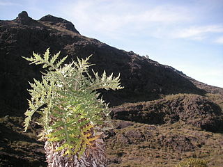
Chirripó National Park is a national park of Costa Rica, encompassing parts of three provinces: San José, Limón and Cartago. It was established in 1975.
Santa Teresa is a small town in Puntarenas Province, Costa Rica. It is located about 150 kilometres (93 mi) west of the capital city of San José. Like other coastal villages on the Nicoya Peninsula such as neighboring Mal Pais, Santa Teresa started as a remote fishing village, relying on agriculture, cattle ranching and small-scale fishing. Today, tourism is the main source of income of most families, and the town hosts surf camps, yoga retreats, and both luxury and budget accommodations.

Palmar Sur Airport is an airport serving the adjacent towns of Palmar Norte and Palmar Sur in Osa Canton, Puntarenas Province, Costa Rica.

Puerto Jiménez Airport is an airport serving Puerto Jiménez, a Gulf of Dulce coastal town in Puntarenas Province, Costa Rica. The airport is just east of the town. It is owned and managed by the country's Directorate General of Civil Aviation (DGAC).

Tambor Airport is an airport serving Tambor, Costa Rica. The airport also serves tourist destinations like Mal Pais, Santa Teresa, Montezuma, and the Cabo Blanco Absolute Natural Reserve.

Carrillo Airport is an airport serving Puerto Carrillo, a Pacific coastal village in Guanacaste Province, Costa Rica. The airport and village are 5 kilometres (3 mi) east of Sámara village.

Nosara Airport is an airport serving Nosara, a village in the Guanacaste Province of Costa Rica. The airport is approximately 15 minutes from the beaches of Nosara, the main tourist attraction in the area. The airport is owned and administrated by the country's Directorate General of Civil Aviation (DGAC).

Bahía Drake Airport is an airport serving Bahía Drake, a Pacific coastal district with a long tradition as a tourist destination in Osa Canton, Puntarenas Province, Costa Rica. The airport is also known as Drake Bay Airport.

Puntarenas is a canton in the Puntarenas province of Costa Rica. The head city is Puntarenas.

La Fortuna is a district of the San Carlos canton, in the Alajuela province of Costa Rica.

Sixaola is a district of the Talamanca canton, in the Limón province of Costa Rica. It is a border town together with Guabito, Panamá Sixaola is right across the Sixaola River from Guabito, Panama.

Cabuya is a small fishing village on the Nicoya Peninsula of Costa Rica.

Lepanto is a district of the Puntarenas canton, in the Puntarenas province of Costa Rica.

Paquera is a district of the Puntarenas canton, in the Puntarenas province of Costa Rica.
National Tertiary Route 624, or just Route 624 is a National Road Route of Costa Rica, located in the Puntarenas province.


