Dundee Township is a civil township of Monroe County in the U.S. state of Michigan. The population was 8,145 at the 2020 census, up from 6,759 in 2010. The township contains the village of Dundee, and the majority of the township is served by Dundee Community Schools.

Bath Township is one of the nine townships of Summit County, Ohio, United States. A suburb of Akron, the 2020 census found 10,024 people in the township.
Ghent is an unincorporated community in central Bath Township, Summit County, Ohio, United States. It lies in the area of Granger and Cleveland-Massillon roads, just north of the Ghent Road exit of Interstate 77. It is included in the Montrose-Ghent census-designated place.

Bath is an unincorporated community in the northern part of Bath Township, Summit County, Ohio, United States. It is centered at the intersection of Cleveland-Massillon and Ira roads. It was developed 'circa 1820.

Copley Township is one of the nine townships of Summit County, Ohio, United States. The 2020 census found 18,403 people in the township.
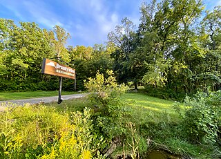
Copley is an unincorporated community in Summit County, in the U.S. state of Ohio.
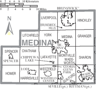
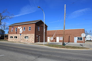
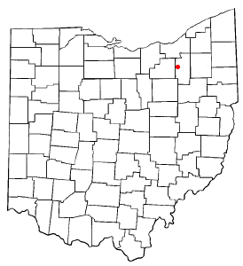
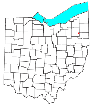
Sharon Center is an unincorporated community and census-designated place in Medina County, Ohio, United States. It is centered at the intersection of Ohio state routes 94 and 162 in Sharon Township. This intersection is actually a large traffic circle with a park in the center containing a gazebo and several memorials to veterans of various wars.
Diamond is an unincorporated community in eastern Palmyra Township, Portage County, Ohio, United States. It has a post office with the ZIP code 44412. The community is part of the Akron Metropolitan Statistical Area. Interstate 76 travels near Diamond. The town used to be a stop on the New York Central Railroad, but the stop was abandoned in the early 1970s.
Pharisburg is an unincorporated community in Leesburg Township, Union County, Ohio, United States. It is located at 40°20′43″N83°18′13″W, at the intersection of Ohio State Routes 4 and 347, about two miles west of Magnetic Springs.
Kingsway is an unincorporated community in Rice Township, Sandusky County, Ohio, United States.
Cobbs Corners is a former settlement in Portage County, in the U.S. state of Ohio. It was located in Mantua Township.
Mahoning is a former settlement in Portage County, in the U.S. state of Ohio. It was located at the present-day intersection of North Main Street and Ohio State Route 82 in northern Windham Township, north of the village of Windham.
Yale is an unincorporated community in Portage County, in the U.S. state of Ohio. It centered at the intersection of Alliance Road and Yale Road along Ohio State Route 14 where the townships of Edinburg, Palmyra, Atwater, and Deerfield meet.
Friendsville is an unincorporated community in Medina County, in the U.S. state of Ohio.
Freeburg is an unincorporated community in Washington Township, Stark County, in the U.S. state of Ohio.

Boston is an unincorporated community in Summit County, in the U.S. state of Ohio.
Brandywine is an unincorporated community in Summit County, in the U.S. state of Ohio.
Everett is an unincorporated community in Summit County, in the U.S. state of Ohio.
Columbia Hills Corners is an unincorporated community in Lorain County, in the U.S. state of Ohio.
Western Star is an unincorporated community in Medina and Summit counties, in the U.S. state of Ohio.

