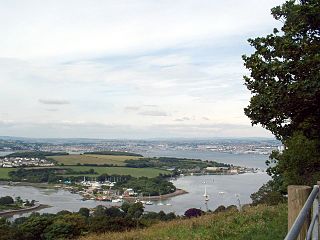
The Hamoaze is an estuarine stretch of the English tidal River Tamar, between its confluence with the River Lynher and Plymouth Sound.

Louis-Hébert is a federal electoral district in the Canadian province of Quebec. Represented in the House of Commons since 1968, its population was certified, according to the detailed statistics of 2001, as 98,156.

Abbotskerswell is a village and civil parish in the English county of Devon. The village is in the north part of the parish and is located two miles (3 km) south of the town of Newton Abbot, 7 miles (11 km) from the seaside resort of Torquay and 32 miles (51 km) from the city of Plymouth. The A381 road between Newton Abbot and Totnes runs down the western side of the parish and the main railway line between these two towns forms part of its eastern boundary.

Ford railway station is a railway station in Ford, West Sussex, England. It is located on the West Coastway Line which runs between Brighton and Southampton and it is 60 miles 48 chains (97.5 km) down the line from London Bridge via Redhill. The station and the trains serving it are operated by Southern.

McClurg is an unincorporated community in extreme northeastern Taney County, Missouri, United States. It is located on Missouri Supplemental Route W, approximately three miles east of Brownbranch or twenty miles (32 km) northeast of Forsyth. McClurg is part of the Branson, Missouri Micropolitan Statistical Area.

Mill Creek is a 14.0-mile-long (22.5 km) tributary stream of the South Branch Potomac River, belonging to the Potomac River and Chesapeake Bay watersheds. The stream is located in Hampshire County in West Virginia's Eastern Panhandle. Mill Creek flows into the South Branch west of Romney Bridge near Vanderlip along the Northwestern Turnpike.

Morchard Road railway station is located in the village of Down St Mary in Devon, England. It is named after the village of Morchard Bishop which lies a few miles to the north-east. It is on the Tarka Line to Barnstaple, 16 miles 08 chains (25.9 km) from Exeter Central at milepost 187.5 from London Waterloo. The station and trains are operated by Great Western Railway.
Braggadocio is an unincorporated community in Pemiscot County, Missouri, United States. It is located 8 miles (13 km) west of Caruthersville on Missouri Route J and 5.5 miles (8.9 km) north of Steele on Route Z.

Coffinswell is a small village in South Devon, England, just off the A380, the busy Newton Abbot to Torquay road. It lies within Teignbridge District Council.

St. Ann's Well Gardens is a park in Hove, East Sussex, about half a mile from the shore. The park is renowned for its chalybeate spring, which is now named St. Ann's Well. In this case, the name "St. Ann" does not refer to any saint. Instead, the name was apparently based on a myth of Annafrieda, a Saxon lady whose lover was murdered. Her tears miraculously became the Chalybeate Spring which is now called St. Ann's Well.

Cruwys Morchard is an ecclesiastical and civil parish in the Mid Devon district of the county of Devon in England. It is located about four to five miles west of Tiverton along the road to Witheridge. The parish covers about 5,765 acres (23.33 km2) of land, and comprises a number of scattered houses and farms, and three small hamlets, Pennymoor, Way Village and Nomansland. The church and the manor house are in the centre of the parish. The population at the time of the 2000 census was 461. The parish takes its name from the Cruwys family who have been Lords of the Manor here since the reign of King John (1199–1216).

Morchard Bishop is a village and civil parish in Mid Devon in the English county of Devon. It has a population of 975, and contains a primary school, two churches, and a playing field with tennis court. Notable past residents include Ernest Bevin.

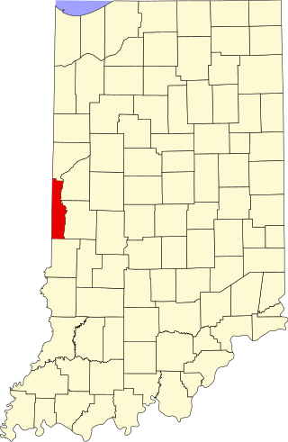
Randall is a former town in Helt Township, Vermillion County, in the U.S. state of Indiana. Randall is also 1.6 miles northwest of another extinct town: Toronto, on W County Road 700 S. The nearest extant community is the town of Dana, to the northeast.
Louis-Hébert is a provincial electoral district in the Capitale-Nationale region of Quebec, Canada. It consists of part of the Sainte-Foy–Sillery–Cap-Rouge borough of Quebec City, as well as all of Saint-Augustin-de-Desmaures.

This is a list of halls of residence both on and off campus at the University of Leeds in Leeds, England.

Bone Cave is an unincorporated community in Van Buren County, Tennessee, United States. It lies just off U.S. Route 70S northwest of Spencer and southeast of Rock Island. Its elevation is 965 feet (294 m), and it is located at 35°46′30″N85°35′6″W. The Rocky River passes through the community. The various forms of its names led the Board on Geographic Names to decide on the official form of the community's name in 1895.

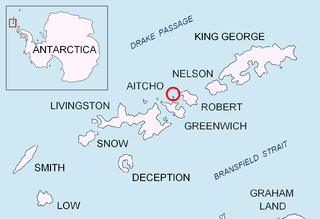
Pasarel Island is an ice-free island in the Aitcho group on the west side of English Strait in the South Shetland Islands, Antarctica. The island is situated 900 m (980 yd) northwest of Barrientos Island, 1.35 km (0.84 mi) northeast of Sierra Island and 650 m (710 yd) southeast of Emeline Island. Extending 450 by 260 m. The area was visited by early 19th century sealers.

Robert Geoffrey Cruwys was an English cricketer and clergyman. He was born in the family manor, Cruwys Morchard House, located in Cruwys Morchard, a small parish in Devon which takes the name from the Cruwys family who have been Lords of the Manor here since the reign of King John (1199–1216).
Astrakhanovka is a town in Aktobe Region, west Kazakhstan. It lies at an altitude of 182 m (597 ft).

The border between the countries of France and the United Kingdom in Europe is a maritime border that stretches along the Channel, the North Sea and the Atlantic Ocean. The Channel Tunnel links the two countries underground and is defined as a 'land frontier', and not widely recognised as a land border.


