Notable residents
- Zack Smith - hockey player
- Erik Karlsson - hockey player [ citation needed ]
Morgan's Grant | |
|---|---|
Neighbourhood | |
| Country | Canada |
| Province | Ontario |
| City | Ottawa |
| Government | |
| • City Councillor | Cathy Curry |
| Time zone | UTC−5 (Eastern (EST)) |
| • Summer (DST) | UTC−4 (EDT) |
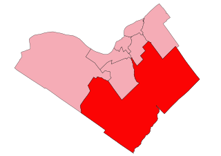
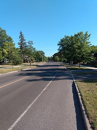
Morgan's Grant is a suburban neighbourhood located in Kanata, Ottawa, Ontario, Canada. It is north of the Kanata North Business Park, west of March Road, and north of Terry Fox Drive. As of the 2016 Canada Census, its population was 9,825. [1]
Morgan's Grant has several recreational pathways, a number of playgrounds, a public elementary school, a French public elementary school, and a variety of services.
Along with the neighbourhoods of Brookside and Briarbrook, Morgan's Grant is part of the Briarbrook Brookside Morgan's Grant Community Association. [2]
The modern Morgan's Grant was originally part of the Township of March, and was first settled by Europeans in the early nineteenth century, many buildings from the 1800s still exist and are active to this day, such as "806 March Road" and "160 Flamborough Way", 160 Flamborough Way was actually a Loyal Orange Lodge, number 338, during the 1800s where farmers would meet up, and the St Isidore Church was also a part of Township of March in the 1800s. Development of the area began in the late 1980s and more construction of schools and houses during 2000–2009 with homes around the main streets of Morgan's Grant Way, Allenby Road, Ipswich Terrace, Halton Terrace and Flamborough Way, Mersey Drive, leading up to Terry Fox Drive and Monk Environmental Park. Starting in the mid to late 1990s, expansion began by Minto Developments to the north and has since reached up to Old Carp Road.

Kanata is a suburb and former city within Ottawa, Ontario, Canada. It is located about 22 km (14 mi) west of the city's downtown core. As of 2021, the former City of Kanata had a population of 98,938, with the population centre having a population of 137,118. Before it was amalgamated into Ottawa in 2001, it was one of the fastest-growing cities in Canada and the fastest-growing community in Eastern Ontario. Located just to the west of the National Capital Commission Greenbelt, it is one of the largest of several communities that surround central Ottawa.

Nepean is a former municipality and now geographic area of Ottawa, Ontario, Canada. Located west of Ottawa's inner core, it was an independent city until amalgamated with the Regional Municipality of Ottawa–Carleton in 2001 to become the new city of Ottawa. However, the name Nepean continues in common usage in reference to the area. The population of Nepean is about 186,593 people.

Richmond is a suburban community, part of the Canadian capital of Ottawa, Ontario, Canada. Founded in 1818, it spans the Jock River, a tributary of the Rideau River. A part of the National Capital Region, Richmond is located 10 kilometres (6.2 mi) southwest of Kanata and immediately south to the community of Stittsville.
Beacon Hill is a neighbourhood located in Beacon Hill-Cyrville Ward in the east end of Ottawa, Ontario, Canada. Beacon Hill was a part of the City of Gloucester until it was amalgamated with the new city of Ottawa in 2001.

Scarborough Village is a neighbourhood in Toronto, Ontario, Canada, located in the Scarborough district. It was one of the earliest settlements in the former township of Scarborough with the distinction of being the site of the township's first post office. Today, the neighbourhood is composed of private and public housing, apartment complexes, schools, a few condominiums, and strip mall plazas. The neighbourhood lies along the Scarborough Bluffs escarpment.

Carleton is a federal electoral district in Ontario, Canada, represented in the House of Commons of Canada from 1867 to 1968 and since 2015. It was represented in the Legislative Assembly of Upper Canada from 1821 to 1840 and in the Legislative Assembly of the Province of Canada from 1841 until 1866. It has been represented by Pierre Poilievre, the current Leader of the Opposition, since its creation in 2015.

Alta Vista is a neighbourhood in Alta Vista Ward in Ottawa, Ontario, Canada. Its boundaries according to the Alta Vista Community Association are that part of Alta Vista Ward south of Smyth Road in the north, north of Walkley Road and east of the Rideau River, and west of the "greenspace underneath Haig Drive". However, the name is ambiguous, as there are several sub-neighbourhoods in this area,, as the neighbourhood could refer to the ward as a whole, down to the core Alta Vista area,, centred on Alta Vista Drive.

Bells Corners is a suburban neighbourhood in Ottawa, Ontario, Canada. It is located along Robertson Road west of downtown, within Ottawa's western Greenbelt, in College Ward. As of the Canada 2016 Census, the community had a population of 9,272.
Bridlewood is a neighbourhood in Kanata South Ward in the western part of Ottawa, Ontario, Canada. Bridlewood was part of the Township of Nepean until 1978, and then part of the City of Kanata until 2001, when that city amalgamated with the City of Ottawa.
Hazeldean Road is a major road in Ottawa's west end. This road runs between the junction of Highway 7 west of Stittsville and Eagleson Road in Kanata, where it becomes Robertson Road east of the intersection and proceeds towards Bells Corners in the former city of Nepean, Ontario as a four-lane rural route through the Greenbelt.

Kanata North Ward or Ward 4 is a ward in the city of Ottawa, Ontario, Canada. The ward was created in 2006 when its predecessor, Kanata Ward, split in two main parts. The original Kanata Ward covered all of the former City of Kanata. The new Kanata North Ward also includes a small part taken from West Carleton Ward

Crystal Beach is a neighbourhood in Ottawa, Ontario, Canada. It is located in the west end of Ottawa, in Bay Ward. The neighbourhood is triangular in shape, and its boundaries can broadly be described as Carling Avenue to the northeast, Moodie Drive to the west, and Corkstown Road to the south. It is. According to the Canada 2011 Census, the total population of the neighbourhood was 2,416.

Kanata Lakes also known as Marchwood-Lakeside is a neighbourhood in Kanata North Ward in the west end of the city of Ottawa, Ontario, Canada. Prior to amalgamation in 2001, it was located within the City of Kanata. It is located north of the Queensway, west of Beaverbrook, east of Terry Fox Drive, and south of Morgan's Grant. Kanata Lakes is located about 20 km (12 mi) west-southwest of Downtown Ottawa.
Terry Fox Drive is a major arterial road in Ottawa, Ontario named for the late Canadian humanitarian, activist, and athlete Terry Fox. Located in the suburb of Kanata in the city's west end, the road is a major route for residents traveling to/from the north end of Kanata. Starting in the Kanata North Technology Park at an intersection with Herzberg Road, it crosses March Road and Innovation Drive and bisects an old-growth forest, before heading south past Kanata Centrum. It crosses Highway 417, passes Katimavik-Hazeldean and Glen Cairn, and ends at Eagleson Road, where it continues east as Hope Side Road. Currently, Terry Fox Drive is a four lane arterial between just north of Richardson Side Road and just south of Winchester Drive, and a two lane undivided road elsewhere.
Beaverbrook is a suburban neighbourhood in Kanata North Ward in the city of Ottawa, Ontario, Canada. It is located within the former city of Kanata. Beaverbrook is known for its hedged houses and community facilities. The neighbourhood is bounded by the Kanata North Business Park to the north, March Road to the east, Campeau Drive to the south and Knudson Avenue & Weslock Way to the west.
Glen Cairn is a neighbourhood in Kanata South Ward in the west end of Ottawa, Ontario, Canada. It is also the name of a public school in the area. Prior to amalgamation in 2001, it was located in the City of Kanata. It is located in South Kanata, about 22 km (14 mi) west of Downtown Ottawa. It was one of the original neighbourhoods in Kanata. The community was built in the 1960s, and was part of Goulbourn Township until the creation of Kanata in 1978. As of the Canada 2016 Census, there were 11,836 people living in Glen Cairn.
Katimavik-Hazeldean is a neighbourhood in Kanata South Ward in the west end of Ottawa, Ontario, Canada. It is located in the former City of Kanata which amalgamated into Ottawa in 2001. It is located in south-central Kanata, bounded by Eagleson Road to the east, Hazeldean Road to the south, the Carp River to the west, and Highway 417 to the north.

Kanata—Carleton is a federal electoral district in Ottawa, Ontario.

Kanata—Carleton is a provincial electoral district in Ottawa, Ontario which was first contested in the 2018 provincial election.