The Dakelh or Carrier are the indigenous people of a large portion of the Central Interior of British Columbia, Canada.

The Skeena River is the second-longest river entirely within British Columbia, Canada. Since ancient times, the Skeena has been an important transportation artery, particularly for the Tsimshian and the Gitxsan—whose names mean "inside the Skeena River" ,and "people of the Skeena River," respectively. The river and its basin sustain a wide variety of fish, wildlife, and vegetation, and communities native to the area depend on the health of the river. The Tsimshian migrated to the Lower Skeena River, and the Gitxsan occupy territory of the Upper Skeena.
Enbridge Inc. is a Canadian multinational pipeline and energy company headquartered in Calgary, Alberta, Canada. Enbridge owns and operates pipelines throughout Canada and the United States, transporting crude oil, natural gas, and natural gas liquids, and also generates renewable energy. Enbridge's pipeline system is the longest in North America and the largest oil export pipeline network in the world. Its crude oil system consists of 28,661 kilometres of pipelines. Its 38,300 kilometre natural gas pipeline system connects multiple Canadian provinces, several US states, and the Gulf of Mexico. The company was formed by Imperial Oil in 1949 as the Interprovincial Pipe Line Company Limited to transport Alberta oil to refineries. Over time, it has grown through acquisition of other existing pipeline companies and the expansion of their projects.

The Bulkley River in British Columbia is a major tributary of the Skeena River. The Bulkley is 257 kilometres (160 mi) long with a drainage basin covering 12,400 square kilometres (4,800 sq mi).

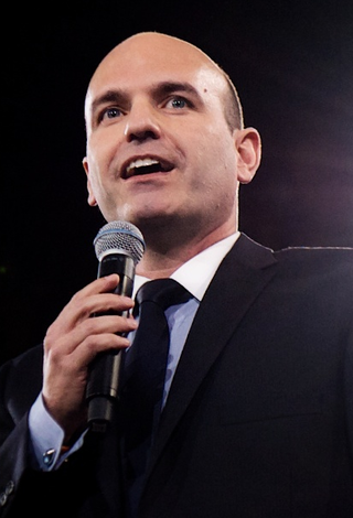
Nathan Cullen is a Canadian politician. A member of the New Democratic Party (NDP), he is the Member of the Legislative Assembly (MLA) for Stikine in British Columbia. He has served in the Executive Council of British Columbia since 2020, currently as Minister of Water, Land and Resource Stewardship and Minister Responsible for Fisheries.

The Wetʼsuwetʼen are a First Nation who live on the Bulkley River and around Burns Lake, Broman Lake, and François Lake in the northwestern Central Interior of British Columbia. The endonym Wetʼsuwetʼen means "People of the Wa Dzun Kwuh River ".

Houston is a forestry, mining and tourism town in the Bulkley Valley of the Northern Interior of British Columbia, Canada. Its population as of 2021 was 3,052, with approximately 2,000 in the surrounding rural area. It is known as the "steelhead capital" and it has the world's largest fly fishing rod. Houston's tourism industry is largely based on ecotourism and Steelhead Park, situated along Highway 16. Houston is named in honour of the pioneer newspaperman John Houston.
Driftwood Canyon Provincial Park is a provincial park in British Columbia, Canada. Driftwood Canyon Provincial Park covers 23 ha of the Bulkley River Valley, on the east side of Driftwood Creek, a tributary of the Bulkley River, 10 km northeast of the town of Smithers. The park is accessible from Driftwood Road from Provincial Highway 16. It was created in 1967 by the donation of the land by the late Gordon Harvey (1913–1976) to protect fossil beds on the east side of Driftwood Creek. The beds were discovered around the beginning of the 20th century. The park lands are part of the asserted traditional territory of the Wet'suwet'en First Nation.

The Wetʼsuwetʼen First Nation is a Wetʼsuwetʼen First Nations band located outside of the village of Burns Lake, British Columbia, Canada. It was formerly known as the Broman Lake Indian Band and is still usually referred to as Broman Lake although this is no longer its official name. Its members speak the Wetʼsuwetʼen dialect of Babine-Witsuwitʼen, a Northern Athabaskan language. The main community is on Palling Indian Reserve No. 1.

The Bulkley Valley is in the northwest Central Interior of British Columbia, Canada.

Witset is a Wet'suwet'en village in Central British Columbia, Canada on the west side of the Bulkley River on Coryatsaqua (Moricetown) Indian Reserve No. 2, and on Moricetown Indian Reserve No.1. The current village was built during the early 1900s. Evidence of inhabitants date back to around 5,500 years ago.
The Environmental Assessment Office is a Crown Agency of the provincial government of British Columbia, Canada. Its mandate is to coordinate assessments of major development proposals in British Columbia. It reports to the provincial Minister of Environment.
The Enbridge Northern Gateway Pipelines were a planned-but-never-built project for a twin pipeline from Bruderheim, Alberta, to Kitimat, British Columbia. The project was active from the mid-2000s to 2016. The eastbound pipeline would have imported natural gas condensate, and the westbound pipeline would have exported diluted bitumen from the Athabasca oil sands to a marine terminal in Kitimat for transportation to Asian markets via oil tankers. The project would have also included terminal facilities with "integrated marine infrastructure at tidewater to accommodate loading and unloading of oil and condensate tankers, and marine transportation of oil and condensate." The CA$7.9 billion project was first proposed in the mid-2000s but was postponed several times. The project plan was developed by Enbridge Inc., a Canadian crude oil and liquids pipeline and storage company.
The Yinka Dene Alliance was a coalition of six First Nations from northern British Columbia, organized to prevent the Enbridge Northern Gateway Pipelines being built through their traditional territories. The coalition first comprised the Nadleh Whut'en, Nak'azdli, Takla Lake, Saik'uz and Wet'suwet'en First Nations. The Tl'azt'en First Nation later joined. These bands represented the interests of around 5,000 aboriginals. The alliance was active from 2010 until 2016 when the pipeline project was cancelled. They utilized indigenous, Canadian and international law, and organized various public protests across Canada.

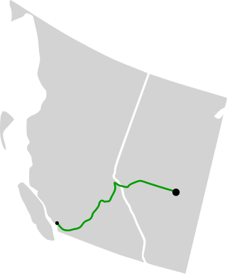
The Trans Mountain Pipeline System, or simply the Trans Mountain Pipeline(TMPL), is a multiple product pipeline system that carries crude and refined products from Edmonton, Alberta, to the coast of British Columbia, Canada.

The Unistʼotʼen Camp is a protest camp and indigenous healing centre in northern British Columbia, Canada. It is located within the traditional territory of the Unist'otʼen clan of the Wetʼsuwetʼen First Nation peoples. Established after the proposal of several pipeline projects in the area, it is situated where several pipelines will pass, as a means to block their construction.

The Coastal GasLink pipeline is a TC Energy natural gas pipeline under construction in British Columbia, Canada. Starting in Dawson Creek, the pipeline's route crosses through the Canadian Rockies and other mountain ranges to Kitimat, where the gas will be exported to Asian customers. Its route passes through several First Nations peoples' traditional lands, including some that are unceded. Controversy around the project has highlighted important divisions within the leadership structure of impacted First Nations: elected band councils established by the 1876 Indian Act support the project, but traditional hereditary chiefs of the Wetʼsuwetʼen people oppose the project on ecological grounds and organized blockades to obstruct construction on their traditional land.
The following is a timeline of the 2020 Canadian pipeline and railway protests which originated with the opposition by the hereditary chiefs of the Wetʼsuwetʼen people in British Columbia (BC), Canada to the Coastal GasLink Pipeline project.
From January to March 2020, a series of civil disobedience protests were held in Canada over the construction of the Coastal GasLink Pipeline (CGL) through 190 kilometres (120 mi) of Wetʼsuwetʼen First Nation territory in British Columbia (BC), land that is unceded. Other concerns of the protesters were Indigenous land rights, the actions of police, land conservation, and the environmental impact of energy projects.
Freda Huson, Chief Howilhkat of the Wet’suwet’en First Nation in Canada, is an Indigenous rights activist for the Wet'suwet'en people. She is wing-chief of the Wet’suwet’en's Dark House Clan. Huson established the Uni’stot’en healing camp on the land that became the federally recognized territory of the Wet’suwet’en Nation. She is a leader in the opposition against the construction of pipelines. Since 2010, she has lived on her ancestral lands in Talbeetskwa in British Columbia with her children.


