Lake Mashū is a endorheic crater lake formed in the caldera of a potentially active volcano. It is located in Akan National Park on the island of Hokkaidō, Japan. The lake has been called the clearest lake in the world.

Mount Asahi is a mountain located in the town of Higashikawa, Hokkaido and the tallest mountain in the Japanese island of Hokkaido. It is part of the Daisetsuzan Volcanic Group of the Ishikari Mountains, it is located in the northern part of the Daisetsuzan National Park.

Mount Yōtei is an active stratovolcano located in Shikotsu-Toya National Park, Hokkaidō, Japan. It is also called Yezo Fuji or Ezo Fuji (蝦夷富士), "Ezo" being an old name for the island of Hokkaido, because it resembles Mount Fuji. The mountain is also known as Makkari Nupuri (マッカリヌプリ) and Mount Shiribeshi. It is one of the 100 famous mountains in Japan.

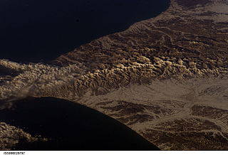
Hidaka Mountains is a mountain range in southeastern Hokkaido, Japan. It runs 150 km from Mount Sahoro or Karikachi Pass in central Hokkaidō south, running into the sea at Cape Erimo. It consists of folded mountains that range from 1,500 to 2,000 metres in height. Mount Poroshiri is the highest at 2,053 m. The Hidaka Mountains separate the subprefectures of Hidaka and Tokachi. Most of the range lies in the Hidaka-sanmyaku Erimo Quasi-National Park. Since the mountain range lies so far north, the alpine climate zone lies at a lower altitude.

Mount Tomuraushi is located in Daisetsuzan National Park, Hokkaidō, Japan. Its name was derived from the Ainu words for "place with many flowers" or "place with many water stains". It is one of the 100 famous mountains in Japan.

Mount Rishiri is a quaternary stratovolcano located off the coast of Hokkaidō, Japan in the Sea of Japan. The extinct volcano rises out of the sea forming Rishiri Island. Because its cone shape resembles Mount Fuji it is sometimes referred to as Rishiri Fuji. It is one of the 100 famous mountains in Japan.
Mount Yuniishikari is part of the Ishikari Mountains, Hokkaidō, Japan.

Mount Shari is a quaternary stratovolcano and one of Japan's 100 famous mountains. Its summit is 1,547 metres (5,075 ft). The summit consists of Mount Shari, Southern Mount Shari and the western ridge. It is located on the Hokkaidō's Shiretoko Peninsula on the border of Shari and Kiyosato in Shari District, Abashiri and Shibetsu in Shibetsu District, Nemuro.
Mount Maru is a lava dome located in the Nipesotsu-Maruyama Volcanic Group of the Ishikari Mountains, Hokkaidō, Japan. Mount Maru is also known as Higashi-Tokachi-Maruyama (東十勝丸山) or Higashi-Taisetsu-Maruyama (東大雪丸山) to distinguish it from other mountains with the same name. Only in 1989 did scientists discover that Mount Maru is a quaternary volcano. The mountain sits on the border between the towns of Kamishihoro and Shintoku.

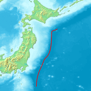
The Northeastern Japan Arc, also Northeastern Honshū Arc, is an island arc on the Pacific Ring of Fire. The arc runs north to south along the Tōhoku region of Honshū, Japan. It is the result of the subduction of the Pacific Plate underneath the Okhotsk Plate at the Japan Trench. The southern end of the arc converges with the Southwestern Japan Arc and the Izu-Bonin-Mariana Arc at the Fossa Magna (ja) at the east end of the Itoigawa-Shizuoka Tectonic Line (ITIL). This is the geologic border between eastern and western Honshū. Mount Fuji is at the point where these three arcs meet. To the north, the Northeastern Japan arc extends through the Oshima Peninsula of Hokkaidō. The arc converges in a collision zone with the Sakhalin Island Arc and the Kuril arc in the volcanic Ishikari Mountains of central Hokkaidō. This collision formed the Teshio and Yūbari Mountains.

Mount Raiden is an andesitic volcano in the Mount Raiden Volcanic Group on the border between Iwanai and Rankoshi, Hokkaidō, Japan. Mount Raiden is a pyroclastic cone. The mountain consists of primarily non-alkali, mafic, volcanic rock.
Mount Mekunnai is an andesitic volcano in the Mount Raiden Volcanic Group on the border between Iwanai and Rankoshi, Hokkaidō, Japan. Mount Mekunnai is a pyroclastic cone. The mountain consists of primarily non-alkali, mafic, volcanic rock. The rock is younger than that of neighboring Mount Raiden, being categorized at 700,000 to 13,000 years old. The rock is older than that of the Niseko Volcanic Group.

Mount Shiretoko is a volcano located on the Shiretoko Peninsula in Hokkaidō, Japan. The mountain consists of non-alkali mafic rocks, andesite. Mount Shiretoko is in Shari town, in Shari District of Abashiri Subprefecture.

Mount Teshio is the tallest mountain in the Kitami Mountains. It is located on the border of Shibetsu and Takinoue, Hokkaidō, Japan. It is the source of the Teshio River.
Mount Karifuri is a mountain in the Hidaka Mountains of Hokkaidō, Japan. The mountain sits on the border between Minamifurano and Shimukappu. It is 1,323.2 metres (4,341.2 ft) high. It is the source of the Mu River (Hokkaidō).

Mount Asahi is a mountain in Asahikawa, Hokkaidō, Japan. It is part of the Ishikari Mountains.

Mount Okutoppu is a mountain of the Shokanbetsudake Mountains. It is located on the border between Shintotsukawa and Ishikari, Hokkaidō, Japan. The mountain is also known as Mount Oshirarika.

Mount Shokanbetsu is the highest mountain of the Shokanbetsudake Mountains. It is located on the border between Hokuryū, Shintotsukawa and Mashike, Hokkaidō, Japan. The peak is also known as Mashike Fuji (増毛富士).
Hako is a village in the Aragatsotn Province of Armenia. It may also refer to:


